


Flight Paths
 Oct 30, 2015 | 5:26 am
#1
Original Poster

Join Date: Feb 2008
Location: CLE
Posts: 1,891
Flight Paths
Mods: Please move if this isnt the correct forum.
I'm curious. When I check flight routs, ex: UA 50 EWR-FRA. Flightaware shows this:
MERIT HFD PUT EBONY N275A TUDEP NATU BEXET OSGAR BAKUR UN546 STU UL9 GAVGO UL18 INLAK UL607 SPI UT180 PESOV T180 RASVO T180 UNOKO
I know, it sounds "Greek" (no offense to people of Greek origin) to me, but can someone explain. Sometimes I see real "words" as well like:
HAPIE YAHOO BRADD N255A JOOPY NATZ SOMAX NATZ ATSUR RATKA UN502 JSY UY111 INGOR UM25 LUKIP
Yep, just a curious person.
 Oct 30, 2015 | 7:19 am
#2

Join Date: Sep 2002
Location: Orlando, FL, US
Programs: DL-Dirt Medallion;US-Cast Iron Preferred
Posts: 3,617
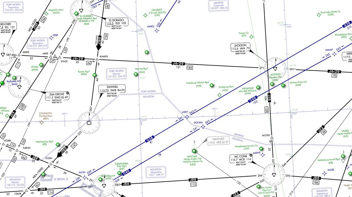
Those are aviation waypoints and airways. Waypoints are typically 5 letter codes, often meant to be pronounceable as words even if they're not real words. This site:
http://www.iflightplanner.com/AviationCharts/
will show waypoints in the US. If you take the portion of the flight that is over the US and plug it into the "flight route" field, it will show the path on the map. Try MERIT HFD PUT EBONY for example.
http://www.iflightplanner.com/AviationCharts/
will show waypoints in the US. If you take the portion of the flight that is over the US and plug it into the "flight route" field, it will show the path on the map. Try MERIT HFD PUT EBONY for example.
 Oct 30, 2015 | 11:14 am
#5
FlyerTalk Evangelist


Join Date: May 2002
Location: Pittsburgh
Programs: MR LT Titanium, AA LT PLT, UA SLV, Avis PreferredPlus, HH Gold, Hertz PC, National Executive, etc.
Posts: 31,692
You can have some fun (and waste a lot of time) looking for region-related names in this data. I know FLURY and CRSBY are near PIT, along with several others sports figures that I can't recall off the top of my head.
My favorite - If you're approaching Pease airport in NH, you might just be vectored to ITAWT ITAW PUDYE TTATT IDEED. No idea on whether there's a tie to Tweety and Sylvestery, or someone was just creative.
Landing on 1R in Kansas City? You might approach via SPICY BARBQ TERKY SMOKE RIBBS.
etc.
My favorite - If you're approaching Pease airport in NH, you might just be vectored to ITAWT ITAW PUDYE TTATT IDEED. No idea on whether there's a tie to Tweety and Sylvestery, or someone was just creative.
Landing on 1R in Kansas City? You might approach via SPICY BARBQ TERKY SMOKE RIBBS.
etc.
Oct 30, 2015 | 12:51 pm
#6


Join Date: Dec 2009
Location: RDU
Programs: DL DM+(segs)/MM, UA Ag, Hilton DM, Marriott Ti (life Pt), TSA Opt-out Platinum
Posts: 3,366
Another good site I use often is Airnav.com
You can look up all kinds of airport/navaid info there. Even can find airport diagrams which I find fascinating for some odd reason.
You can look up all kinds of airport/navaid info there. Even can find airport diagrams which I find fascinating for some odd reason.
Oct 30, 2015 | 4:02 pm
#7
Original Poster
Join Date: Feb 2008
Location: CLE
Posts: 1,891
You can have some fun (and waste a lot of time) looking for region-related names in this data. I know FLURY and CRSBY are near PIT, along with several others sports figures that I can't recall off the top of my head.
My favorite - If you're approaching Pease airport in NH, you might just be vectored to ITAWT ITAW PUDYE TTATT IDEED. No idea on whether there's a tie to Tweety and Sylvestery, or someone was just creative.
Landing on 1R in Kansas City? You might approach via SPICY BARBQ TERKY SMOKE RIBBS.
etc.
My favorite - If you're approaching Pease airport in NH, you might just be vectored to ITAWT ITAW PUDYE TTATT IDEED. No idea on whether there's a tie to Tweety and Sylvestery, or someone was just creative.
Landing on 1R in Kansas City? You might approach via SPICY BARBQ TERKY SMOKE RIBBS.
etc.
Oct 30, 2015 | 4:08 pm
#8
A FlyerTalk Posting Legend


Join Date: Apr 2001
Location: PSM
Posts: 69,232
Oct 31, 2015 | 9:02 am
#9
Join Date: Apr 2005
Location: NYC/ISP
Programs: UA-Plat, United Club
Posts: 486
It also may (or may not) be interesting to look at the North Atlantic Tracks from the flight plans posted. They are the "airways" that are labeled NAT_ (U and Z in the above). The points and lat/longs that these tracks fly over are changed on a day to day basis based on winds and weather across the Atlantic. It might look like more Greek, but for anyone interested you can see the days tracks at https://www.notams.faa.gov/common/nat.html.
dan
edit: add a couple images as examples of tracks from Aviation Knowledge Wiki
Westbound Tracks
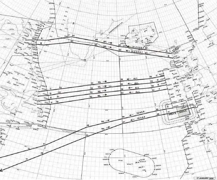
Eastbound Tracks
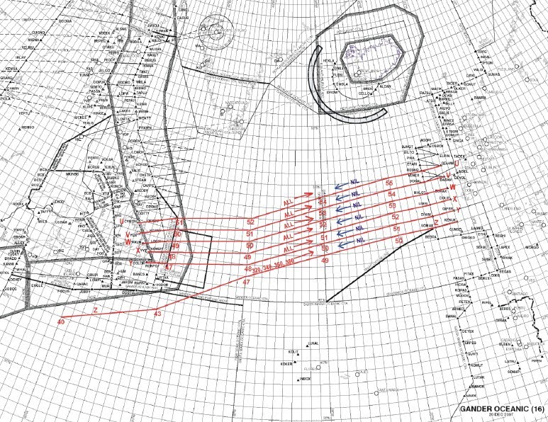
dan
edit: add a couple images as examples of tracks from Aviation Knowledge Wiki
Westbound Tracks
Eastbound Tracks
Last edited by raybolt; Oct 31, 2015 at 9:09 am
Oct 31, 2015 | 3:20 pm
#11

Join Date: Oct 2015
Location: next to HAM
Programs: LH M+M
Posts: 977

Aerial navigation is a complex thing. Try to listen to some ATC recordings to get a glance at let alone the tower/aircraft communication over navigation.
