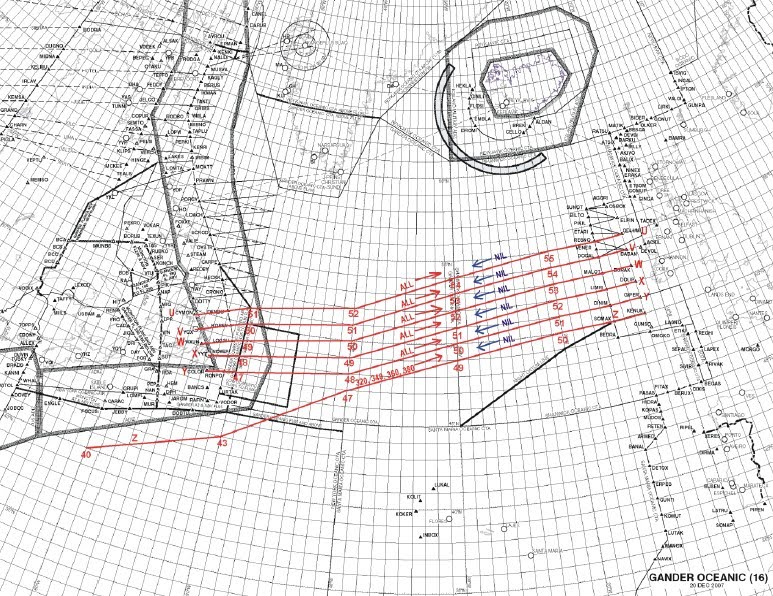
It also may (or may not) be interesting to look at the North Atlantic Tracks from the flight plans posted. They are the "airways" that are labeled NAT_ (U and Z in the above). The points and lat/longs that these tracks fly over are changed on a day to day basis based on winds and weather across the Atlantic. It might look like more Greek, but for anyone interested you can see the days tracks at
https://www.notams.faa.gov/common/nat.html.
dan
edit: add a couple images as examples of tracks from
Aviation Knowledge Wiki
Westbound Tracks
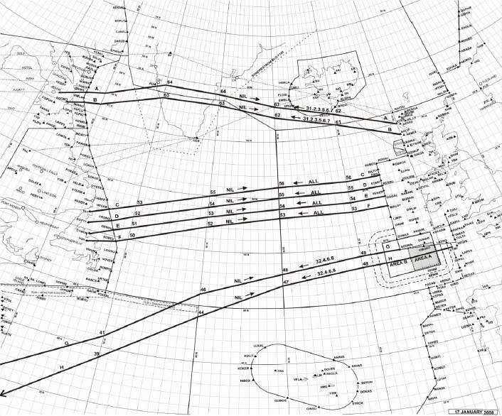
Eastbound Tracks