


The BA Cloud!

 May 1, 2018, 5:53 am
#797
Ambassador, British Airways; FlyerTalk Posting Legend
Join Date: Apr 2012
Location: Leeds, UK
Programs: BA GGL/CCR, GfL, HH Diamond
Posts: 42,964
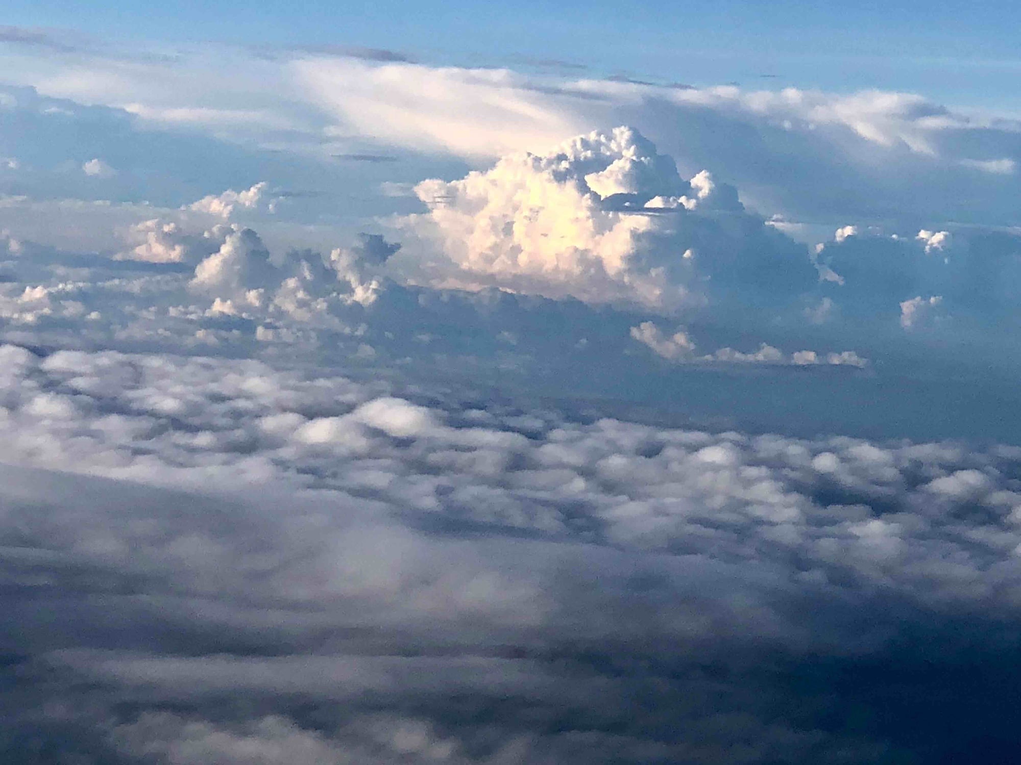
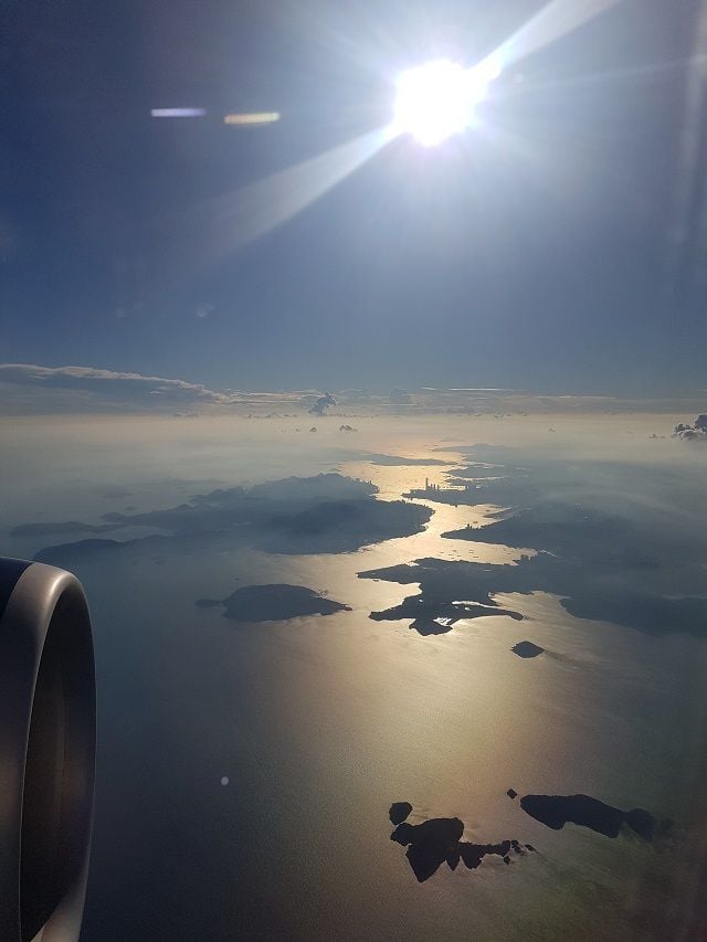
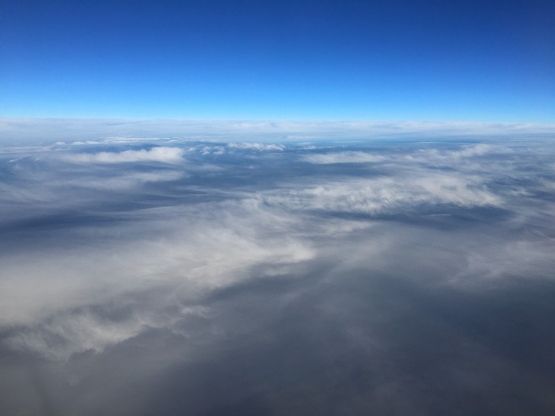
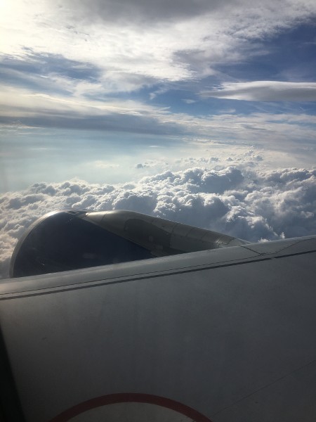
I am guessing nothing particularly interesting about these clouds, but as it has been over a month since someone posted a photo I thought I would post something. Captured in the hold at Bovingdon today.
 May 1, 2018, 6:31 am
#798
Join Date: Nov 2007
Location: SW London
Programs: BAEC Silver; Hilton Diamond;a miscellany of other hotel non-statuses
Posts: 3,607
I almost hesitate to mention this but...
About 10 years ago we were approaching GLA (possibly EDI) and I looked out of the starboard window. I recall seeing a church style cross sticking up above the otherwise dense clouds, with its base at cloud level.
Is there some mountain top construction or similar that could give that effect?
About 10 years ago we were approaching GLA (possibly EDI) and I looked out of the starboard window. I recall seeing a church style cross sticking up above the otherwise dense clouds, with its base at cloud level.
Is there some mountain top construction or similar that could give that effect?
Jun 3, 2018, 1:59 pm
#799
Original Poster


Join Date: Nov 2010
Location: Bristol, UK
Programs: HH D, Rad VIP, Marriott G
Posts: 5,357
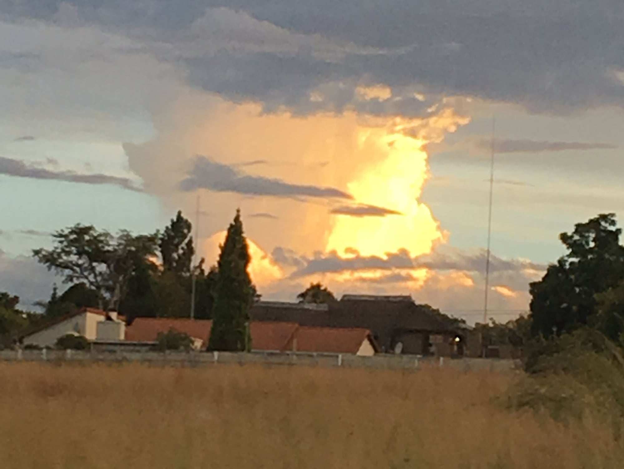
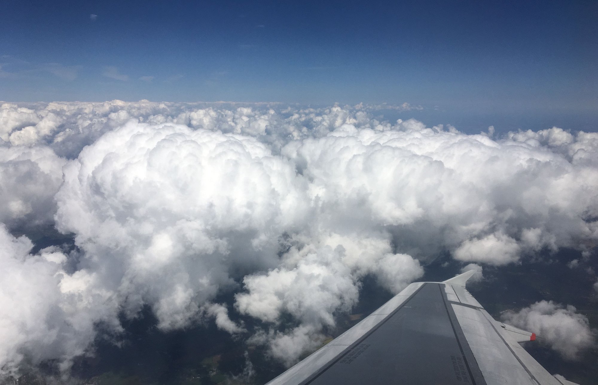
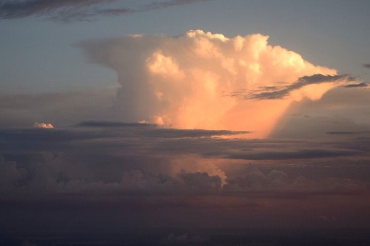
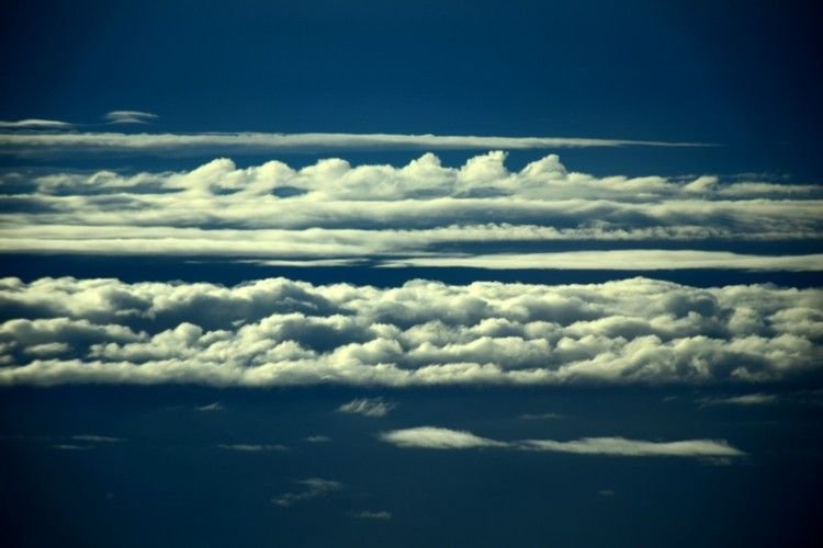
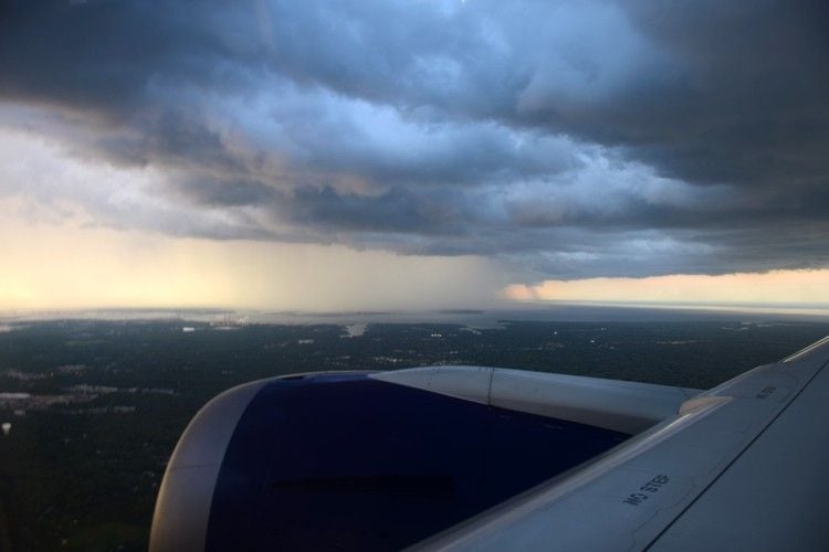
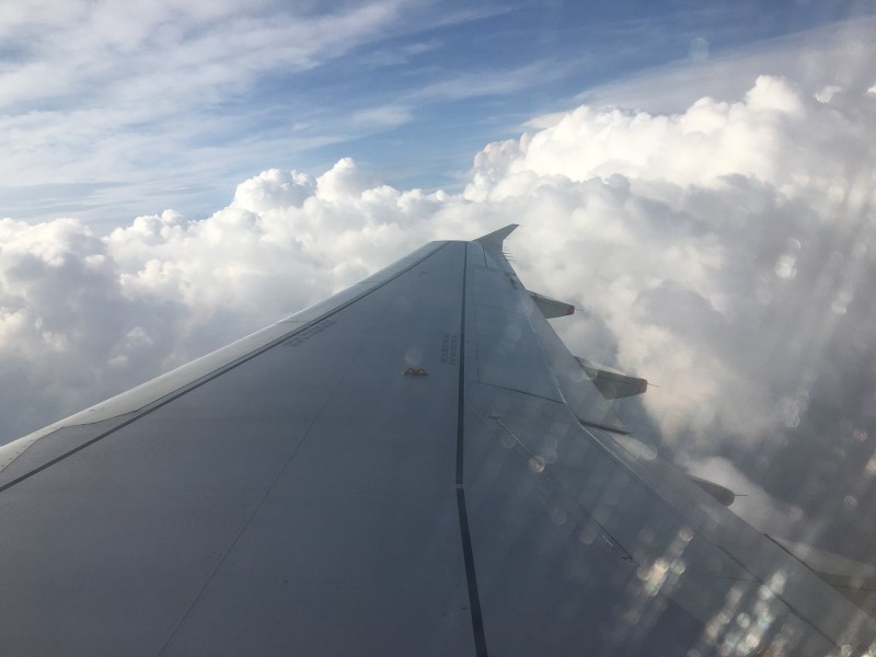
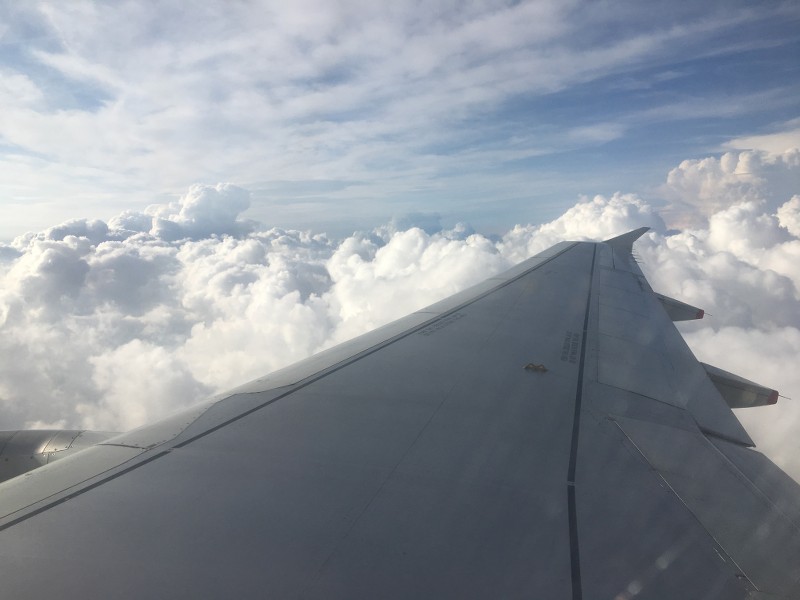
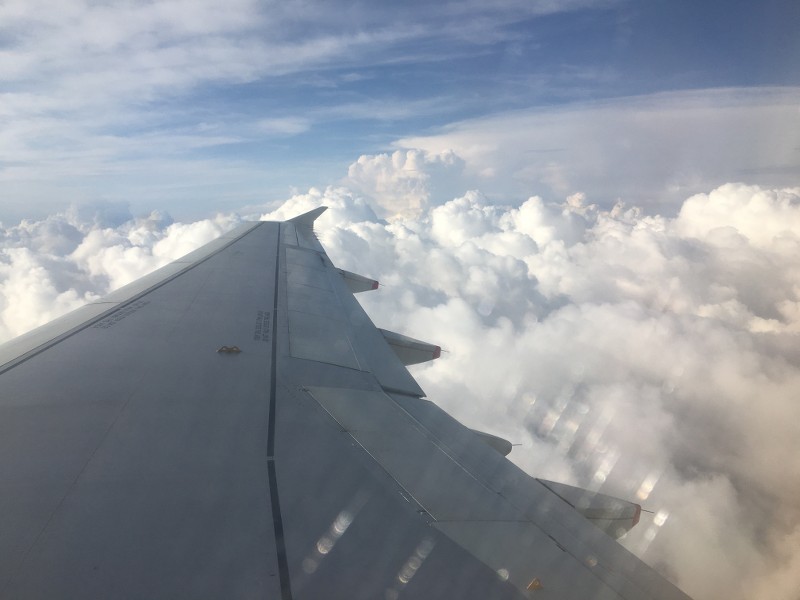
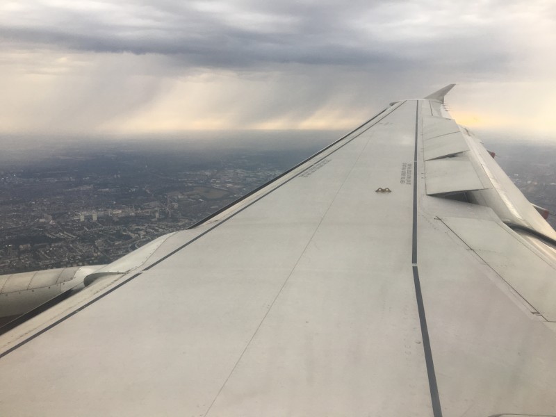
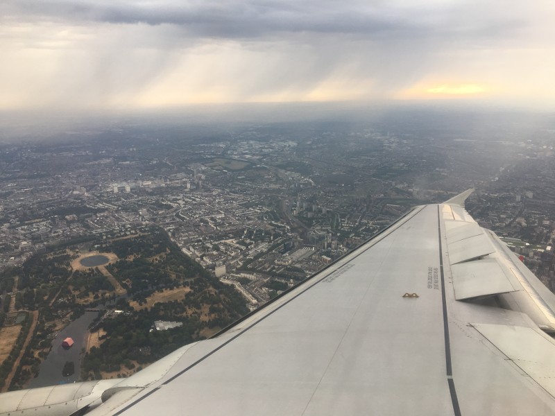
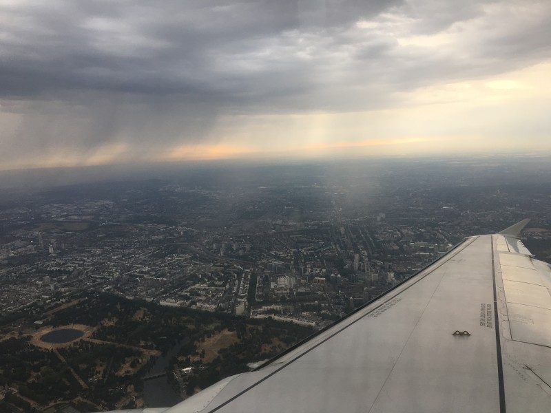
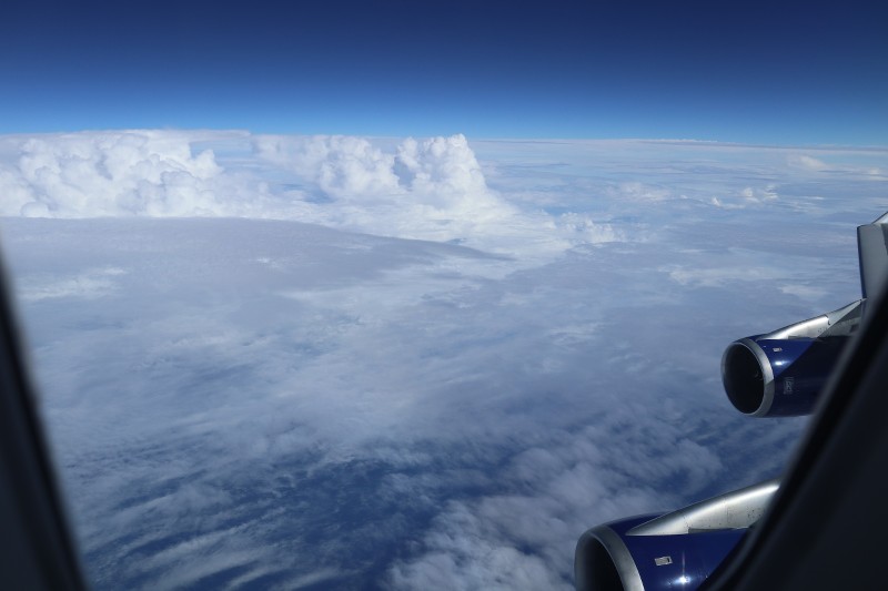
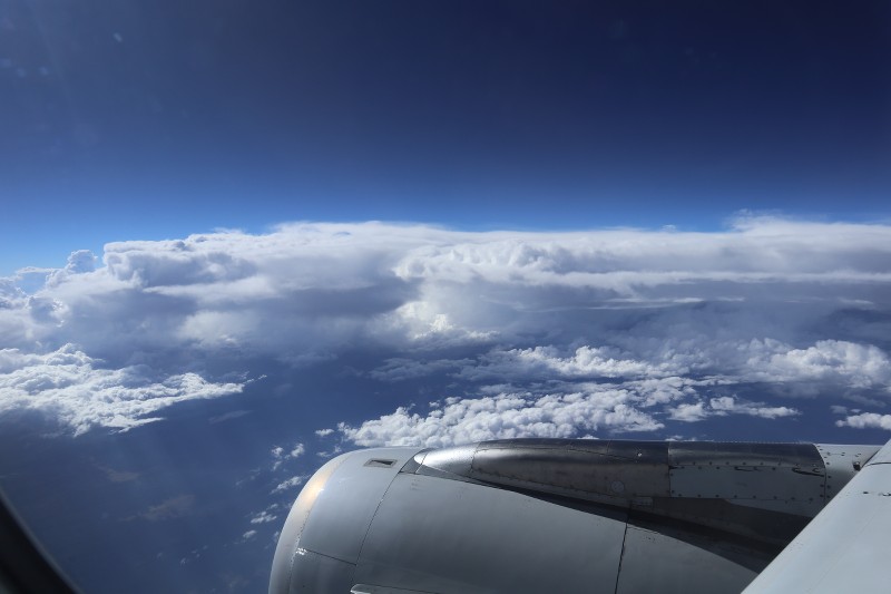
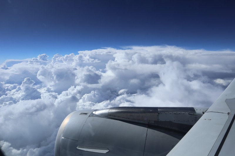
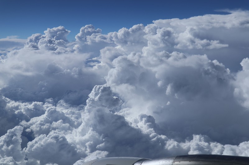
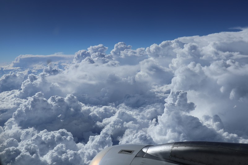
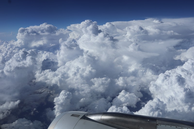
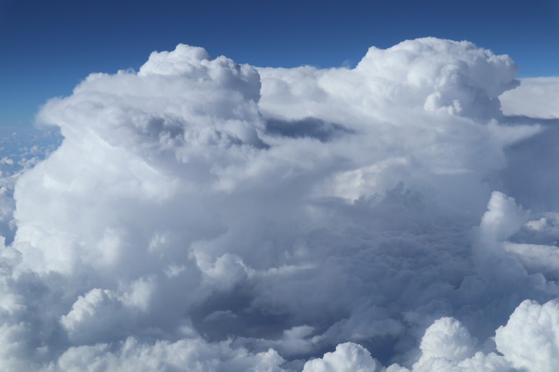
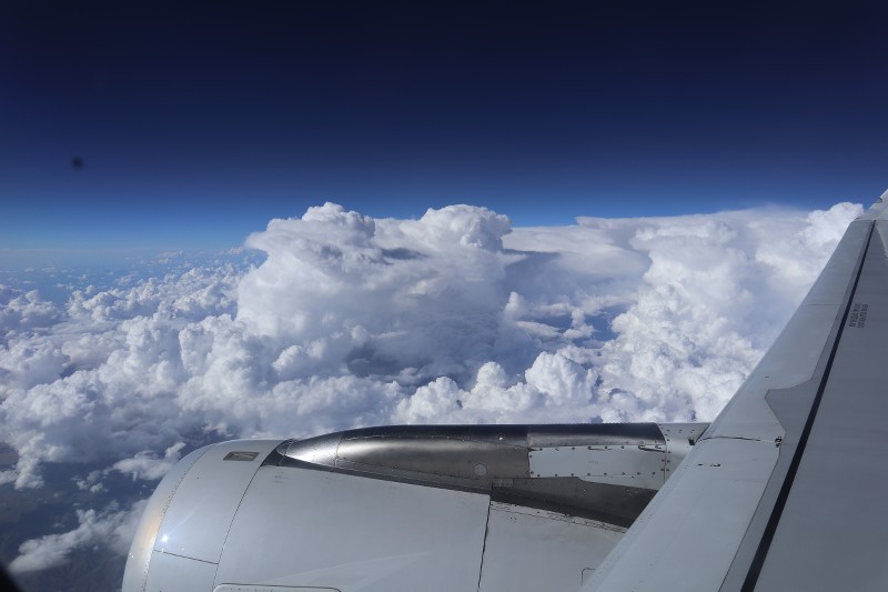
Flew back from VIE last night and with the warm moist weather of late over the continent and beyond, some great thunderstorm clouds around to see and photograph:
Below we are very close to the edge of the thunderstorm 'anvil' and I just liked the detail that one could see...The high winds at this flight level shear the tops of the thunderstorm clouds and cause this 'anvil' shape. This also means that the cloud is in it's 'mature' stage and will not grow any further and is now starting to lose its energy (unless some new heat or moisture is gained by movement over the ground on its path)...
Below another anvil, with some developing Cumulus clouds below. You can see the wind is blowing from right to left in the picture from the way the tops of the clouds are being sheared as they grow!
Just after take off, a lovely still in its 'teenage growth' stage Towering Cumulus, or Cumulonimbus (didn't see any lightning or thunder so can't tell!)...The energy being used is almost tangible!
Anyone else seen any interesting weather enroute recently or at a BA/OW destination?
Thanks to those that posted upthread, great pictures, thanks for sharing them. ^
Jun 26, 2018, 5:45 am
#800
Join Date: Apr 2015
Location: US/UK - and elsewhere
Programs: BA Gold
Posts: 2,557
A few from recent trips:
Coming into Brindisi a week or so ago - this to the west of the city...
Running down the east coast of the US into BWI:
... to avoid storms over Baltimore - we just clipped the southern edge of this TS on approach to BWI (on 33L):
Coming into Brindisi a week or so ago - this to the west of the city...
Running down the east coast of the US into BWI:
... to avoid storms over Baltimore - we just clipped the southern edge of this TS on approach to BWI (on 33L):
Last edited by CKBA; Jun 26, 2018 at 7:27 pm
 Jul 26, 2018, 1:55 pm
#803
Original Poster
Join Date: Nov 2010
Location: Bristol, UK
Programs: HH D, Rad VIP, Marriott G
Posts: 5,357
Love these latest ones KARFA, some excellent action being shown there throughout the journey with the cloud showing moisture is present in the low and mid levels but just can't seem to form into any Cumulus at any level as the moisture is not quite enough...just enough for cloud but not enough to make TCU or CB's on that day with a lot of wind causing the striation of the clouds almost like thin Cirrus.
Later in the flight and especially the last photos really show the mountain waves starting to sculpt the clouds and given some further time we'd see some Altocumulus Lenticularis (almond shaped clouds) from the strong convergence of the winds at altitude.
Great cloud photos, hope they fascinated you as much as me!
Anyone else had an interesting cloud or weather scenario while flying BA / OW recently?
Safe travels.
 Jul 27, 2018, 2:11 am
#805
Original Poster
Join Date: Nov 2010
Location: Bristol, UK
Programs: HH D, Rad VIP, Marriott G
Posts: 5,357
Nice one Prospero ^
Love how this almost captures that feeling when one is swimming below water and looking up at the surface of the water above with the way light plays on the surface...the same effect here and indeed would have had me captivated as well.
Some great Stratocumulus undulatus captured there with the crepuscular rays poking through!
As a side note, <humour warning> I was perplexed why you were stating that the picture was taken at 15,000 (15k) feet above ground level (which I originally thought you were posting as a guide to guess what cloud this was (due to where the bases of the clouds would be located at height wise)) ...obviously I haven't been flying enough lately as didn't enter my mind that 15k was your seat position and not the flight level!
Safe travels everyone, anyone else have a weather related picture or cloudscape from their BA/OW travels?
Jul 27, 2018, 1:15 pm
#806
Ambassador, British Airways; FlyerTalk Posting Legend
Join Date: Apr 2012
Location: Leeds, UK
Programs: BA GGL/CCR, GfL, HH Diamond
Posts: 42,964
lots of storms around the north of England today - due to a few lightening strike in and around Doncaster which took out the signalling I ended up getting the flight down from LBA this evening which gave a good view of the troublemakers
Jul 27, 2018, 4:14 pm
#807
Original Poster
Join Date: Nov 2010
Location: Bristol, UK
Programs: HH D, Rad VIP, Marriott G
Posts: 5,357
Great pics as always KARFA, that CB with the anvil top in the back right of the pics is definitely a bad boy...likely was causing all sorts of mayhem, the TCU/CB's below you were still on the hob and cooking up nicely...still in growth stage and not yet decaying like the one in the back right...
Thanks for the pics, wish we'd get some rain here in Bristol, dry as a bone still and although it threatened rain earlier complete with some clouds thick enough to rain, there were only a few dirty drops to tease and then it had moved on to build and release the energy elsewhere.
Hope everyone gets where they need to be this weekend, safe travels!
 Jul 28, 2018, 6:55 am
#809
Original Poster
Join Date: Nov 2010
Location: Bristol, UK
Programs: HH D, Rad VIP, Marriott G
Posts: 5,357
Amazing pictures showing a few atmospheric dynamics here KARFA, thanks for posting them. ^^
In no particular order, from the pictures I read:
-this very hot, humid air mass over the UK (until yesterday that is) allowed the convective clouds to build quite easily but while the clouds could get to a vertical extent that allowed precipitation development, the air underneath the clouds is still so very warm and 'dry' (respectively) so while there was significant precipitation occurring in your photo, the air would 'absorb' the moisture and most of the showery rain never reached the ground! (this is called Virga in Meteorological terms) and is always fascinating to see and watch. Obviously with time and increasing change in the air mass, the showers will eventually reach the ground and give us the relief we need here in the UK after the long dry spell.
-I'm guessing the winds were a tail wind here in the photos? Always hard to tell these things but that is my take on the situation (maybe wrongly) as the usual convective cycles associated with the showery precipitation that is occurring in the photos shows the showers being blown not only downward but also outwards from the 'cloud' that is producing the precipitation. This area of precipitation is usually just behind the 'gust front' associated with a strong convective cell (like a thunderstorm cell) with quite well developed vertical mass. So the winds blow down and out (from both leading and trailing edges of the TCU / CB cloud) and the precipitation just behind this (again on both sides of the storm cell) does the same, following the downdrafts...when the downdrafts are incredibly strong and intense, these are called microbursts (not evident here though) and can greatly affect aviation in the area due to the incredible shear they place on some aircraft and localised turbulence with associated instant drops/climbs one can experience. Anyway, the downdrafts here are going away from the BA plane and may be localised but from looking at the flaps on the wing, I could also understand that there is not as much lift available during this period of flight and therefore the flaps help extend the wind surface area to generate more lift (typical in descents I believe but also when there is a tailwind and turbulence? (I"m not a pilot so am guessing wildly with this last bit about the plane situation but certainly in past experiences with strong convective activity during landing especially and on smaller planes, it seems like the plane typically is almost at a crawl and the flaps are extended to help generate lift and the speed reduced to help combat the gusty nature of the convective cells and any strong deviance to what one is aiming for when judging landing speed and alignment...anyway, a lovely couple of pictures and maybe off the mark but that is how I interpret the situation and love the detail and images...)
Safe travels everyone! Anyone else have some recent BA related / OW flight weather pics?
Sep 2, 2018, 3:11 pm
#810
Ambassador, British Airways; FlyerTalk Posting Legend
Join Date: Apr 2012
Location: Leeds, UK
Programs: BA GGL/CCR, GfL, HH Diamond
Posts: 42,964
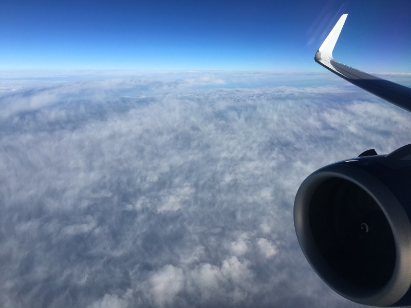
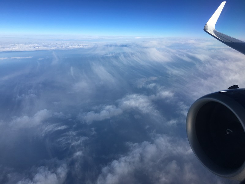
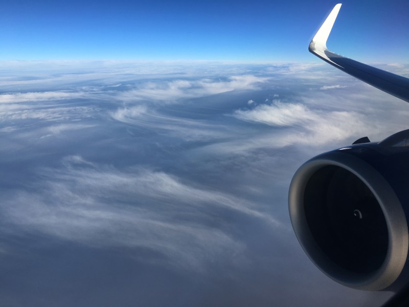
Clouds spotted during my OTP-PHX trip.
LHR-OTP over central Europe Friday 24 August
LHR-JFK approach the US Saturday 25 August
JFK-LAX over western US about 1/2 hours out of LAX Saturday 25 August
LHR-OTP over central Europe Friday 24 August
LHR-JFK approach the US Saturday 25 August
JFK-LAX over western US about 1/2 hours out of LAX Saturday 25 August