


Visiting the Faroe Islands
 Aug 8, 2016, 8:27 pm
#46
Original Poster
Join Date: Mar 2008
Location: Grantham, NH
Posts: 530
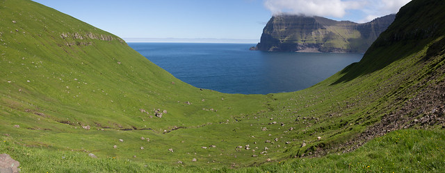
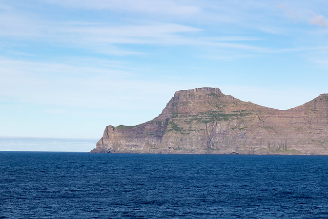
In a country that loves tunnels, Kalsoy is the grandfather of them all, with this one little island having fivetunnels (four on the road between Syđradalur and Trollanes, and one as a branching side tunnel off the northermost tunnel).
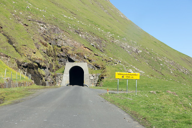
As you drive through the tunnels one at a time, each time you emerge into a different valley.
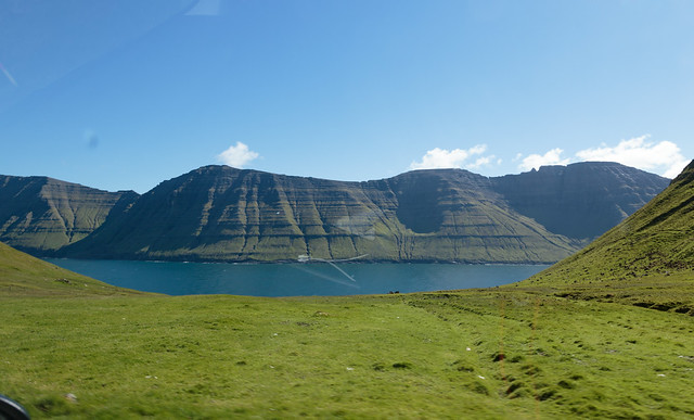
Here's one valley with a nice view of Kunoy:
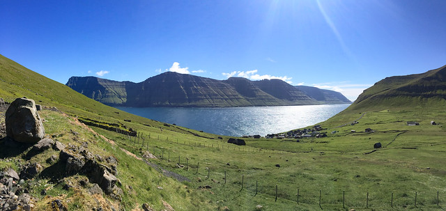
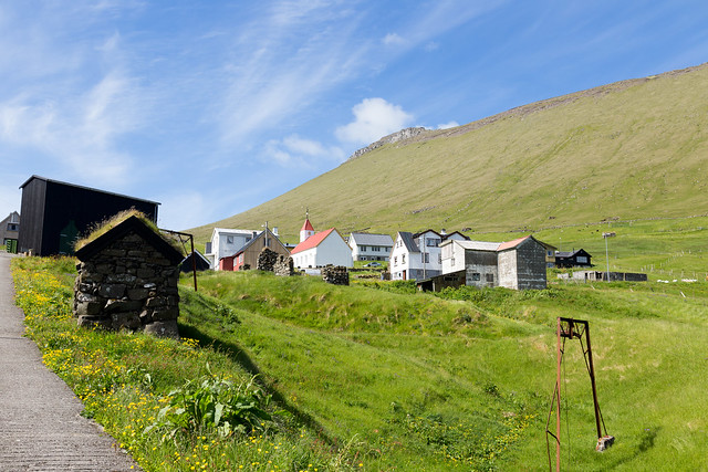
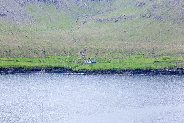
The next valley has the nice little village of Mikladalur (I'll swing back to that later)
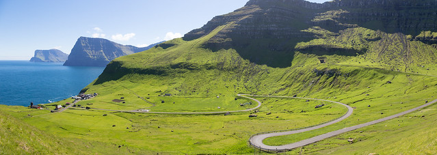
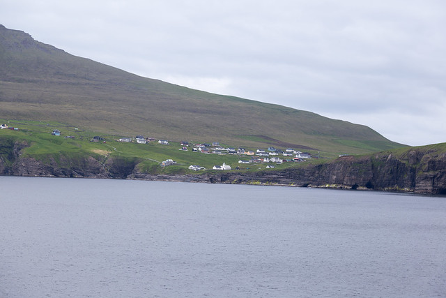
And you finally emerge from the last tunnel and descend down the switchbacks to the little town of Trřllanes:
As you drive through the tunnels one at a time, each time you emerge into a different valley.
Here's one valley with a nice view of Kunoy:
The next valley has the nice little village of Mikladalur (I'll swing back to that later)
And you finally emerge from the last tunnel and descend down the switchbacks to the little town of Trřllanes:
 Aug 8, 2016, 8:27 pm
#47
Original Poster
Join Date: Mar 2008
Location: Grantham, NH
Posts: 530
Our planned hike has us leaving the road and heading to the northern tip of Kalsoy to a point called Kalloy, which has an automated lighthouse.
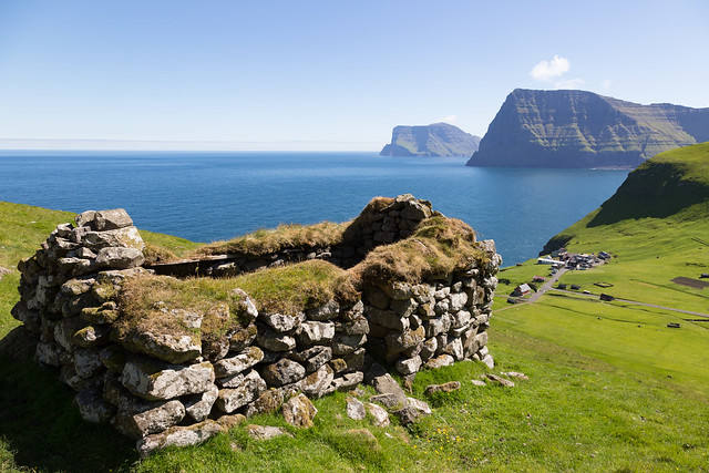
The first stop on the hike was this old stone shelter:
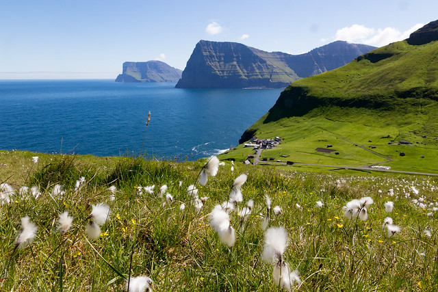
Then a nice view of Trřllanes with the wildflowers:
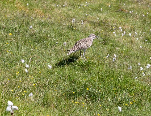
Some surprisingly friendly birds, like this Whimbrel:
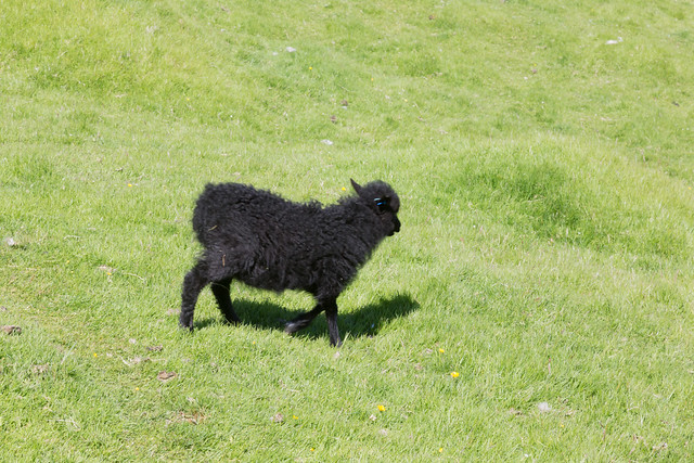
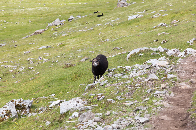
And the ever-present sheep:
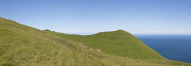
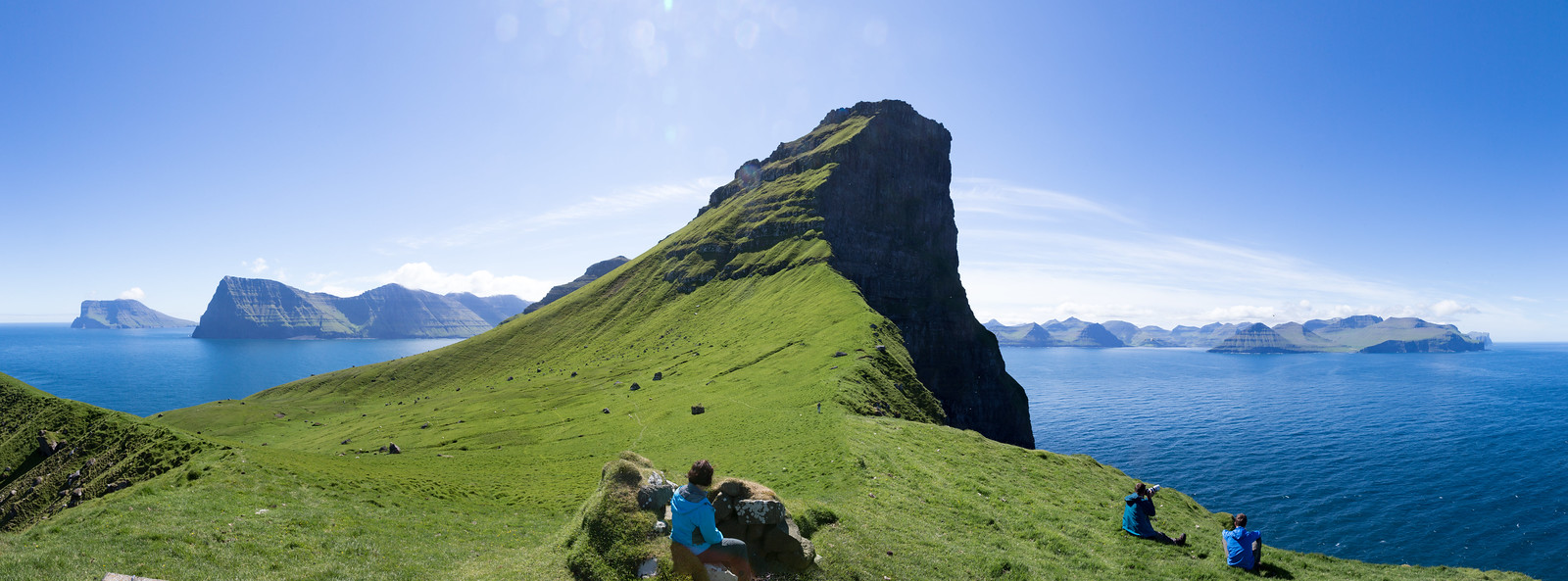
Rounding the ridge, our destination came into view:
The first stop on the hike was this old stone shelter:
Then a nice view of Trřllanes with the wildflowers:
Some surprisingly friendly birds, like this Whimbrel:
And the ever-present sheep:
Rounding the ridge, our destination came into view:
Aug 8, 2016, 8:28 pm
#48
Original Poster
Join Date: Mar 2008
Location: Grantham, NH
Posts: 530
Why do you go to the lighthouse? It's simple.
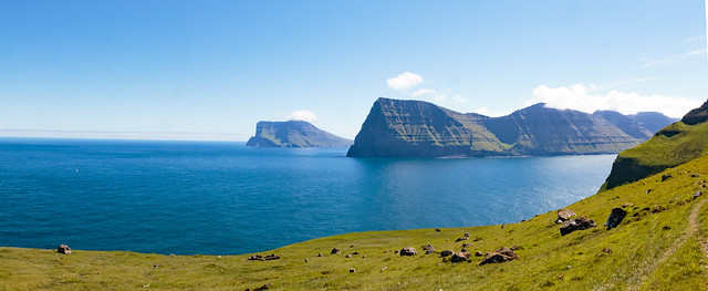
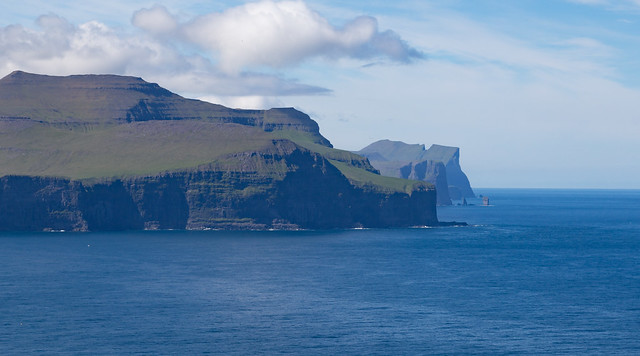
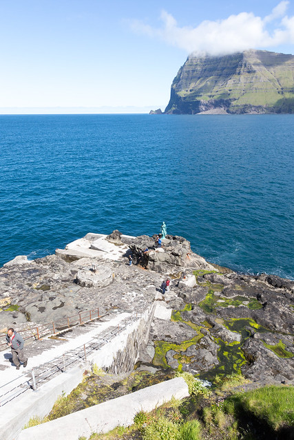
First, as you approach, you get a rather nice view to the east of Kunoy and Viđoy.
The end of Viđoy is Enniberg cliff, which at 750 m is the second highest sea-cliff in Europe (after Hornelen in Norway), which apparently is a neat experience (that we didn't get to do, doing it safely involves scheduling a guide and having the right weather):
As you crest the ridge, you get a nice view was as well over to Eysturoy and Streymoy:
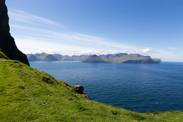
Off the tip of Eysturoy are two giant sea stacks called Risin og Kellingin (The Giant and The Witch). This isn't the best place to view them, but that you can see them from here is neat:
Here's another view west, where you can see the village of Gjogv[1]
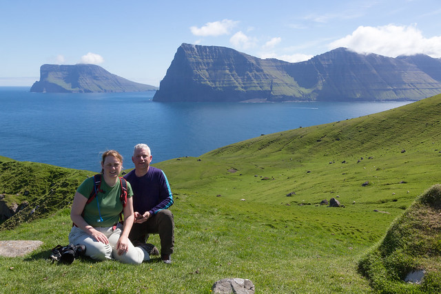
And proving that we were there:
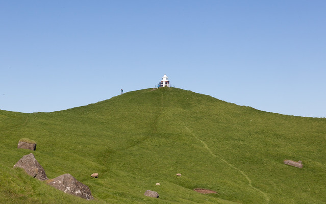
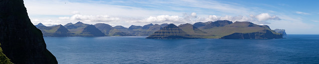
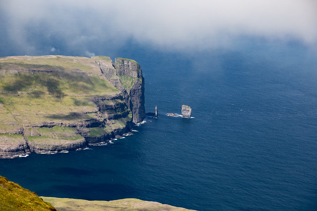
But the real neat thing is walking right up to the lighthouse, turning around, and getting the complete view.
This is what the view from Kallur Lighthouse is. That's five islands (Viđoy, Kunoy, Kalsoy itself, Eysturoy, and Streymoy). This is one of the finest views I've had anywhere.
(And kicking myself as a photographer for getting that much lens flare)
[1] Anyone want to take a stab at pronouncing that?
First, as you approach, you get a rather nice view to the east of Kunoy and Viđoy.
The end of Viđoy is Enniberg cliff, which at 750 m is the second highest sea-cliff in Europe (after Hornelen in Norway), which apparently is a neat experience (that we didn't get to do, doing it safely involves scheduling a guide and having the right weather):
As you crest the ridge, you get a nice view was as well over to Eysturoy and Streymoy:
Off the tip of Eysturoy are two giant sea stacks called Risin og Kellingin (The Giant and The Witch). This isn't the best place to view them, but that you can see them from here is neat:
Here's another view west, where you can see the village of Gjogv[1]
And proving that we were there:
But the real neat thing is walking right up to the lighthouse, turning around, and getting the complete view.
This is what the view from Kallur Lighthouse is. That's five islands (Viđoy, Kunoy, Kalsoy itself, Eysturoy, and Streymoy). This is one of the finest views I've had anywhere.
(And kicking myself as a photographer for getting that much lens flare)
[1] Anyone want to take a stab at pronouncing that?
Aug 8, 2016, 8:29 pm
#49
Original Poster
Join Date: Mar 2008
Location: Grantham, NH
Posts: 530
After that hike, we walked back to Trřllanes and had to start heading back to the ferry.
However, another group of hikers told us about a neat little side trip we could do. Several sources had mentioned that Kalsoy had five tunnels on it, but we had only counted four in our drive (and since there's basically just the one road, we were wondering the discrepancy). It turns out, the last tunnel between Trřllanes and Mikladalur, Trřllanestunnilin, is actually two tunnels. About halfway down the tunnel there's actually an unmarked side tunnel that's really easy to miss. But sure enough, we found it on the return trip, and found ourselves looking at the uninhabited Djúpidalur ("Deep Valley"):
Why does an uninhabited valley get it's own secret side tunnel? Apparently, the steep slopes of Djúpidalur are prized sheep grazing, so when the tunnels got installed, they managed to lobby for the side tunnel so they could access the valley, doing so under the guise of it being an emergency exit from the main tunnel.
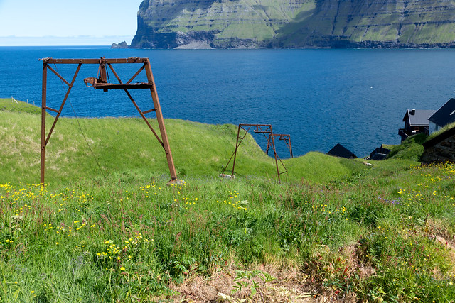
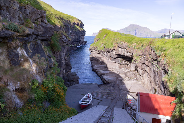
Down from the uninhabited valley is another valley and village, Mikladalur ("The Big Valley"), which is a pleasant little town.
Here, you can see remnants of an old boat lift that must have gotten heavy usage back before the road arrived:
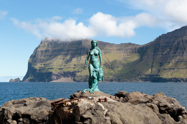
One of the attractions in Mikladalur is a relatively new sculpture installed down on the beach: a selkie.
The selkie is a legend that some people sacrificed themselves to the sea and became seals, but once a year, on the Twelfth Night, the selkies are allowed to shed their seal skin and become humans again for a night.
Apparently there's a further legend on Kalsoy that at one point the villagers killed and ate the (seal) husband and child of one of the selkies, and the selkie placed a curse on the village that "some will die at sea and others fall from the mountain tops, until there be as many dead as can link hands all round the shores of the isle of Kalsoy!’"
In honor of that, the statue of a Selkie is built on the shore:
However, another group of hikers told us about a neat little side trip we could do. Several sources had mentioned that Kalsoy had five tunnels on it, but we had only counted four in our drive (and since there's basically just the one road, we were wondering the discrepancy). It turns out, the last tunnel between Trřllanes and Mikladalur, Trřllanestunnilin, is actually two tunnels. About halfway down the tunnel there's actually an unmarked side tunnel that's really easy to miss. But sure enough, we found it on the return trip, and found ourselves looking at the uninhabited Djúpidalur ("Deep Valley"):
Why does an uninhabited valley get it's own secret side tunnel? Apparently, the steep slopes of Djúpidalur are prized sheep grazing, so when the tunnels got installed, they managed to lobby for the side tunnel so they could access the valley, doing so under the guise of it being an emergency exit from the main tunnel.
Down from the uninhabited valley is another valley and village, Mikladalur ("The Big Valley"), which is a pleasant little town.
Here, you can see remnants of an old boat lift that must have gotten heavy usage back before the road arrived:
One of the attractions in Mikladalur is a relatively new sculpture installed down on the beach: a selkie.
The selkie is a legend that some people sacrificed themselves to the sea and became seals, but once a year, on the Twelfth Night, the selkies are allowed to shed their seal skin and become humans again for a night.
Apparently there's a further legend on Kalsoy that at one point the villagers killed and ate the (seal) husband and child of one of the selkies, and the selkie placed a curse on the village that "some will die at sea and others fall from the mountain tops, until there be as many dead as can link hands all round the shores of the isle of Kalsoy!’"
In honor of that, the statue of a Selkie is built on the shore:
Aug 8, 2016, 8:31 pm
#50
Original Poster
Join Date: Mar 2008
Location: Grantham, NH
Posts: 530
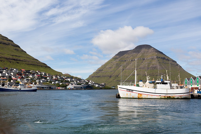
However, the day we went to Kalsoy, while having absolutely perfect weather, had a reduced ferry schedule, so we had to hustle back to the ferry terminal lest we end up stuck on the island for two days (since no ferries run on Sunday), and we were soon back in Klaksvik Harbor:
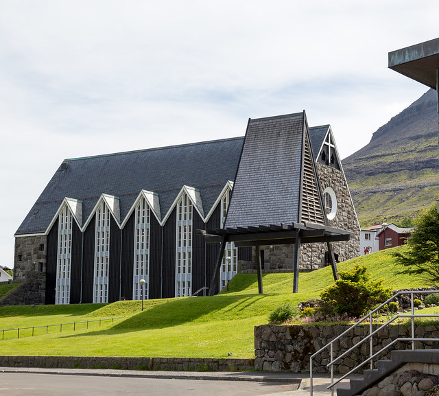
One of the sights we wanted to see in Klaksvik was their "new" church from 1963:
Which is quite impressive inside:
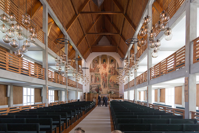
And, like most churches, I thought this church had another votive ship:
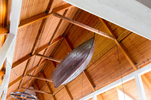
But it's not. In December 1913, all of the able-bodied men of the village of Skarđ in Kunoy died in a boating accident, and by 1920, the village was deserted. This is one of the fishing boats from Skarđ
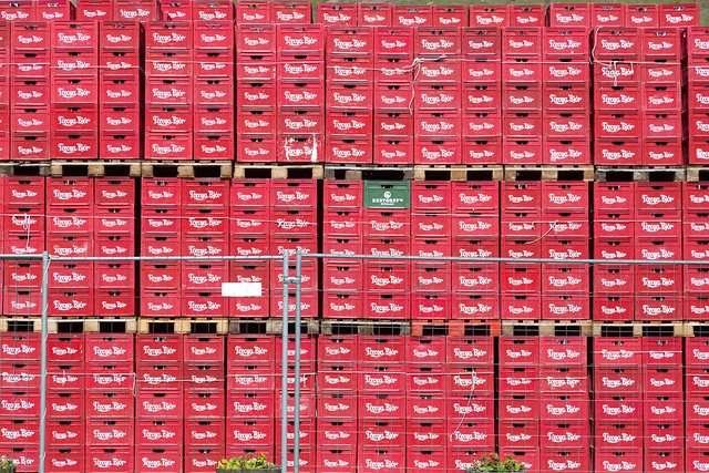
And then, across the street, we hit up Fřroya Bjór, the island's oldest brewery (the name means, simply, "Faroese Beer"):
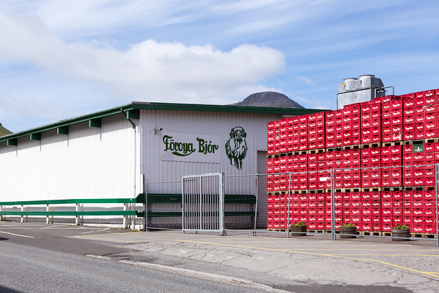
Looking at the piles outside, I thought, "one of these things is not like the others!"
One of the sights we wanted to see in Klaksvik was their "new" church from 1963:
Which is quite impressive inside:
And, like most churches, I thought this church had another votive ship:
But it's not. In December 1913, all of the able-bodied men of the village of Skarđ in Kunoy died in a boating accident, and by 1920, the village was deserted. This is one of the fishing boats from Skarđ
And then, across the street, we hit up Fřroya Bjór, the island's oldest brewery (the name means, simply, "Faroese Beer"):
Looking at the piles outside, I thought, "one of these things is not like the others!"
Aug 8, 2016, 8:32 pm
#51
Original Poster
Join Date: Mar 2008
Location: Grantham, NH
Posts: 530
After getting into Klaksvik, we discovered that "Saturday Night" is actually a pretty quiet time, and most places are closed.
For dinner, we decided to check out Big Stan, which was quite interesting, since the owners of Big Stan are a pair of brothers from Swaziland.
Yes, that's two guys from Swaziland. Selling shawarma. In the Faroe Islands.
God bless globalism.
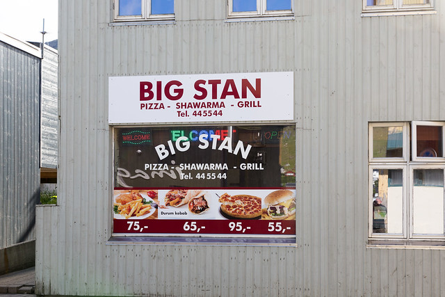
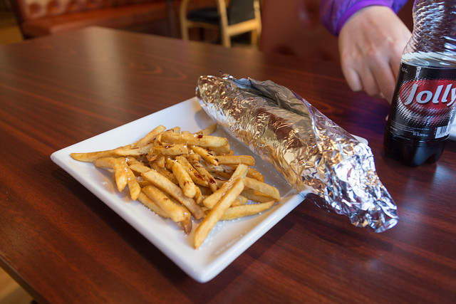
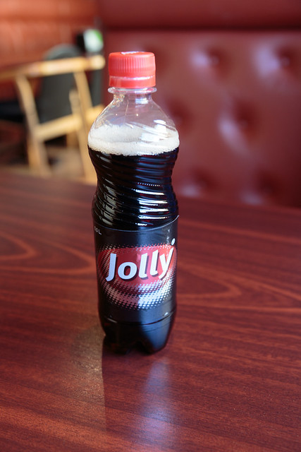
And enjoying a Jolly Cola, which is way more common than Coca Cola in the islands (and bottled by Foroya Bjor across the street):
For dinner, we decided to check out Big Stan, which was quite interesting, since the owners of Big Stan are a pair of brothers from Swaziland.
Yes, that's two guys from Swaziland. Selling shawarma. In the Faroe Islands.
God bless globalism.
And enjoying a Jolly Cola, which is way more common than Coca Cola in the islands (and bottled by Foroya Bjor across the street):
Aug 8, 2016, 8:32 pm
#52
Original Poster
Join Date: Mar 2008
Location: Grantham, NH
Posts: 530
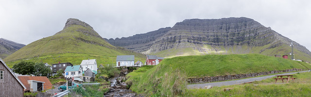
The next stop was checking out the village of Gjógv. Located on the north end of Eysturoy, Gjógv (the name means "Gorge") is a rather picturesque village located next to a... gorge. (As an aside, if you look at the translations, most of the villages in the Faroes actually have pretty unimaginative names like "Big valley" or "West village").
As Faroese villages go, this one is popular with tourists, and a lot of Danish people seem to come here and rent homes for the summer, so unlike most villages it was quite busy.
Oh, and I see that nobody took me up on the pronunciation challenge. The best English spelling approximation I could give is "djiv"
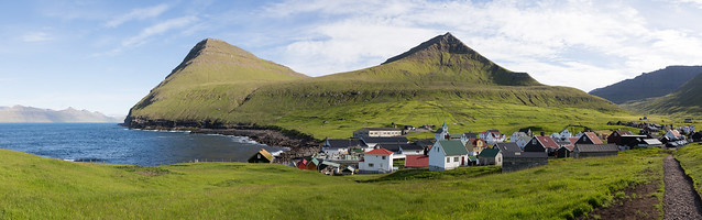
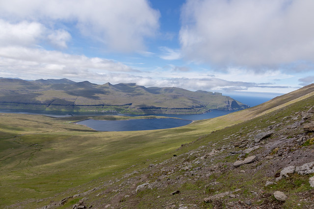
The village has a great view back over to Kalsoy where we had hiked earlier that day:
Really hard to pick out in this photo, but there's a white spec that is the Kallur lighthouse where I took that cool photo:
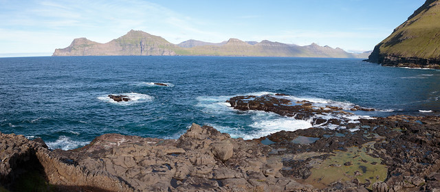
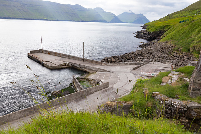
Because of the narrow gorge, it has what looks like a fairly nice harbor:
That is, until you see what the water's like going into the harbor. This harbor is only for the hardcore rower!
As Faroese villages go, this one is popular with tourists, and a lot of Danish people seem to come here and rent homes for the summer, so unlike most villages it was quite busy.
Oh, and I see that nobody took me up on the pronunciation challenge. The best English spelling approximation I could give is "djiv"
The village has a great view back over to Kalsoy where we had hiked earlier that day:
Really hard to pick out in this photo, but there's a white spec that is the Kallur lighthouse where I took that cool photo:
Because of the narrow gorge, it has what looks like a fairly nice harbor:
That is, until you see what the water's like going into the harbor. This harbor is only for the hardcore rower!
Aug 8, 2016, 8:33 pm
#53
Original Poster
Join Date: Mar 2008
Location: Grantham, NH
Posts: 530
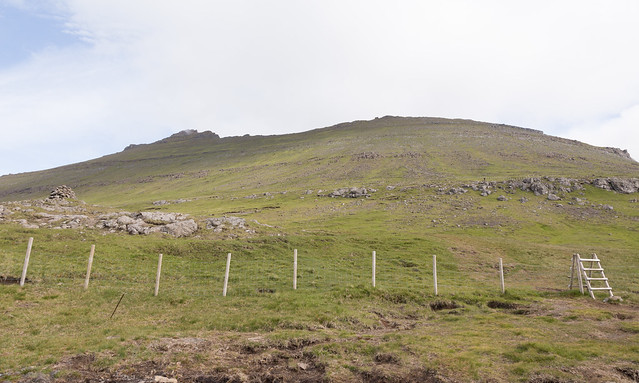
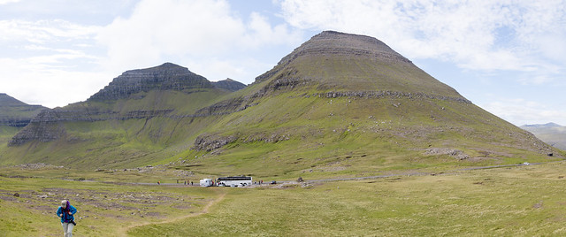
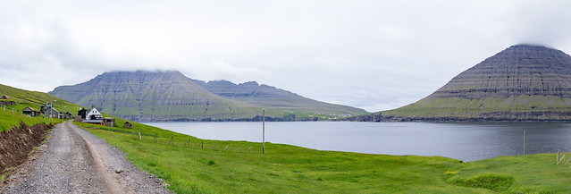
Our last full day in the Faroes, one of our goals was to hike up Slćttaratindur, the tallest peak in the Faroes. Fairly far north on Eysturoy, it's known for having great views of the island.
It's also well known for fickle weather. Here, you can see that visibility at the peak was going to be questionable.
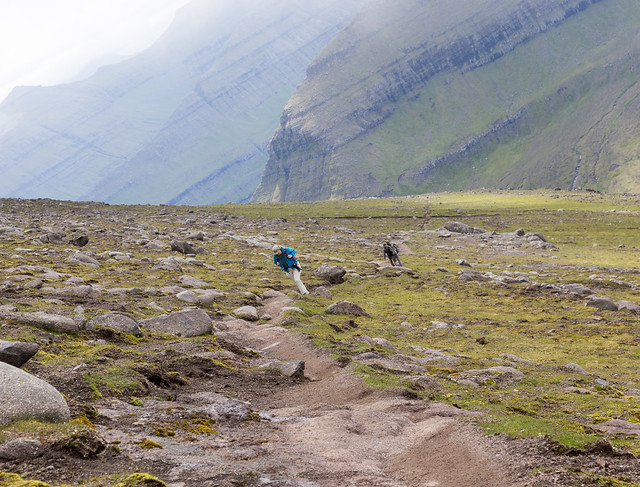
This also shows you how the typical Faroes trail isn't really marked. There's not any foliage blocking the way, so mostly you are left to get from Point A to Point B by whatever sheep trails look most convenient:
It doesn't really look like it from this view, but the trail mostly goes straight up a 45 degree slope:
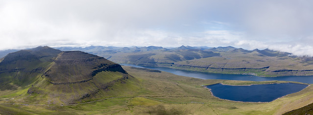
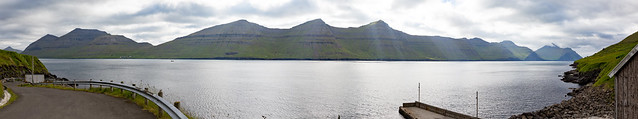
The Faroe Islands aren't large or particularly tall, but views like this make you feel like you are hiking along the roof of the world, with peaks as far as the eye can see (realistically, that's only about 15 miles worth of peaks with lots of hidden fjords and sounds!):
Some more indication of the sort of slope we were on most of our hiking:
As luck had it, the view started to get a bit iffy as the clouds closed in. In fact, we were socked in with fog at the West summit.
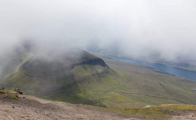
But occasionally the clouds parted, like this good view of Risin og Kellingin
And again, giving up after 30 minutes waiting for the weather to clear, we got down, and then things started to clear up. I'll have to give the peak another try on a future visit:
And remember, somewhere, somehow, a sheep is always watching you.
It's also well known for fickle weather. Here, you can see that visibility at the peak was going to be questionable.
This also shows you how the typical Faroes trail isn't really marked. There's not any foliage blocking the way, so mostly you are left to get from Point A to Point B by whatever sheep trails look most convenient:
It doesn't really look like it from this view, but the trail mostly goes straight up a 45 degree slope:
The Faroe Islands aren't large or particularly tall, but views like this make you feel like you are hiking along the roof of the world, with peaks as far as the eye can see (realistically, that's only about 15 miles worth of peaks with lots of hidden fjords and sounds!):
Some more indication of the sort of slope we were on most of our hiking:
As luck had it, the view started to get a bit iffy as the clouds closed in. In fact, we were socked in with fog at the West summit.
But occasionally the clouds parted, like this good view of Risin og Kellingin
And again, giving up after 30 minutes waiting for the weather to clear, we got down, and then things started to clear up. I'll have to give the peak another try on a future visit:
And remember, somewhere, somehow, a sheep is always watching you.
Aug 8, 2016, 8:34 pm
#54
Original Poster
Join Date: Mar 2008
Location: Grantham, NH
Posts: 530
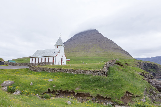
Viđareiđi is the northern-most settlement in the Faroes, on the island of Viđoy.
The high mountain in the background has, on the far side, Cape Enniberg, a 750m vertical cliff dropping all the way down to the Atlantic.
It's supposedly an incredible view, but the hike up there is long (takes most of the day) and dangerous without a guide. Due to these issues, and the poor weather, we did the Slćttaratindur hike instead.
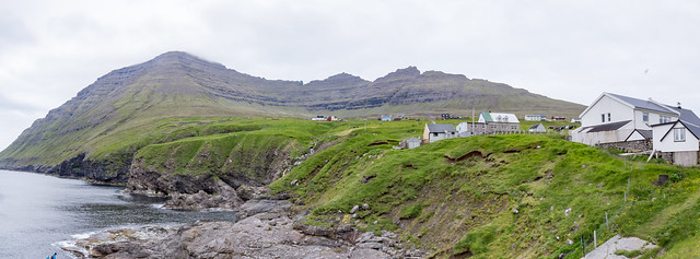
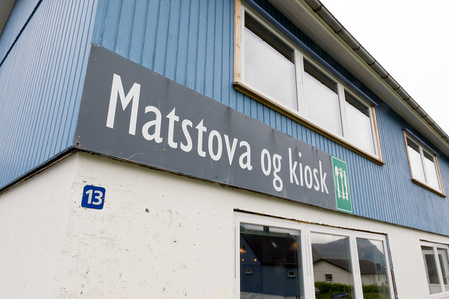
Viđareiđi sits in a surprisingly steep valley, but considering that it's one of the furthest out settlements, it's got a bit more than most towns. Including the rarity outside of Torshavn and Klaksvik: an actual restaurant: Matstovan hjá Elisabeth á Viđareiđi ("Elizabeth's Restaurant").
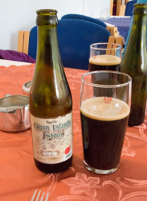
Where we had some Faroese beer:
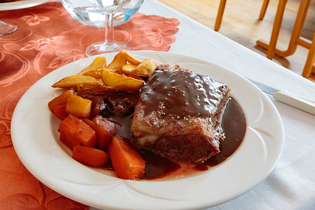
And, for what surprised me by being only the second time this happened on the island, I had lamb. A giant saddle of lamb. While a bit pricey (~$28), this was gooooood:
The high mountain in the background has, on the far side, Cape Enniberg, a 750m vertical cliff dropping all the way down to the Atlantic.
It's supposedly an incredible view, but the hike up there is long (takes most of the day) and dangerous without a guide. Due to these issues, and the poor weather, we did the Slćttaratindur hike instead.
Viđareiđi sits in a surprisingly steep valley, but considering that it's one of the furthest out settlements, it's got a bit more than most towns. Including the rarity outside of Torshavn and Klaksvik: an actual restaurant: Matstovan hjá Elisabeth á Viđareiđi ("Elizabeth's Restaurant").
Where we had some Faroese beer:
And, for what surprised me by being only the second time this happened on the island, I had lamb. A giant saddle of lamb. While a bit pricey (~$28), this was gooooood:
Aug 8, 2016, 8:34 pm
#55
Original Poster
Join Date: Mar 2008
Location: Grantham, NH
Posts: 530
The small town of Múli across the sound from Viđareiđi is an interesting little tale.
Until the 1980s, most of the Northeastern islands were quite remote, and mostly served by periodic ferries and mailboats, and by town residents rowing to other towns for services. For example, the people of Múli didn't have a church, so they'd actually row across every Sunday to Viđareiđi for services:
Starting in the late 1960s, the Faroes had a determined civil engineering effort to expand transport throughout the isalnds. First, a bridge between Viđoy and Borđoy . Then a pair of tunnels linking Klaskvik to Norđdepil made road travel feasible all the way up to Viđareiđi (although the road is subject to frequent landslides and is being replaced currently by yet another tunnel). By the mid-80s, most everything in the northeast was connected except for Múli (which had just recently gotten power in the 1970s).
Well, in 1989 the first temporary road reached Múli, and following that, the complete road in 1992.
At which point the handful of remaining residents in Múli used the road.... to move out to Klaksvik.
It's now basically an abandoned hamlet, although one or two of the houses do get minor use in the summer. We did check it out, and there was one person staying there:
Aug 8, 2016, 8:35 pm
#56
Original Poster
Join Date: Mar 2008
Location: Grantham, NH
Posts: 530
Our next stop was the Island of Kunoy. Historically, this rugged island had three very small settlements, Kunoy on the west, and Haraldssund and Skarđ on the east.
Skarđ, however, got abandoned around 1920, since in 1913 almost all of the men in the village died in a fishing accident.
The remaining villages got somewhat restablized by the creation of yet another tunnel and a causeway, now making it a relatively short drive from Kunoy back to Klaksvik.
As you emerge from the tunnel, you get a great view of Kalsoy (although the weather was quite dismal):
The Faroe Islands (somewhat guided by Denmark) have had quite the transformation by the use of civil engineering. Many towns used to be utterly dependent on their harbor and boats (often manually rowed) to get basic good and mail, and now most of these towns are well connected by a series of tunnels, bridges, and causeways. Indeed, Kunoy is now only a short drive from Klaksvik.
But there's a bit of a downside to all this development: several towns we visited all had a near-derelict harbor that's only seldomly used now; the maritime way of life has started to disappear:
Kunoy is wedged between some very steep and tall cliffs and the sea, making it a bit surprisingly to know that back in the day, the residents of Haraldssund and Skarđ used to walk here over the mountains for church:
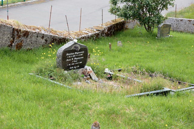
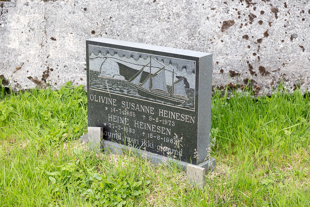
And, like I saw back in Torshavn, the Faroese like elaborate tombstones:
Skarđ, however, got abandoned around 1920, since in 1913 almost all of the men in the village died in a fishing accident.
The remaining villages got somewhat restablized by the creation of yet another tunnel and a causeway, now making it a relatively short drive from Kunoy back to Klaksvik.
As you emerge from the tunnel, you get a great view of Kalsoy (although the weather was quite dismal):
The Faroe Islands (somewhat guided by Denmark) have had quite the transformation by the use of civil engineering. Many towns used to be utterly dependent on their harbor and boats (often manually rowed) to get basic good and mail, and now most of these towns are well connected by a series of tunnels, bridges, and causeways. Indeed, Kunoy is now only a short drive from Klaksvik.
But there's a bit of a downside to all this development: several towns we visited all had a near-derelict harbor that's only seldomly used now; the maritime way of life has started to disappear:
Kunoy is wedged between some very steep and tall cliffs and the sea, making it a bit surprisingly to know that back in the day, the residents of Haraldssund and Skarđ used to walk here over the mountains for church:
And, like I saw back in Torshavn, the Faroese like elaborate tombstones:
Aug 8, 2016, 8:36 pm
#57
Original Poster
Join Date: Mar 2008
Location: Grantham, NH
Posts: 530
Being a long day, and having to head out to Scotland in the morning, we went back to the airbnb, did a bit of packing, and then decided to take a nice evening stroll in the 10:30pm twilight.
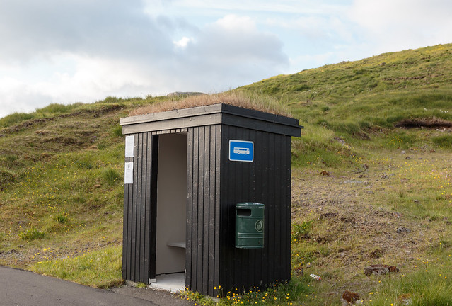
Even the bus stops have turf roofs:
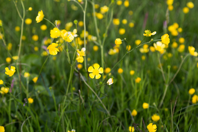
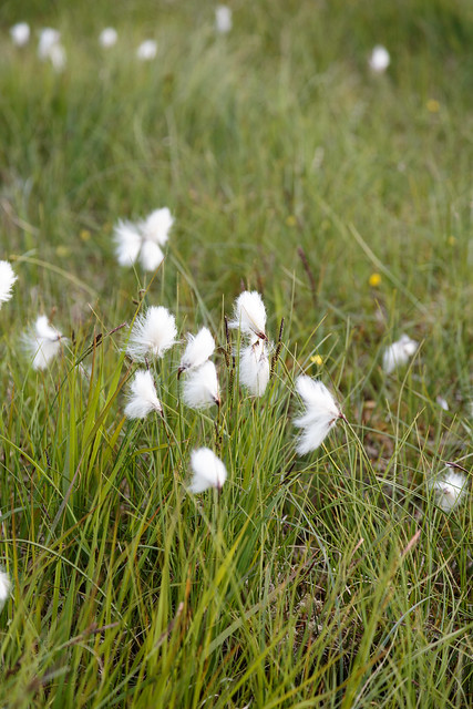
The fields were full of cottongrass and buttercups:
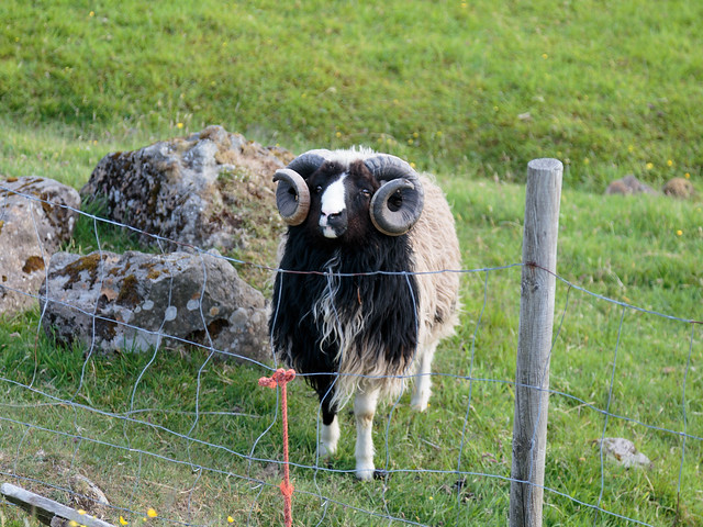
The farm down the way had this really cool-looking ram:
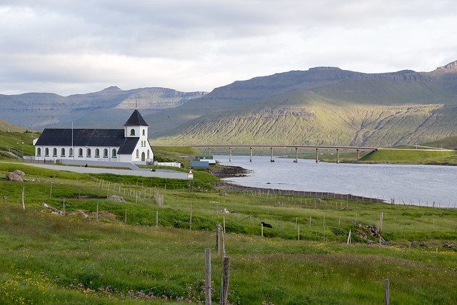
And we eventually walked down to Norđskáli Church and the "Bridge over the Atlantic" (really Sundini Sound):
Even the bus stops have turf roofs:
The fields were full of cottongrass and buttercups:
The farm down the way had this really cool-looking ram:
And we eventually walked down to Norđskáli Church and the "Bridge over the Atlantic" (really Sundini Sound):
Aug 8, 2016, 8:36 pm
#58
Original Poster
Join Date: Mar 2008
Location: Grantham, NH
Posts: 530
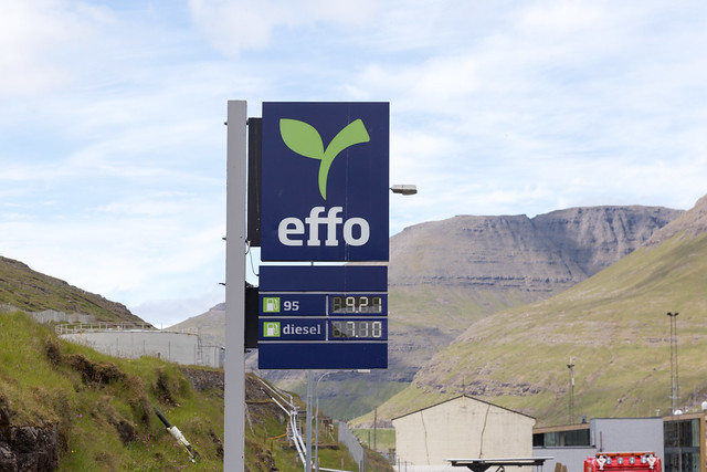
One mildly frustrating aspect as a tourist is that the Faroes still follow old-school European shop hours. In that most everything closes implausibly early, despite the late sun. Much stuff has limited hours on Saturday, and almost everything is closed on Sunday.
And most of the towns don't have much in the way of retail, grocery, or light sundries.
But, like Iceland, the major exception to that is the gas station. When most everything else is closed, or you need some food when no other restaurant is to be found, you can usually still stop here:
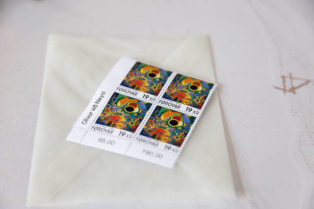
You can buy stamps:
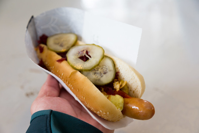
You can buy a great Danish-style hot dog (with remoulade and pickles!):
And you can even buy..... yarn and knitting needles:

And most of the towns don't have much in the way of retail, grocery, or light sundries.
But, like Iceland, the major exception to that is the gas station. When most everything else is closed, or you need some food when no other restaurant is to be found, you can usually still stop here:
You can buy stamps:
You can buy a great Danish-style hot dog (with remoulade and pickles!):
And you can even buy..... yarn and knitting needles:
Aug 8, 2016, 8:37 pm
#59
Original Poster
Join Date: Mar 2008
Location: Grantham, NH
Posts: 530
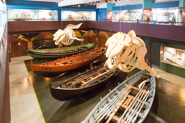
Final stop on the way back to Vagar Airport: the National Museum, with some cool exhibits on the maritime traditions of the islands:
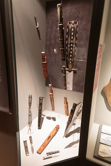
Whaling knives:
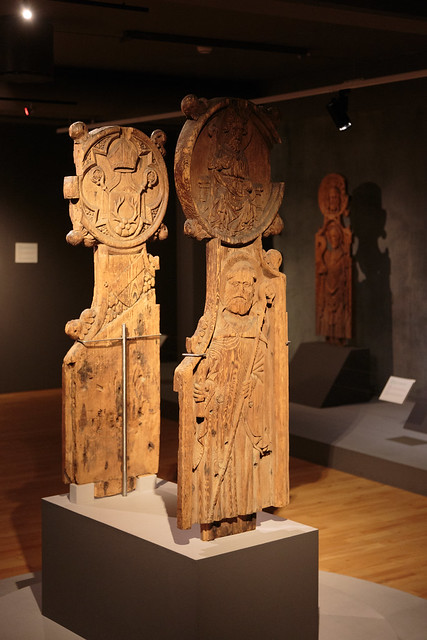
And odd collection of elaborate carved pew ends:
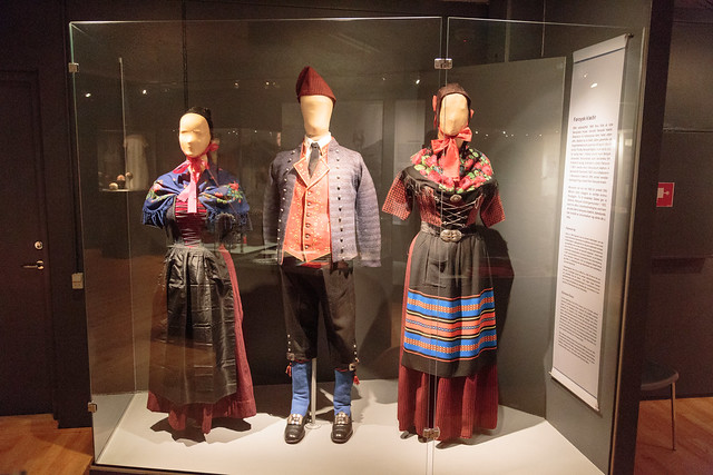
And a nice exhibit on traditional Faroese clothing (which we did see a few times, such as when there was the wedding in Klaksvik):
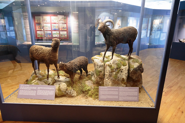
Oh, and those sheep everywhere? They aren't the sheep that had been "native" since the 600s. Those went extinct back in the 1800s, with the last 3 taxidermied and on display. The modern sheep are transplants from the Shetlands:
Whaling knives:
And odd collection of elaborate carved pew ends:
And a nice exhibit on traditional Faroese clothing (which we did see a few times, such as when there was the wedding in Klaksvik):
Oh, and those sheep everywhere? They aren't the sheep that had been "native" since the 600s. Those went extinct back in the 1800s, with the last 3 taxidermied and on display. The modern sheep are transplants from the Shetlands:
Aug 8, 2016, 8:39 pm
#60
Original Poster
Join Date: Mar 2008
Location: Grantham, NH
Posts: 530
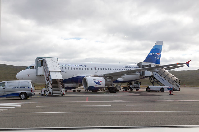
And, alas, like any trip, it has to come to an end. Our next stop was back at Vagar airport, getting on another A319 (fun little trivia bit: while we didn't need any passport inspection to get into the Faroes, leaving to go to Scotland, we got passport inspection and a Danish Schengen exit stamp...)
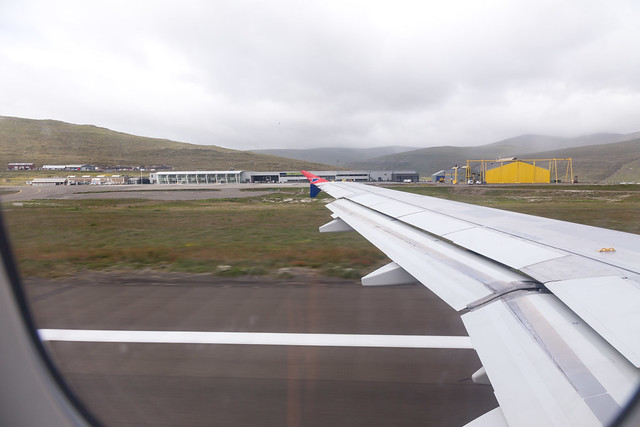
A parting view of Vagar...
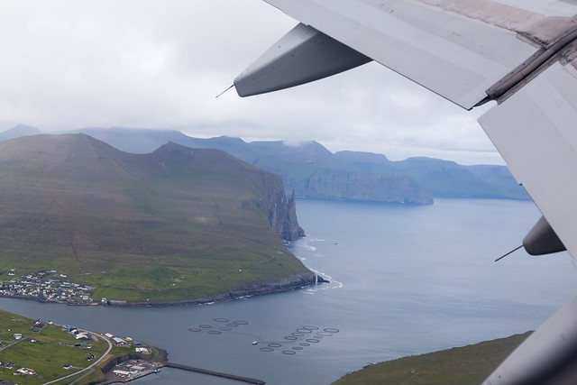
And we were quickly climbing away, with a final last view of Sandavagur before we entered the clouds (and off to Edinburgh, 1:45 away).
A parting view of Vagar...
And we were quickly climbing away, with a final last view of Sandavagur before we entered the clouds (and off to Edinburgh, 1:45 away).