


What is the furthest north south east west you have been?
 Aug 2, 2019, 5:36 pm
#31
FlyerTalk Evangelist
Join Date: May 2002
Location: Pittsburgh
Programs: MR/SPG LT Titanium, AA LT PLT, UA SLV, Avis PreferredPlus
Posts: 31,008
Fwiw, I've stood on the equator (a park outside of Quito) and the prime meridian (in Greenwich). On the data line will be a challenge
 Aug 2, 2019, 6:08 pm
#32
A FlyerTalk Posting Legend
Join Date: Aug 2002
Location: NY Metro Area
Programs: AA 2MM Yay!, UA MM, Costco General Member
Posts: 49,040
Hmm. Did I have to land? If not:
North: a few miles south of the North Pole on a very atypical JFK-NRT route that went almost directly over the pole, down into northern Siberia then turned back East to get to NRT.
If if I had to land probably Helsinki
South: Hobart, Tasmania - not Cape of Good Hope, which is probably second.
East and West: Not sure how to count it. Been on a few RTW trips. One leaving NYC going east and several leaving NYC going west. The farthest west I have gone from NYC is DC if I count a US city before NYC or Dublin if I count a non-US City. Farthest east from NYC going east before continuing to NYC is Hong Kong.
In trips where I left NYC, went somewhere and turned around back to NYC. Farthest west from NYC was Singapore with Kota Kinabalu, Borneo as a close second. Going east from NYC and returning the farthest was Mumbai.
Last edited by GadgetFreak; Aug 3, 2019 at 9:25 am Reason: Geography are hard
 Aug 2, 2019, 6:21 pm
#33
Join Date: Apr 2005
Location: Boston Suburbrs
Programs: AA ExPlat, IHG Spire Amb
Posts: 1,205
This is fun.
For E/W... .Lets pick Samoa and American Samoa. As I recall, for my day trip across the dateline, I had to book my round trip ticket in reverse - the return as the originating flight and vise versa due to the dateline.
North -- theres a spit of land north of Barrow Alaska. Saw a polar bear there.
Melbourne Australia.
Aug 3, 2019, 12:15 am
#35
Join Date: Dec 2006
Location: NRT / HND
Programs: AA EXP, NH Plat, Former UA 1K
Posts: 5,665
I'm from the US, but have lived in Asia for many years. I'll also just use standard gps coordinates as my baseline (prime meridian)
North - Oslo, Norway (59� 91' N)
South - Phillip Island, Victoria, Australia (38� 48' S)
East - Guam (144� 79' E)
West - Kauai, Hawaii (155� 58' W)
North - Oslo, Norway (59� 91' N)
South - Phillip Island, Victoria, Australia (38� 48' S)
East - Guam (144� 79' E)
West - Kauai, Hawaii (155� 58' W)
Aug 3, 2019, 12:41 am
#36
FlyerTalk Evangelist
Join Date: Nov 2000
Location: Atlanta, GA, USA
Programs: Frontier Gold, DL estranged 1MMer, Spirit VIP, CO/NW/UA/AA once gold/plat/comped gold now dust.
Posts: 38,151
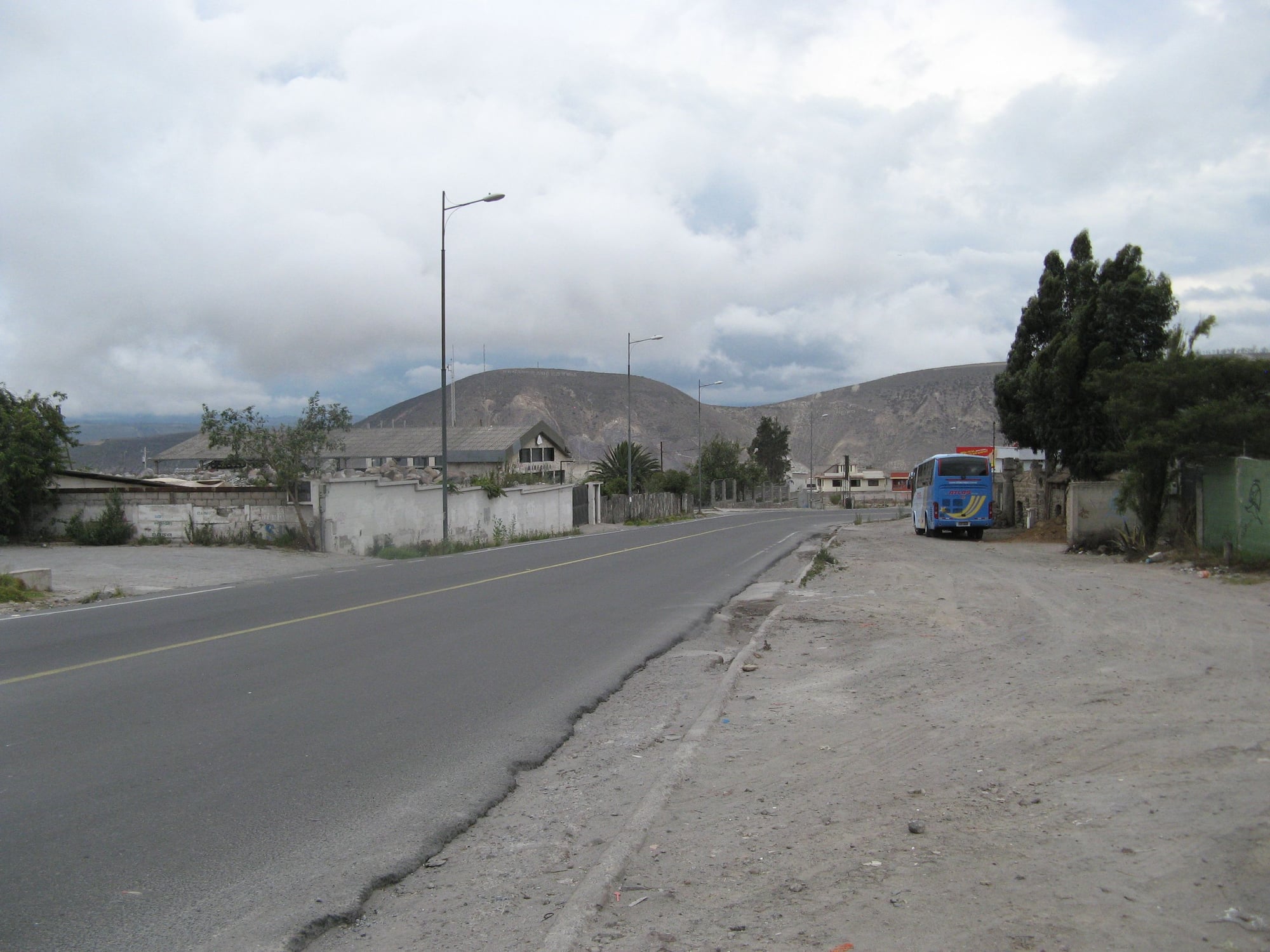
Looking down the "true" line of the (disputed) equator from the postcard, as best I could tell. The line would cross the street diagonally, and this is looking inland. The park with the tower is about 2-3 blocks to the right.
Aug 3, 2019, 12:55 am
#37
FlyerTalk Evangelist
Join Date: Nov 2000
Location: Atlanta, GA, USA
Programs: Frontier Gold, DL estranged 1MMer, Spirit VIP, CO/NW/UA/AA once gold/plat/comped gold now dust.
Posts: 38,151
Re: OP.
NORTH: The southernmost mile of the Dalton Highway in Alaska near Livengood 65.52 N
SOUTH: Slope point New Zealand 46.66 S
East-west are a wraparound and I used proximity to the International Date Line to determine.
EAST (first to get the next day): Apia, Samoa 171.75 W
WEST (Last to see the current day): Aitutaki, Cook Islands 159.78 W
Aitutaki just barely edged out Rarotonga and Kauai.
Aug 3, 2019, 3:00 am
#38
Join Date: Sep 2012
Programs: AS MVP 75K, UA 1K, Bonvoy Plat.
Posts: 51
North: 90� N at the North Pole
South: 90� S at the South Pole.
East and West are more complex, but I think West would be Honolulu and East is probably Fiji.
Although thinking about it, technically, having walked around the North and South poles, those would be my furthest east and west as well,
South: 90� S at the South Pole.
East and West are more complex, but I think West would be Honolulu and East is probably Fiji.
Although thinking about it, technically, having walked around the North and South poles, those would be my furthest east and west as well,
Aug 3, 2019, 6:07 am
#39
Join Date: Aug 2017
Location: LTN
Programs: Aeroflot Bonus, British Airways Executive Club
Posts: 463
On the surface of the earth:
North: Lapinlahti, Finland (63, 28)
West: Victoria, Canada (48, -123)
South: Singapore (1, 104)
East: Daejeon, South Korea (36, 127)
This is brain-damaging. I just opened Talofa Airways website and the system cannot accept the return date to be earlier than departure date, and the system now says "Your outgoing flight must arrive before the return leg flight departs." if I reverse the legs, choose a morning flight eastbound and an afternoon flight westbound.
Last edited by miklcct; Aug 3, 2019 at 6:20 am
Aug 3, 2019, 6:54 am
#41
Join Date: Jan 2017
Posts: 331
North: at sea near Moffen (80�0′0″ N, 14�30′0″ E) in Svalbard archipelago (and northmost land position would be somewhere in Spitzbergen, Svalbard)
South: Deadvlei, Namibia
West: Gar�ur, Iceland (or somewhere else in Reykjanes west of KEF)
East: Parikkala, Finland (the exact position I didn't record, but near Finnish-Russian border)
And if listing airports, the two or three you probably already guessed from the above listing, but the last one might surprise...
North: LYR
South: WDH
West: KEF
East: KGS
Honourable mentions for airports further away than the above mentioned, which I have seen but not used, go to Ny-�lesund Airport and Lappeenranta Airport.
Aug 3, 2019, 6:58 am
#42
Join Date: Nov 2015
Location: CLE
Programs: DL GM, Hilton Silver, IHG Platinum
Posts: 198
Reading this thread makes me want to travel more.
North Airport: Fairbanks, AK
North Land: somewhere on the Yukon River North of Eagle, AK, reached via 2 days of dog sledding (have to look if I still have the spot coordinates)
South Airport: Melville Hall, Dominica (DOM)
South Land: Southern tip of Dominica (south of 15 degees 15�
West Airport and land: Fairbanks, AK
East airport and land: London (Gatwick for the airport, probably was east of it during the time there but I have no clue where)
Aug 3, 2019, 9:34 am
#43
A FlyerTalk Posting Legend
Join Date: Aug 2002
Location: NY Metro Area
Programs: AA 2MM Yay!, UA MM, Costco General Member
Posts: 49,040
If we look at longitudes, so starting from the Prime Meridian, the highest east longitude I’ve been to is Brisbane and the highest west longitude is Honolulu. They are pretty close to overlapping.
Wrong again, this circle thing is confusing. The highest east latitude I’ve been to is Auckland New Zealand. Although I was only there twice for short stops, in both direction refueling on LAX-SYD.
Wrong again, this circle thing is confusing. The highest east latitude I’ve been to is Auckland New Zealand. Although I was only there twice for short stops, in both direction refueling on LAX-SYD.
Last edited by GadgetFreak; Aug 4, 2019 at 12:32 pm
Aug 3, 2019, 3:17 pm
#45
A FlyerTalk Posting Legend
Join Date: Aug 2002
Location: NY Metro Area
Programs: AA 2MM Yay!, UA MM, Costco General Member
Posts: 49,040