


 Nov 28, 2022, 8:36 am
Last edit by: FlyinHawaiian
Links to sites with information (feel free to add):
https://www.usgs.gov/volcanoes/mauna-loa/volcano-updates
https://www.nps.gov/havo/planyourvisit/maunaloaupdate.htm
https://www.staradvertiser.com/
https://www.hawaiinewsnow.com/
https://www.usgs.gov/volcanoes/mauna-loa/volcano-updates
https://www.nps.gov/havo/planyourvisit/maunaloaupdate.htm
https://www.staradvertiser.com/
https://www.hawaiinewsnow.com/

Mauna Loa Eruption - November/December 2022 [NOW ENDED]
Dec 7, 2022, 3:22 pm
#46
FlyerTalk Evangelist


Join Date: Jun 2010
Location: TOA
Programs: HH Diamond, Marriott LTPP/Platinum Premier, Hyatt Lame-ist, UA !K
Posts: 20,061
Latest images and videos posted for 12/07/2022: Photo and Video Chronology – Mauna Loa – December 7, 2022 | U.S. Geological Survey (usgs.gov)
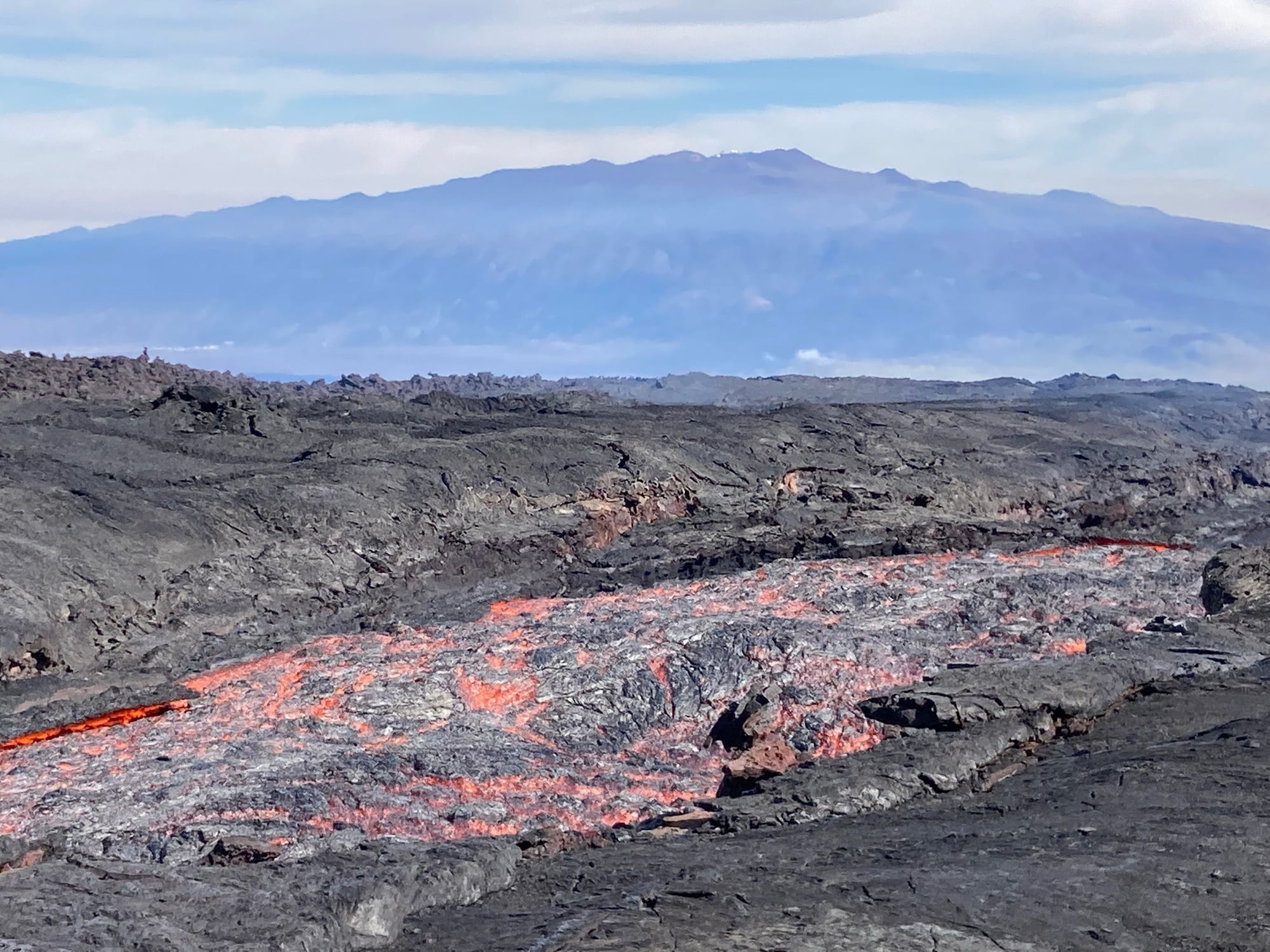
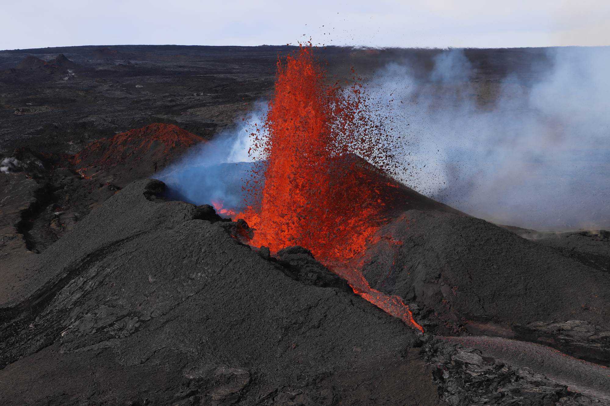
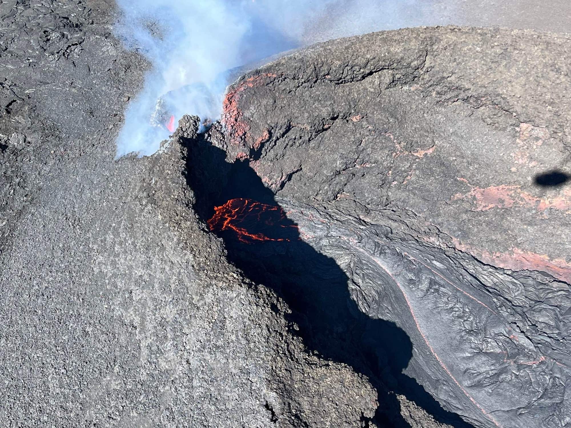
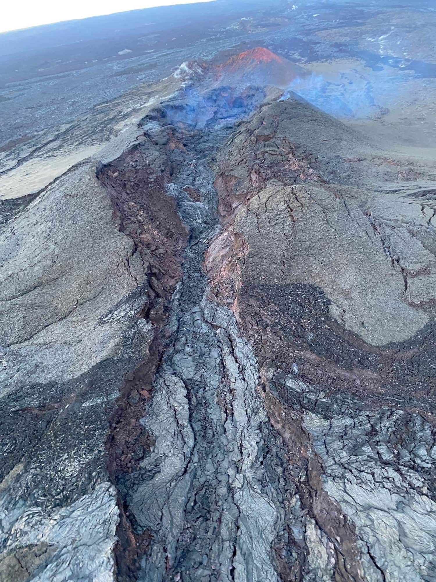
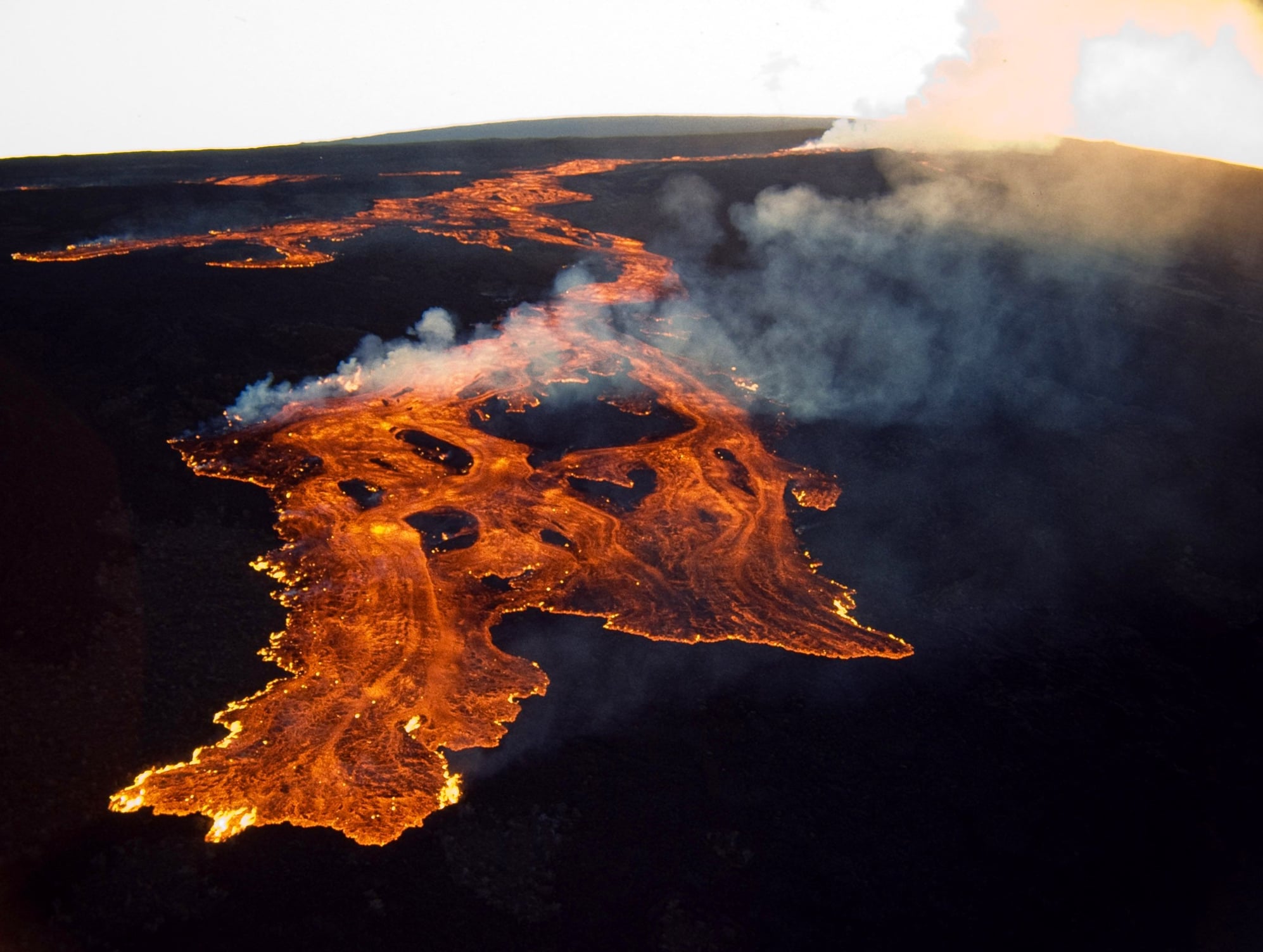
Aerial view of Fissure 3 and its lava flow from this morning:
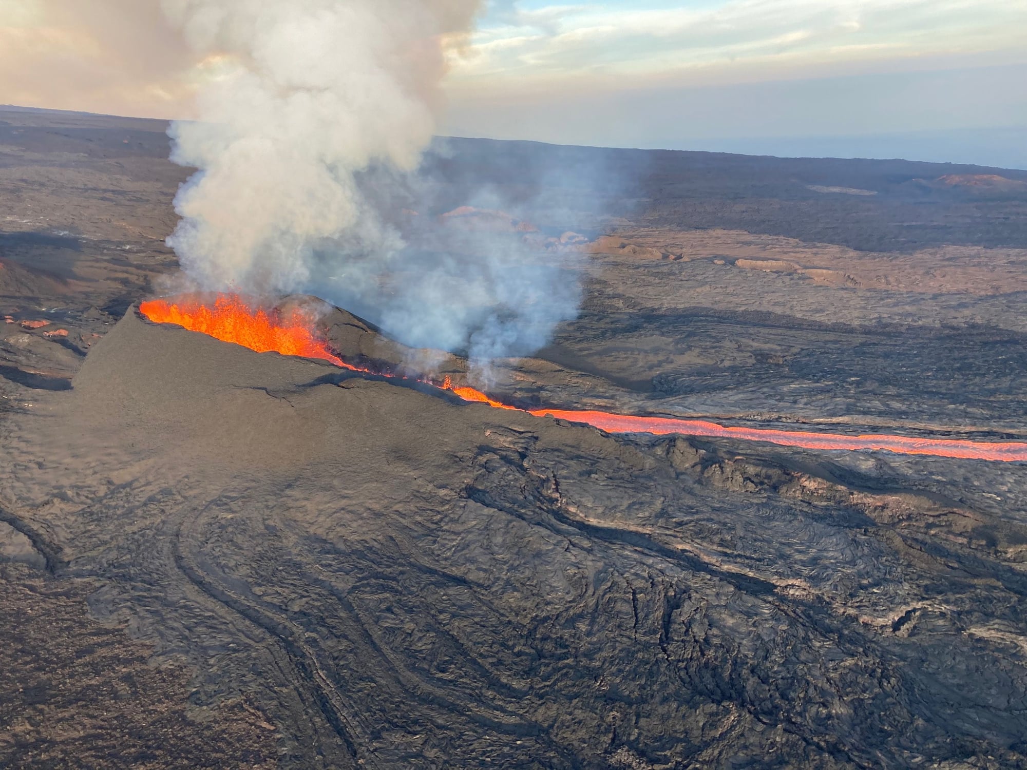
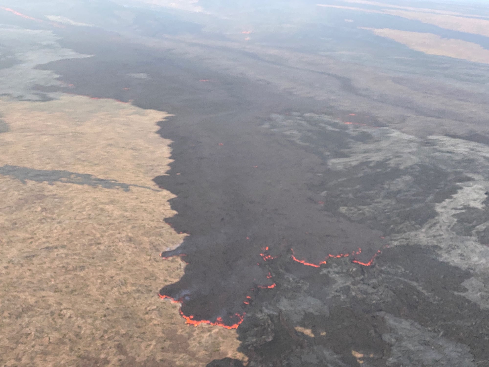
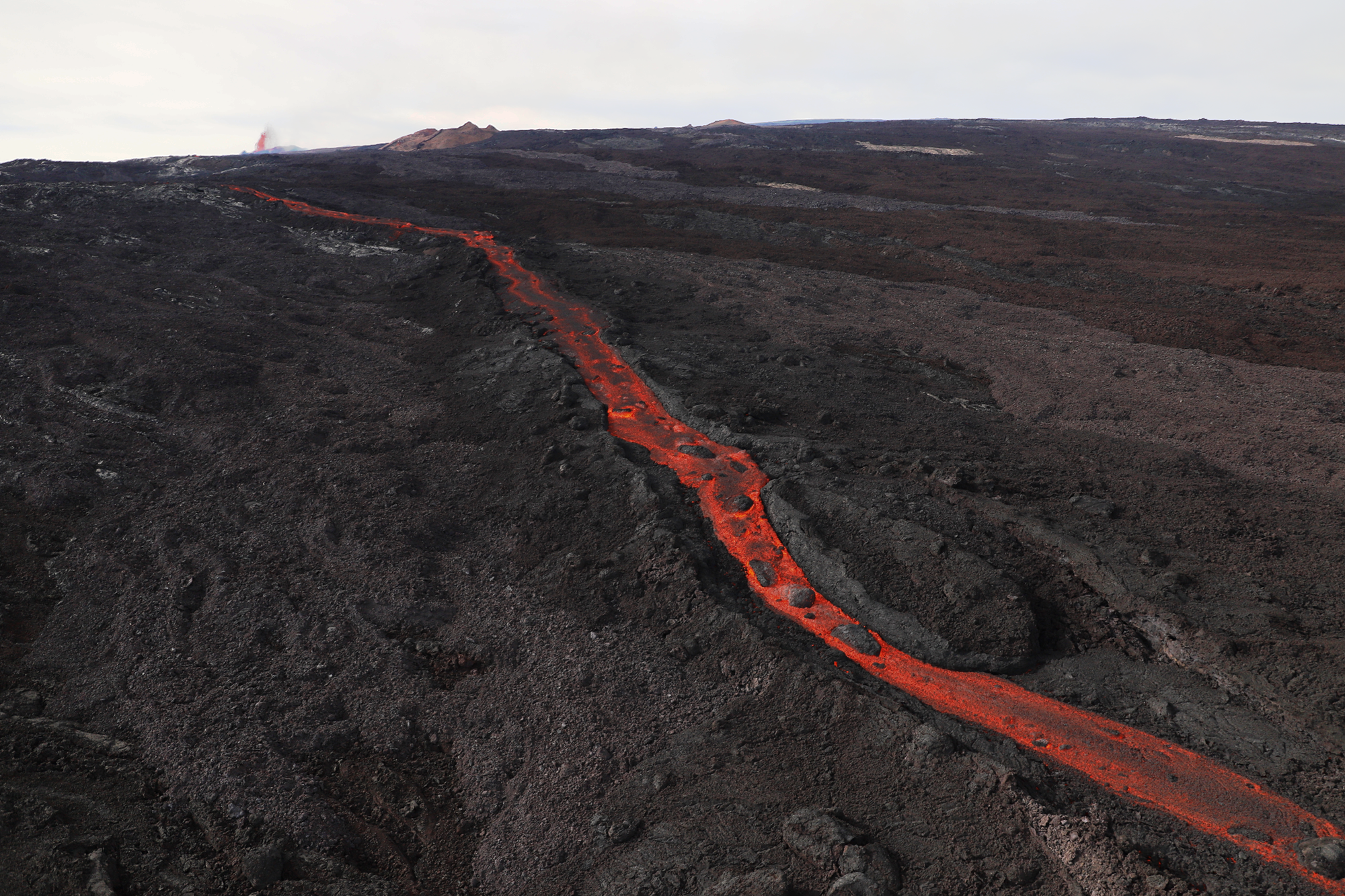
From this morning's report, there was a large breakout from the main lava channel (see below) that slowed the flow front to now be about 1.8 miles from the Saddle Road:
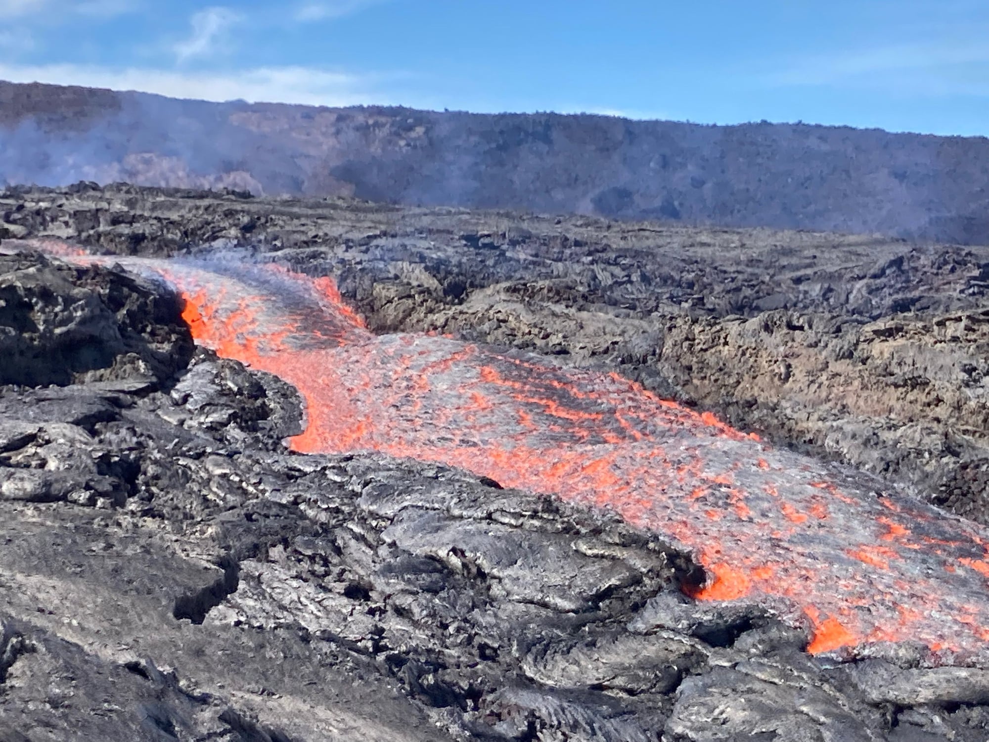
Here's the aerial shot of the breakout:
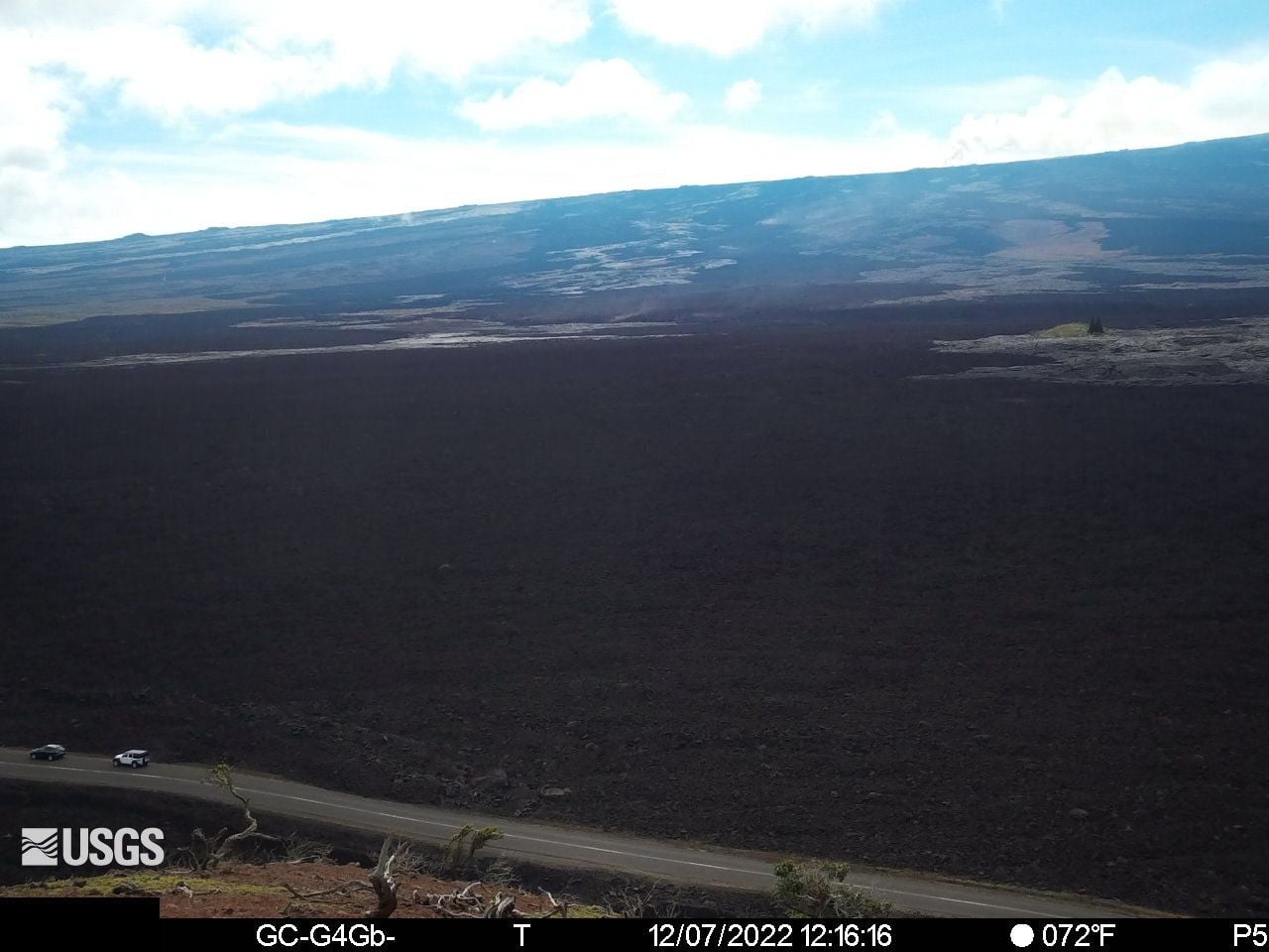
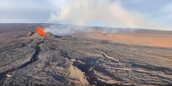
Here's what the new webcam sees when there's no clouds in the way during the light of day (main lava flow is at the middle left of the image):
(For those who were caught in cloud conditions this morning and/or want to see the glow of the flow (and headlights of cars on the Saddle Road) when conditions permit, here's the 24 hour GIF loop: Last 24 Hours - [M9cam] Mauna Loa - Northeast Rift Zone Lava Flow | U.S. Geological Survey (usgs.gov))
And for those who like to see and hear what a lava river looks and sounds like, a new video was posted (click on the image to go to the relevant web page):
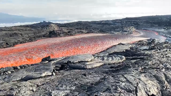
(when rock heated to melting flows like water...)
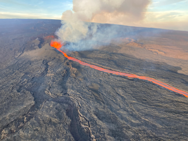
Additional views of the lava channel taken today that were just posted:
David
Aerial view of Fissure 3 and its lava flow from this morning:
From this morning's report, there was a large breakout from the main lava channel (see below) that slowed the flow front to now be about 1.8 miles from the Saddle Road:
As of 6:00 a.m. today, December 7, the flow front was about 1.8 mi (2.9 km) from the Daniel K. Inouye Highway (Saddle Road). The flow advanced only a small distance since midnight possibly due to a significant breakout removing lava from the channel about 2.8 mi (4.5 km) behind the tip of the main flow on the east side. During the past 24 hours, the main flow has advanced at an average rate slower than 20 feet (6 meters) per hour. The lava flow remains active and is continuously supplied from the fissure 3 vent. HVO crews have installed a new webcam to view the front of the main flow https://www.usgs.gov/observatories/h...east-rift-zone
Here's what the new webcam sees when there's no clouds in the way during the light of day (main lava flow is at the middle left of the image):
(For those who were caught in cloud conditions this morning and/or want to see the glow of the flow (and headlights of cars on the Saddle Road) when conditions permit, here's the 24 hour GIF loop: Last 24 Hours - [M9cam] Mauna Loa - Northeast Rift Zone Lava Flow | U.S. Geological Survey (usgs.gov))
And for those who like to see and hear what a lava river looks and sounds like, a new video was posted (click on the image to go to the relevant web page):
(when rock heated to melting flows like water...)
Additional views of the lava channel taken today that were just posted:
David
Last edited by DELee; Dec 7, 2022 at 3:50 pm
 Dec 7, 2022, 9:39 pm
#47
Join Date: Nov 2006
Programs: AA MM PP, MR LT Plat, Globalist
Posts: 1,004
What side of the plane should we sit on when flying into and out of KOA to and from the continental US?
Dec 7, 2022, 10:42 pm
#48
FlyerTalk Evangelist
Join Date: Jun 2010
Location: TOA
Programs: HH Diamond, Marriott LTPP/Platinum Premier, Hyatt Lame-ist, UA !K
Posts: 20,061
Note that during the daytime and with any weather, seeing conditions may not be optimal.
David
Dec 8, 2022, 5:44 am
#49
Join Date: Mar 2011
Location: MFR
Programs: UA 1K 1.9MM, Hilton Gold, Marriott Gold
Posts: 2,885
Excellent!
Got there around 7 and went straight up to the Muana Kea Visitor Center, stopping along the way down for different viewpoints, and did the Old Saddle Road Loop. Then when the Vog rolled in we went back up Mauna Kea and had a great finale watching a fountain of fire above the clouds while sitting in our warm car. Like a drive-in movie.
Got there around 7 and went straight up to the Muana Kea Visitor Center, stopping along the way down for different viewpoints, and did the Old Saddle Road Loop. Then when the Vog rolled in we went back up Mauna Kea and had a great finale watching a fountain of fire above the clouds while sitting in our warm car. Like a drive-in movie.
Last edited by chavala; Dec 9, 2022 at 9:55 am
Dec 8, 2022, 4:28 pm
#50
FlyerTalk Evangelist
Join Date: Jun 2010
Location: TOA
Programs: HH Diamond, Marriott LTPP/Platinum Premier, Hyatt Lame-ist, UA !K
Posts: 20,061
Mauna Loa may be stalling out...
From this morning's update (Mauna Loa - Volcano Updates | U.S. Geological Survey (usgs.gov)):
From today's photo and video page (Photo and Video Chronology � Mauna Loa � December 8, 2022 | U.S. Geological Survey (usgs.gov)), today's lava flow video versus yesterday:
Today: December 8, 2022:
Yesterday, December 7, 2022:
Each photo is linked to the video posted for the relevant day by HVO.
David
From this morning's update (Mauna Loa - Volcano Updates | U.S. Geological Survey (usgs.gov)):
Activity Summary:
The Northeast Rift Zone eruption of Mauna Loa continues with a major change overnight. The fissure 3 (F3) vent continues to erupt but the supply of lava appears to be much reduced this morning. Lava is overtopping channels near the vent with flows extending no farther than 2.5 mi (4 km) from the vent. The channels below this point appear drained of lava and probably no longer feed the main flow front.
As of 5:30 a.m. today, December 8, the flow front was stalled about 1.7 mi (2.8 km) from the Daniel K. Inouye Highway (Saddle Road). The lava flow is now inactive for most of its lower length, but the flow front may appear to advance a little as it settles.
Today: December 8, 2022:
Yesterday, December 7, 2022:
Each photo is linked to the video posted for the relevant day by HVO.
David
Dec 9, 2022, 12:34 am
#51
Join Date: Nov 2006
Programs: AA MM PP, MR LT Plat, Globalist
Posts: 1,004
Dec 9, 2022, 1:42 am
#52
FlyerTalk Evangelist
Join Date: Jun 2010
Location: TOA
Programs: HH Diamond, Marriott LTPP/Platinum Premier, Hyatt Lame-ist, UA !K
Posts: 20,061
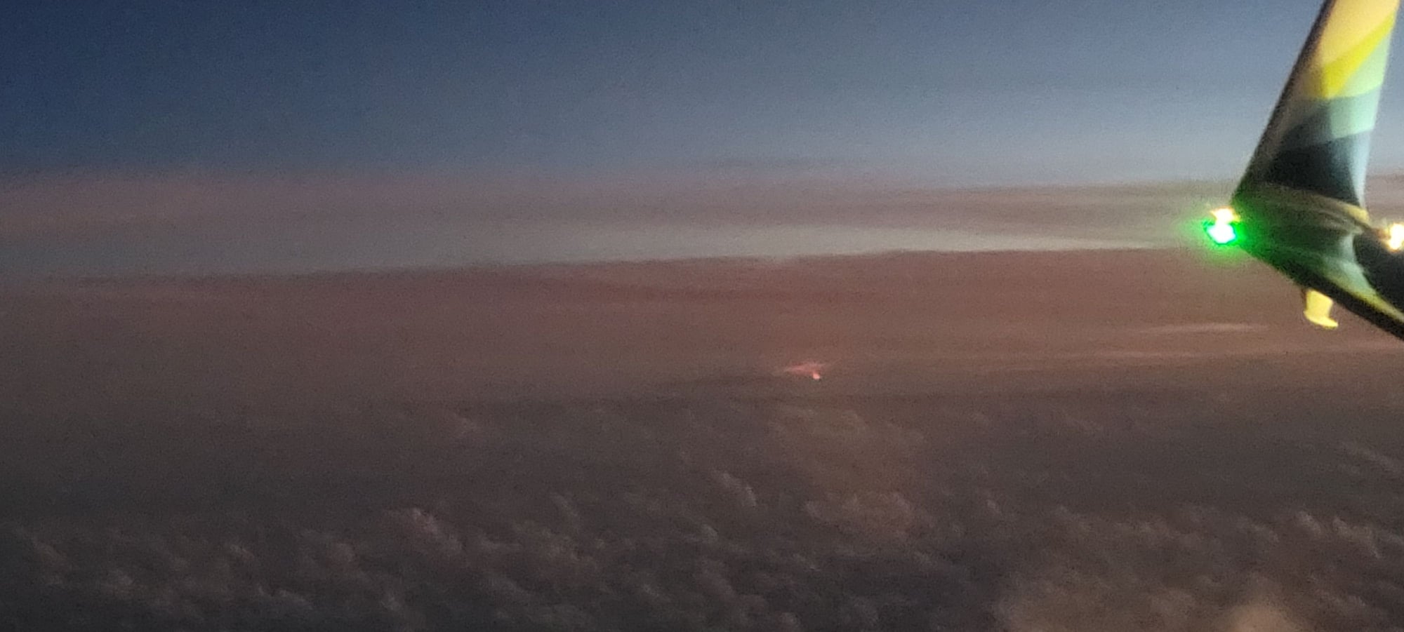
By the time an aircraft has turned around and then headed back toward the north, the plane is going to be several thousands of feet in altitude and will have banked away from Mauna Loa so that, by the time the right side / starboard is aligned for viewing, you're mostly looking at Mauna Kea and, unless you're leaving KOA in the dark, atmospheric haze and weather will likely be affecting seeing conditions to starboard.
I'm not saying that you won't see anything if you sit on the right side with a window - you may simply be farther away trying to view what's going on at Mauna Loa as aacar 's shot showed upthread:
p.s. And, since there's no chance of passenger aircraft flying directly above the lava flows given the TFR right now, viewing from the air on an aircraft will continue to be the province of what the USGS HVO is operating to monitor the eruption.
Last edited by DELee; Dec 9, 2022 at 8:13 am
Dec 9, 2022, 1:08 pm
#53
Join Date: Jul 2011
Location: SF Bay Area
Programs: UA MileagePlus (Premier Gold); Hilton HHonors (Gold); Chase Ultimate Rewards; Amex Plat
Posts: 6,680
https://tfr.faa.gov/save_pages/detail_2_2425.html
Dec 9, 2022, 10:41 pm
#54
FlyerTalk Evangelist
Join Date: Jun 2010
Location: TOA
Programs: HH Diamond, Marriott LTPP/Platinum Premier, Hyatt Lame-ist, UA !K
Posts: 20,061
TFR only applies up to and including 1500 feet AGL. If a commercial flight is in or even near the TFR it is in serious danger of crashing, given that there are two mountains less than 6 miles from the TFR that are higher than the TFR itself...
https://tfr.faa.gov/save_pages/detail_2_2425.html
https://tfr.faa.gov/save_pages/detail_2_2425.html
Given that HVO is operating both rotary aircraft as well as UAVs, still probably not a good idea to transit anyway.
David
Dec 9, 2022, 11:28 pm
#55
FlyerTalk Evangelist
Join Date: Jun 2010
Location: TOA
Programs: HH Diamond, Marriott LTPP/Platinum Premier, Hyatt Lame-ist, UA !K
Posts: 20,061
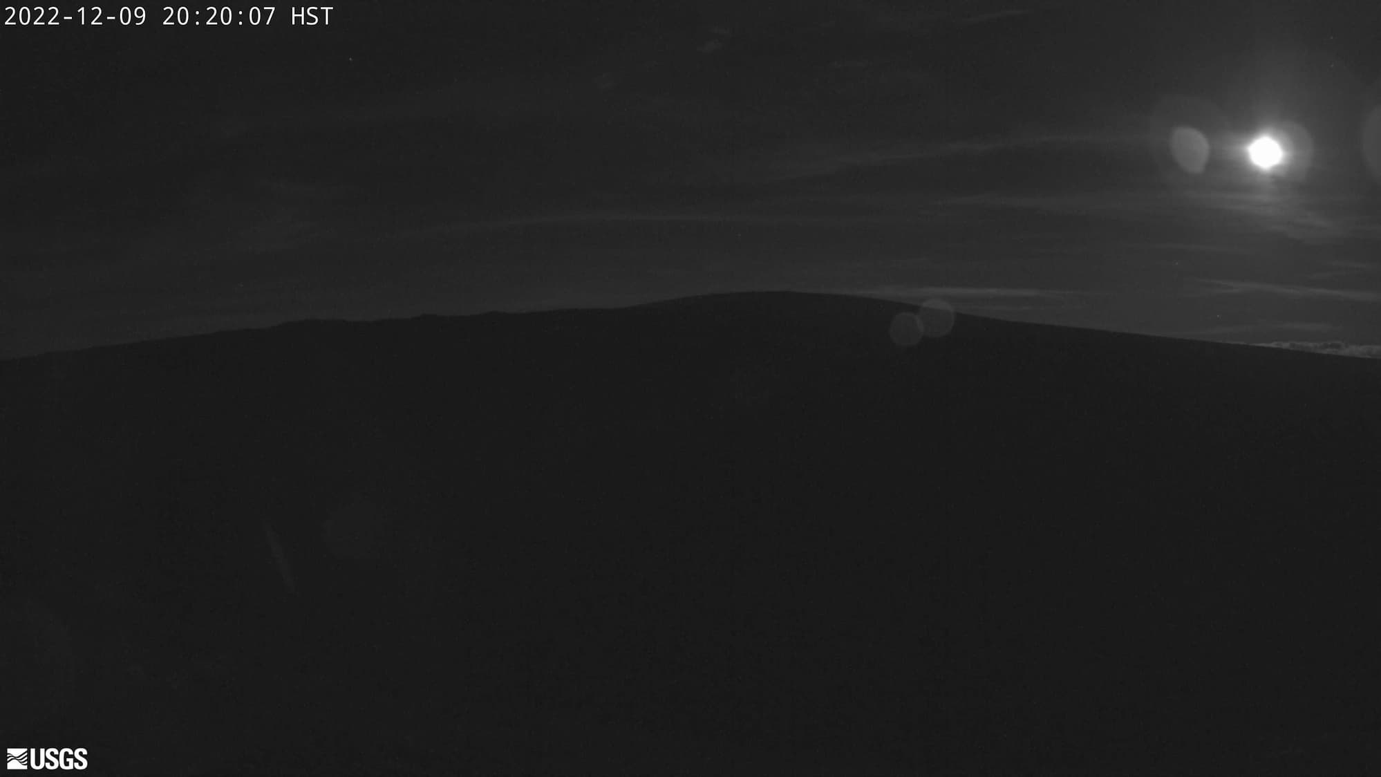
Moon has risen over Mauna Loa tonight (M2cam):
Some folks who've taken the bypass road are seeing what they can (M9cam):
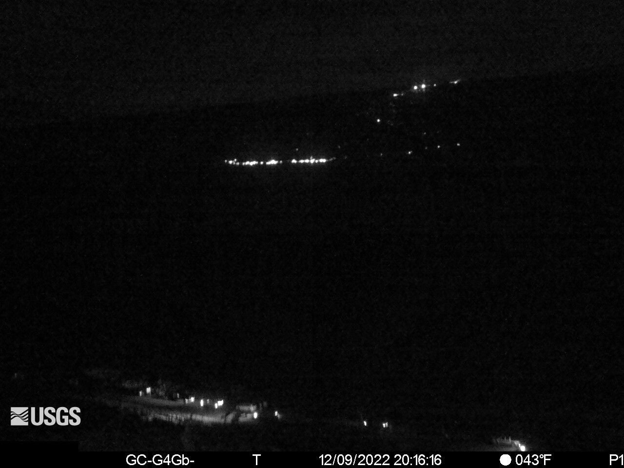
...note that it is not terribly warm outside (at least for Hawaii)
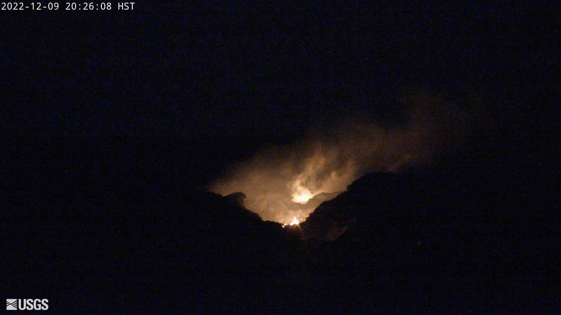
And even up at Fissure 3, there's not a lot to see right now (M8cam):
David
Some folks who've taken the bypass road are seeing what they can (M9cam):
...note that it is not terribly warm outside (at least for Hawaii)
And even up at Fissure 3, there's not a lot to see right now (M8cam):
David
Dec 10, 2022, 1:19 pm
#56
FlyerTalk Evangelist
Join Date: Jun 2010
Location: TOA
Programs: HH Diamond, Marriott LTPP/Platinum Premier, Hyatt Lame-ist, UA !K
Posts: 20,061
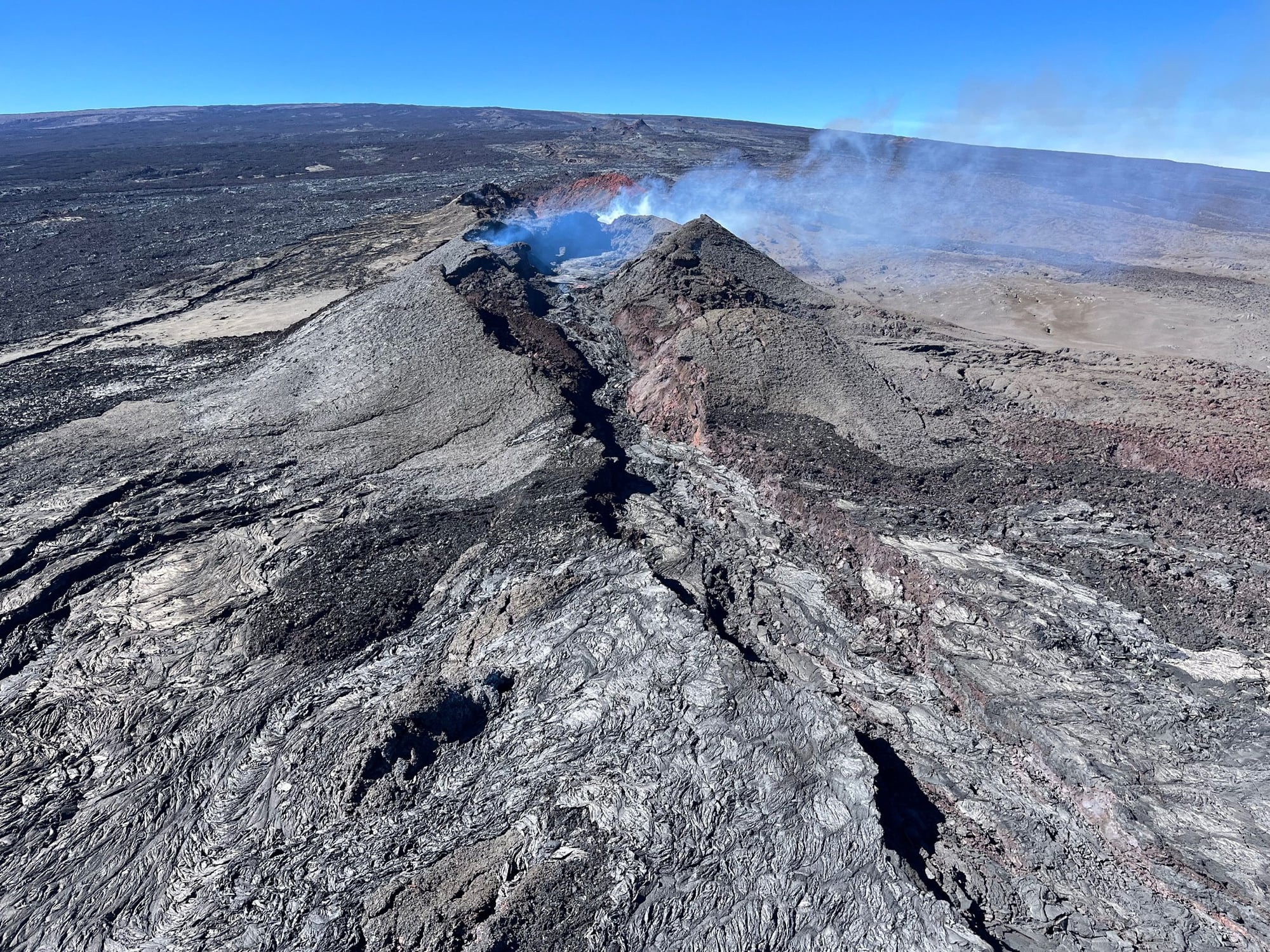
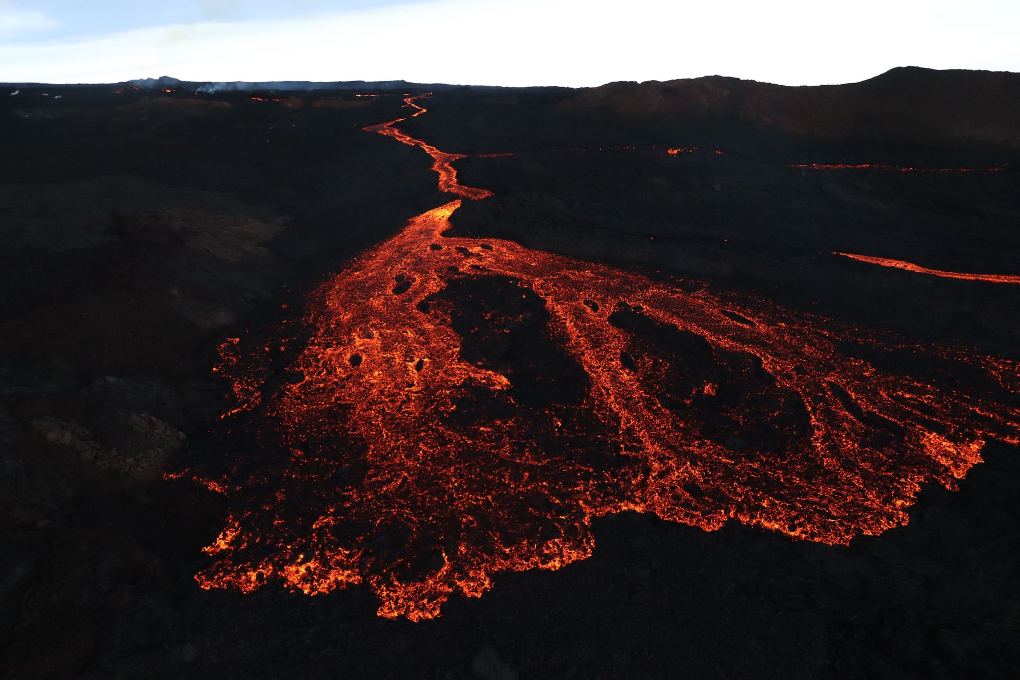
Fissure 3 continues declining:
A visual tale of 3 days at Fissure 3 plus a revised alert level for Mauna Loa:
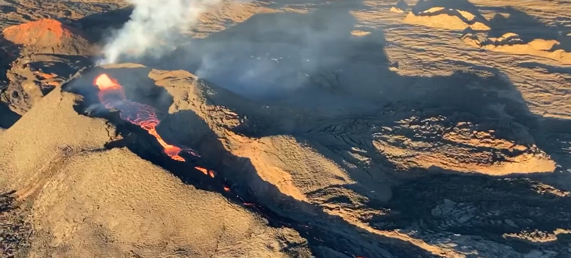
Thursday, December 8, 2022: 100+ foot tall lava fountains and running lava river complete with lava boats:
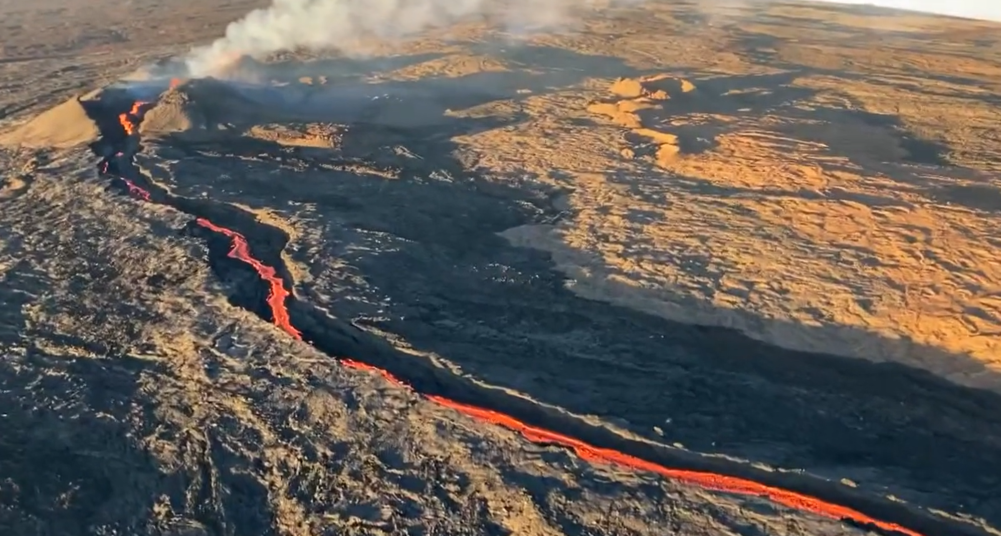
Friday, December 9, 2022: Not so tall lava fountains and lava stream with no lava boats:
Saturday, December 10, 2022: No lava fountains but circulating lava pool and empty lava channel
Also, because of the reduction in activity HVO has downgraded Mauna Loa's alert level from WARNING to WATCH as of this afternoon:
David
Code:
Alert Level: WARNING, Color Code: ORANGE 2022-12-10 19:36:47 UTC HAWAIIAN VOLCANO OBSERVATORY DAILY UPDATE U.S. Geological Survey Saturday, December 10, 2022, 9:36 AM HST (Saturday, December 10, 2022, 19:36 UTC) MAUNA LOA (VNUM #332020) 19�28'30" N 155�36'29" W, Summit Elevation 13681 ft (4170 m) Current Volcano Alert Level: WARNING Current Aviation Color Code: ORANGE Activity Summary: The Northeast Rift Zone eruption of Mauna Loa continues. The fissure 3 (F3) vent continues to erupt with a reduced supply of lava and reduced gas emissions this morning. As of 7:00 a.m. today, December 10, a lava pond replaced the fountains at the F3 vent. The pond fed short lava flows that extended only 1.6 mi (2.6 km) from the vent but are already stagnating. The channels below this point appear drained of lava and no longer feed the main flow front. The inactive main flow front remains stalled about 1.7 mi (2.8 km) from the Daniel K. Inouye Highway (Saddle Road) when last measured on the afternoon of December 8. When seen this morning at 7 am, the front appeared to be in the same location. The inactive main flow front still glows at night and may inch northward very slowly as it settles. Sulfur dioxide (SO2) emission rates were also reduced to approximately 30,000 tonnes per day (t/d) as measured on December 8, 2022. The Hawaii Interagency Vog Information Dashboard has detailed information about vog: https://vog.ivhhn.org/. Forecasts for the dispersion of vog can be found on the VMAP Vog Forecast Dashboard: http://weather.hawaii.edu/vmap/new/. Tremor (a signal associated with subsurface fluid movement) continues its slow and steady decline. This indicates that the magma supply to the vent is decreasing. The significance of the reduced supply of lava is not yet clear; it is common for eruptions to wax and wane or pause completely, but none of the 8 recorded eruptions from Mauna Loa’s Northeast Rift Zone returned to high eruption rates after those rates decreased significantly. Nevertheless, the Hawaiian Volcano Observatory continues to closely monitor the current activity. There is no active lava within Moku'āweoweo caldera nor the Southwest Rift Zone. We do not expect any eruptive activity outside the Northeast Rift Zone. Most recent eruption map: https://www.usgs.gov/media/images/mo...e-eruption-map Information on lava viewing: https://hawaii-county-volcano-hazard...ub.arcgis.com/ The network connection for our streaming video of the fissure 3 fountains has been going in and out. If it is working, you can view it at https://www.youtube.com/usgs/live
Thursday, December 8, 2022: 100+ foot tall lava fountains and running lava river complete with lava boats:
Friday, December 9, 2022: Not so tall lava fountains and lava stream with no lava boats:
Saturday, December 10, 2022: No lava fountains but circulating lava pool and empty lava channel
Also, because of the reduction in activity HVO has downgraded Mauna Loa's alert level from WARNING to WATCH as of this afternoon:
Code:
Alert Level: WATCH, Color Code: ORANGE
2022-12-11 00:35:48 UTC
HVO/USGS Volcanic Activity Notice

Volcano: Mauna Loa (VNUM #332020)

Current Volcano Alert Level: WATCH
Previous Volcano Alert Level: WARNING

Current Aviation Color Code: ORANGE

Issued: Saturday, December 10, 2022, 2:35 PM HST
Source: Hawaiian Volcano Observatory
Notice Number: 2022/H650
Location: N 19 deg 28 min W 155 deg 36 min
Elevation: 13681 ft (4170 m)
Area: Hawaii

Volcanic Activity Summary:Lava eruption from fissure 3 (F3) on the Northeast Rift Zone of Mauna Loa continues but with greatly reduced lava output and volcanic gas emissions. Most lava is confined to the vent in a small pond. The short lava flows active about 1.5 miles (2.4 km) from the vent yesterday have stalled.

The flow front in the Humu'ula Saddle region has stagnated 1.9 miles (3 km) from the Daniel K. Inouye Highway (Saddle Road) and is no longer a threat.

High eruption rates will not resume based on past eruptive behavior and current behavior suggests that the eruption may end soon. However, an inflationary trend of Mauna Loa’s summit is accompanying the decreased activity and there is a small possibility that the eruption could continue at very low eruptive rates.

For these reasons, HVO is reducing the volcano alert level from WARNING to WATCH, reflecting the limited hazards associated with the current activity. The aviation color code will remain at ORANGE, reflecting the uncertainty of continuing eruptive activity and the possibility of volcanic ash emissions.

HVO scientists continue to closely monitor Mauna Loa and the active eruption site for any indication of changes to activity.

The Federal Aviation Administration temporary flight restriction remains in place, extending from the surface to 1500 feet (457 meters) above ground level in the eruption area. See: https://tfr.faa.gov/save_pages/detail_2_2425.html

For more information about the meaning of USGS volcano alert levels and aviation color codes, see https://www.usgs.gov/programs/VHP/vo...s-us-volcanoes
Last edited by FlyinHawaiian; Dec 14, 2022 at 6:08 pm Reason: consecutive posts merged
Dec 11, 2022, 2:05 pm
#57
FlyerTalk Evangelist
Join Date: Jun 2010
Location: TOA
Programs: HH Diamond, Marriott LTPP/Platinum Premier, Hyatt Lame-ist, UA !K
Posts: 20,061
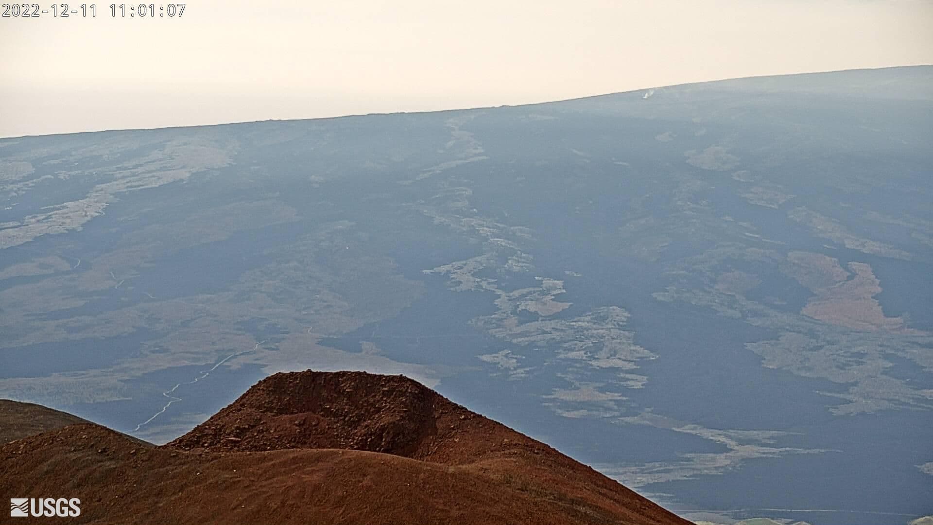
Not much going on:

Looks like this latest eruption may be stopping for now.
Example: Current image of Fissure 3 cone via webcam:
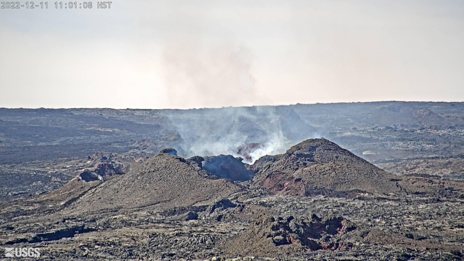
View of the same Fissure 3 venting (upper middle right) almost to the second but from another webcam on Mauna Kea:
David
Code:
Alert Level: WATCH, Color Code: ORANGE 2022-12-11 19:28:06 UTCHAWAIIAN VOLCANO OBSERVATORY DAILY UPDATE U.S. Geological Survey Sunday, December 11, 2022, 9:28 AM HST (Sunday, December 11, 2022, 19:28 UTC) MAUNA LOA (VNUM #332020) 19�28'30" N 155�36'29" W, Summit Elevation 13681 ft (4170 m) Current Volcano Alert Level: WATCH Current Aviation Color Code: ORANGEActivity Summary: The Northeast Rift Zone eruption of Mauna Loa may still be active. Incandescence is restricted to the cone that formed around the fissure 3 vent, there was no observable activity anywhere on the rest of the flow field overnight. As of 7:00 a.m. today, December 11, the M8 webcam shows very little incandescence and no lava movement in the F3 vent. The channels below the vent appear drained of lava and no longer feed the main flow front. The inactive main flow front has stagnated about 1.7 mi (2.8 km) from the Daniel K. Inouye Highway (Saddle Road) when last measured yesterday morning, December 10. The inactive main flow front still glows at a few spots at night and may inch northward very slowly as it continues to settle. Sulfur dioxide (SO2) emission rates continue to be reduced; on December 9, the emission rate was approximately 20,000 tonnes per day (t/d). The Hawaii Interagency Vog Information Dashboard has detailed information about vog: https://vog.ivhhn.org/. Forecasts for the dispersion of vog can be found on the VMAP Vog Forecast Dashboard: http://weather.hawaii.edu/vmap/new/. Tremor (a signal associated with subsurface fluid movement) is no longer detectable; summit and Northeast Rift Zone inflation started on December 7 and is continuing. The significance of the continuing inflation while the flow field is inactive is not yet clear; it is common for eruptions to wax and wane or pause completely, but none of the eight recorded eruptions from Mauna Loa’s Northeast Rift Zone returned to high eruption rates after those rates decreased significantly. Nevertheless, the Hawaiian Volcano Observatory continues to closely monitor the current activity. There is no active lava within Moku'āweoweo caldera nor in either rift zone. Satellite imagery shows the entire 2022 flow field cooling and no longer active.
Looks like this latest eruption may be stopping for now.
Example: Current image of Fissure 3 cone via webcam:
View of the same Fissure 3 venting (upper middle right) almost to the second but from another webcam on Mauna Kea:
David
Last edited by FlyinHawaiian; Dec 14, 2022 at 6:29 pm
Dec 12, 2022, 2:12 pm
#58
FlyerTalk Evangelist
Join Date: Jun 2010
Location: TOA
Programs: HH Diamond, Marriott LTPP/Platinum Premier, Hyatt Lame-ist, UA !K
Posts: 20,061
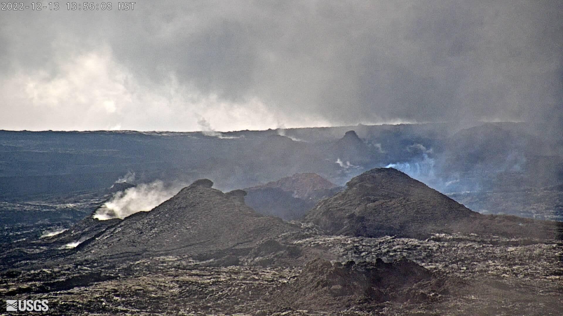
Down to much nothing (taken today - 12/12/2022):
Caption:
Today's HVO Update:
David
Caption:
As of 7:00 a.m. on December 12, Hawaiian Volcano Observatory geologists observed only residual incandescence and no lava movement in the fissure 3 vent on the Northeast Rift Zone of Mauna Loa. The channels below the vent appear drained of lava and no longer feed the main flow front. USGS image by F. Trusdell.
Code:
Alert Level: WATCH, Color Code: ORANGE 2022-12-12 19:35:34 UTC HAWAIIAN VOLCANO OBSERVATORY STATUS REPORT U.S. Geological Survey Monday, December 12, 2022, 9:35 AM HST (Monday, December 12, 2022, 19:35 UTC) MAUNA LOA (VNUM #332020) 19�28'30" N 155�36'29" W, Summit Elevation 13681 ft (4170 m) Current Volcano Alert Level: WATCH Current Aviation Color Code: ORANGEThe Northeast Rift Zone eruption of Mauna Loa may still be active at the fissure 3 (F3) vent but all 2022 lava flows appear to be inactive. As of 7:00 a.m. today, December 12, the Hawaiian Volcano Observatory overflight found only residual incandescence and no lava movement in the F3 vent; as they were leaving the field crew heard small explosions accompanied by sprays of spatter from the west end of the fissure 3 (F3) vent. The channels below the vent appear drained of lava and no longer feed the main flow front. The inactive main flow front remains stalled about 1.7 mi (2.8 km) from the Daniel K. Inouye Highway (Saddle Road) when last measured the morning of December 10. The inactive main flow front still glows at a few spots at night and may inch northward very slowly as it continues to settle. Sulfur dioxide (SO2) emission rates continue to be reduced; on December 10, the emission rate was approximately 2,000 tonnes per day (t/d). The Hawaii Interagency Vog Information Dashboard has detailed information about vog: https://vog.ivhhn.org/. Forecasts for the dispersion of vog can be found on the VMAP Vog Forecast Dashboard: http://weather.hawaii.edu/vmap/new/. Tremor (a signal associated with subsurface fluid movement) is no longer detectable; summit and Northeast Rift Zone inflation continues. The significance of the continuing inflation while the flow field is inactive is not yet clear; it is common for eruptions to wax and wane or pause completely, but none of the eight recorded eruptions from Mauna Loa’s Northeast Rift Zone returned to high eruption rates after those rates decreased significantly. Nevertheless, the Hawaiian Volcano Observatory continues to closely monitor the current activity. There is no active lava within Moku'āweoweo caldera nor in either rift zone. Satellite imagery shows the entire 2022 flow field cooling and no longer active. Most recent eruption map: https://www.usgs.gov/media/images/mo...e-eruption-map Information on viewing the inactive flow front: https://hawaii-county-volcano-hazard...ub.arcgis.com/
Last edited by FlyinHawaiian; Dec 14, 2022 at 6:29 pm
Dec 13, 2022, 5:01 pm
#59
FlyerTalk Evangelist
Join Date: Jun 2010
Location: TOA
Programs: HH Diamond, Marriott LTPP/Platinum Premier, Hyatt Lame-ist, UA !K
Posts: 20,061
HVO calls it for now - will keep reporting daily until 15 December 2022 - downgrades Mauna Loa from ORANGE to YELLOW:
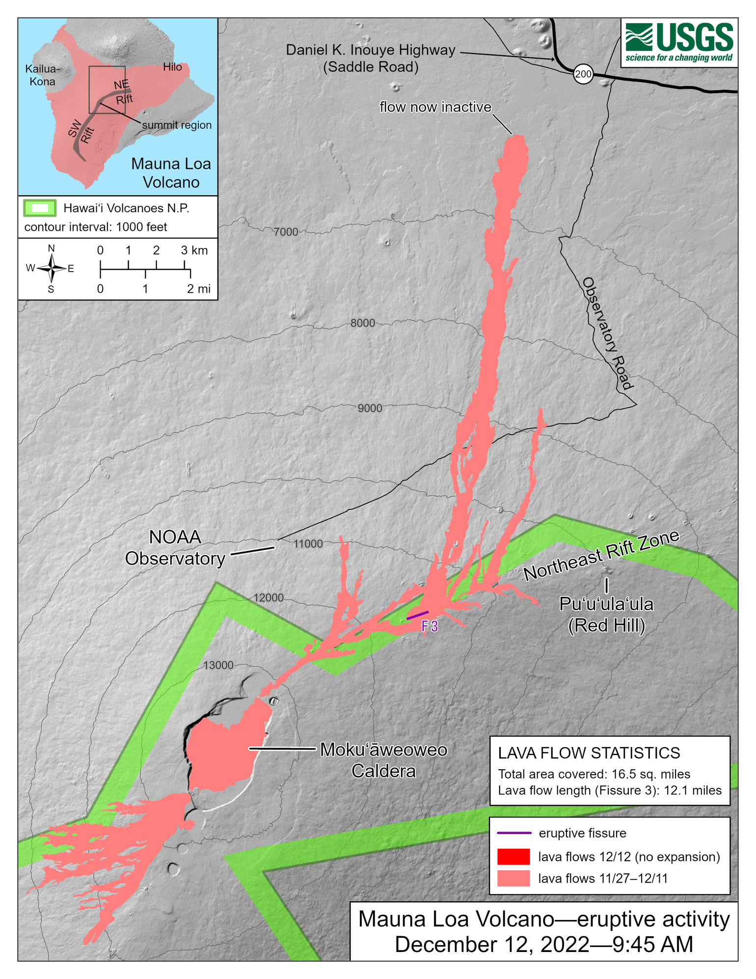
Latest map as of yesterday:
Also a link to the live feed of Fissure 3 (click the image):
David
Code:
Alert Level: ADVISORY, Color Code: YELLOW
2022-12-13 17:17:23 UTC

HVO/USGS Volcanic Activity Notice

Volcano: Mauna Loa (VNUM #332020)

Current Volcano Alert Level: ADVISORY
Previous Volcano Alert Level: WATCH

Current Aviation Color Code: YELLOW
Previous Aviation Color Code: ORANGE


Issued: Tuesday, December 13, 2022, 7:17 AM HST
Source: Hawaiian Volcano Observatory
Notice Number: 2022/H657
Location: N 19 deg 28 min W 155 deg 36 min
Elevation: 13681 ft (4170 m)
Area: Hawaii

Volcanic Activity Summary:

Mauna Loa is no longer erupting. Lava supply to the fissure 3 vent on the Northeast Rift Zone ceased on December 10 and sulfur dioxide emissions have decreased to near pre-eruption background levels. Volcanic tremor and earthquakes associated with the eruption are greatly diminished.

Accordingly, the USGS Hawaiian Volcano Observatory (HVO) is lowering the Volcano Alert Level for ground-based hazards from WATCH to ADVISORY and the Aviation Color Code from ORANGE to YELLOW.

Spots of incandescence may remain near the vent, along channels, and at the flow front for days or weeks as the lava flows cool. However, eruptive activity is not expected to return based on past eruptive behavior. Summit and Northeast Rift Zone inflation continues.

HVO continues to closely monitor Mauna Loa for signs of renewed activity. Should volcanic activity change significantly a new Volcanic Activity Notice will be issued immediately.

Residents and visitors should stay informed and follow County of Hawai‘i and Hawaiʻi Volcanoes National Park guidelines.

For more information about the meaning of aviation color codes, see https://www.usgs.gov/programs/VHP/vo...s-us-volcanoes

Remarks:Continuing hazards

A vent on the west side of the fissure 3 cone remains incandescent and occasionally produces small explosions as trapped gases are released. The lava flows around the vent remain hot and unstable. The vent area is also cut by numerous ground cracks.

Hawai‘i Volcanoes National Park has closed the Mauna Loa Road from Kīpukapuaulu and the closure extends to the summit caldera; for more information please see https://www.nps.gov/havo/index.htm.
Latest map as of yesterday:
Also a link to the live feed of Fissure 3 (click the image):
David
Last edited by FlyinHawaiian; Dec 31, 2022 at 5:45 am
Feb 19, 2023, 10:24 am
#60
FlyerTalk Evangelist
Join Date: Jun 2010
Location: TOA
Programs: HH Diamond, Marriott LTPP/Platinum Premier, Hyatt Lame-ist, UA !K
Posts: 20,061
Summary: Mauna Loa Eruption 2022 (& vs. 1984 Eruption)
USGS/Hawaiian Volcano Observatory posted on Volcano Watch stats for the 2022 eruption - as well as info and scanned photo from 1984's eruption:
2022: Aerial image from November 30, 2022 when the flow front was 3.6 miles/5.8 km from Saddle Road
1984: Taken on March 25, 1984 - no info provided as to where the flow front was
David
- 2022: 40 billion gallons and covered an area of 8,900 acres
- 1984: 58 billion gallons were erupted and covered an area of 11,860 acres
2022: Aerial image from November 30, 2022 when the flow front was 3.6 miles/5.8 km from Saddle Road
1984: Taken on March 25, 1984 - no info provided as to where the flow front was
David