


 Nov 28, 2022, 8:36 am
Last edit by: FlyinHawaiian
Links to sites with information (feel free to add):
https://www.usgs.gov/volcanoes/mauna-loa/volcano-updates
https://www.nps.gov/havo/planyourvisit/maunaloaupdate.htm
https://www.staradvertiser.com/
https://www.hawaiinewsnow.com/
https://www.usgs.gov/volcanoes/mauna-loa/volcano-updates
https://www.nps.gov/havo/planyourvisit/maunaloaupdate.htm
https://www.staradvertiser.com/
https://www.hawaiinewsnow.com/

Mauna Loa Eruption - November/December 2022 [NOW ENDED]
Nov 28, 2022, 10:46 pm
#16
Join Date: Nov 2007
Location: Colorado
Programs: UA Gold (.85 MM), HH Diamond, SPG Platinum (LT Gold), Hertz PC, National EE
Posts: 5,663
Swa airplanes go back to the mainland often. I�m not a Southwest flyer, but they apparently took a conservative approach this time. Maybe too conservative? Who knows, but not since Aloha has anyone given Hawaiian some serious competition; that�s a good thing.
 Nov 28, 2022, 10:48 pm
#17
FlyerTalk Evangelist


Join Date: Jun 2010
Location: TOA
Programs: HH Diamond, Marriott LTPP/Platinum Premier, Hyatt Lame-ist, UA !K
Posts: 20,061
Photos posted by HVO from this morning: https://www.usgs.gov/observatories/h...vember-28-2022
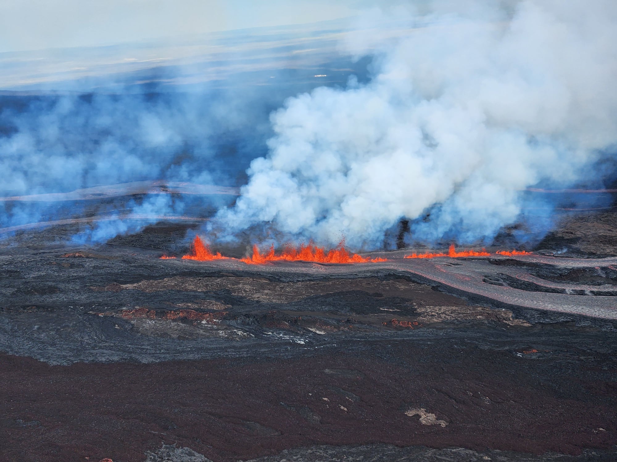
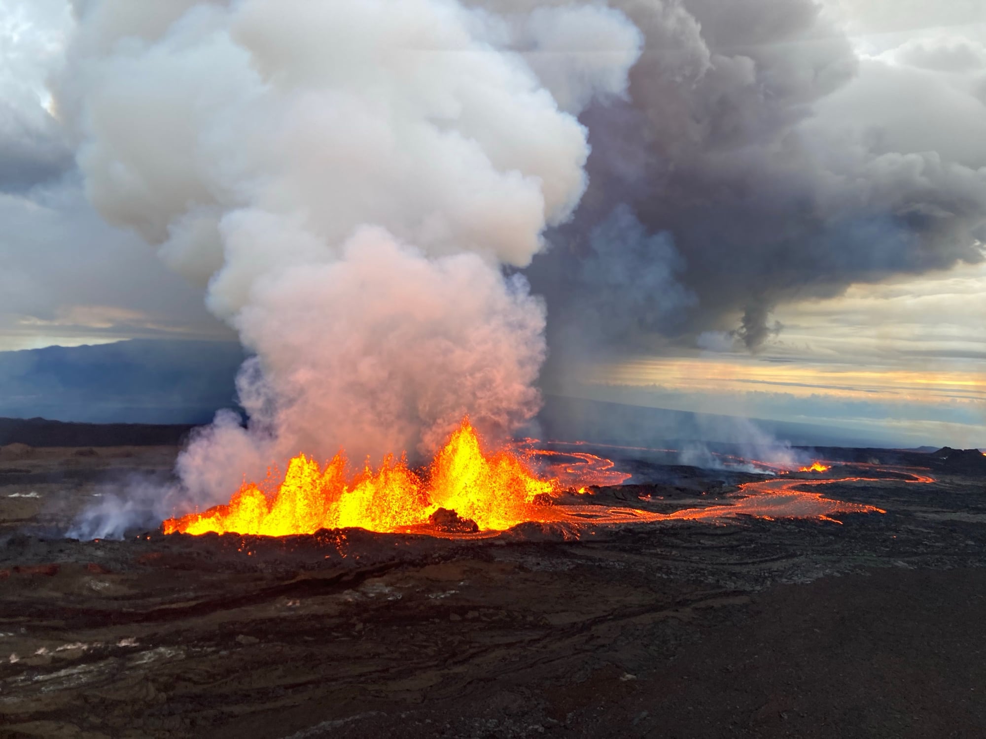
One such photo - fountains of lava at the NE Rift Zone for Mauna Loa (note the tallest of the fountains are estimated at between 100 - 200 feet):
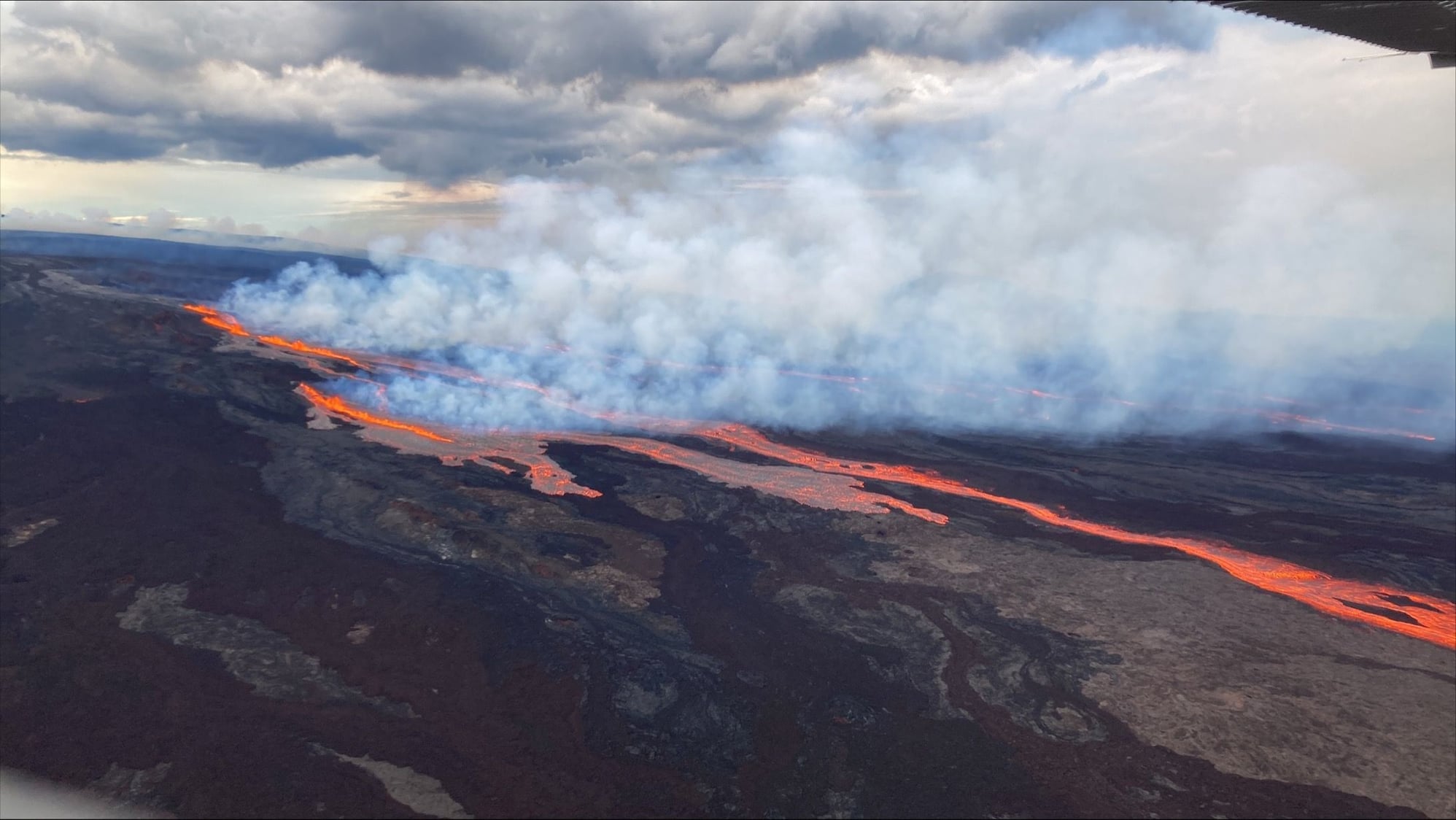
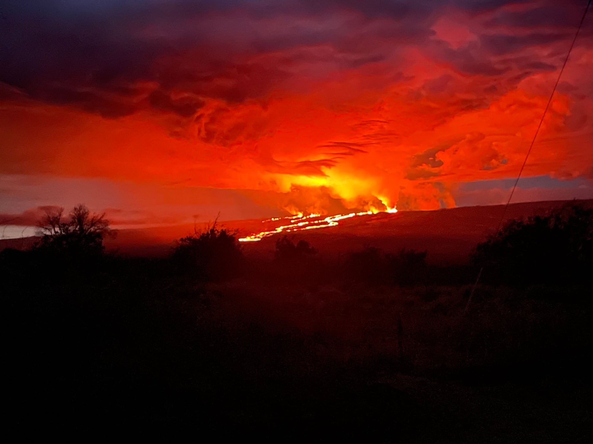
Another - lava flows on the largest active volcano on the planet:
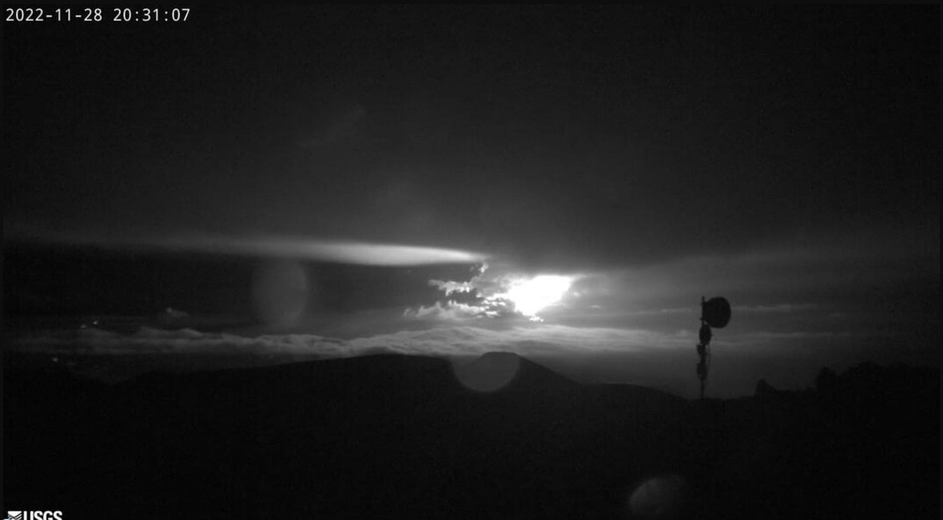
Webcam viewing eruption emplaced on one of the astronomical observatory buildings atop Mauna Kea:
David
One such photo - fountains of lava at the NE Rift Zone for Mauna Loa (note the tallest of the fountains are estimated at between 100 - 200 feet):
Another - lava flows on the largest active volcano on the planet:
Webcam viewing eruption emplaced on one of the astronomical observatory buildings atop Mauna Kea:
David
Last edited by FlyinHawaiian; Nov 30, 2022 at 5:20 pm Reason: consecutive posts merged
 Nov 29, 2022, 9:13 am
#18
Join Date: Nov 2007
Location: WAS
Programs: enjoyed being warm spit for a few years on CO/UA but now nothing :(
Posts: 2,507
Thanks for posting the photos - they are too cool. Was lucky to see a little bit of the Kiluaea eruption this past July, now I want to go out there again now to see these really active flows!
Nov 29, 2022, 9:17 am
#19
Join Date: Sep 2008
Location: SF Bay Area
Programs: None - previously UA
Posts: 4,867
Is it determined yet which side this flow is headed, ie towards Kohala or Hilo?
Nov 29, 2022, 9:56 am
#20
Join Date: Sep 2012
Posts: 195
I would imagine the latest eruption is good for the helicopter tour business.
Nov 29, 2022, 12:33 pm
#21
FlyerTalk Evangelist
Join Date: Jun 2010
Location: TOA
Programs: HH Diamond, Marriott LTPP/Platinum Premier, Hyatt Lame-ist, UA !K
Posts: 20,061
The Federal Aviation Administration has enacted a Temporary Flight Restriction encompassing a five nautical mile radius around Mauna Loa summit and 5,000 above ground level. Approved emergency response flights are excepted.
Photo from 11/28/2022 showing eruption activity at both Kilauea and Mauna Loa in the early morning:
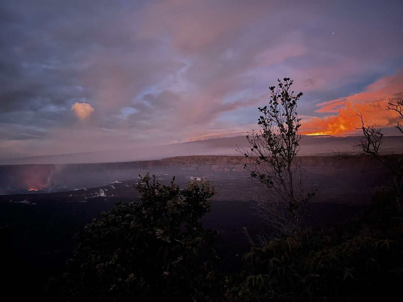
Source: Park is open with some closures as Mauna Loa erupts - Hawaiʻi Volcanoes National Park (U.S. National Park Service) (nps.gov)
David
Last edited by FlyinHawaiian; Dec 9, 2022 at 6:38 am Reason: consecutive posts merged
Nov 29, 2022, 1:55 pm
#22
Moderator: Hawaii-based airlines & Hawai'i forums
Original Poster
Join Date: Mar 2003
Location: Ka ʻĀpala Nui, Nuioka
Programs: NEXUS/Global Entry, Delta, United, Hyatt, IHG, Marriott, and Hertz
Posts: 18,042
Hilo is downslope from the current activity in the Northeast rift zone; that being said there isn’t currently any projected lava flow impact to inhabited areas. The main impact is increased vog which can impact people with respiratory issues.
Nov 29, 2022, 3:19 pm
#23
FlyerTalk Evangelist
Join Date: Jun 2010
Location: TOA
Programs: HH Diamond, Marriott LTPP/Platinum Premier, Hyatt Lame-ist, UA !K
Posts: 20,061
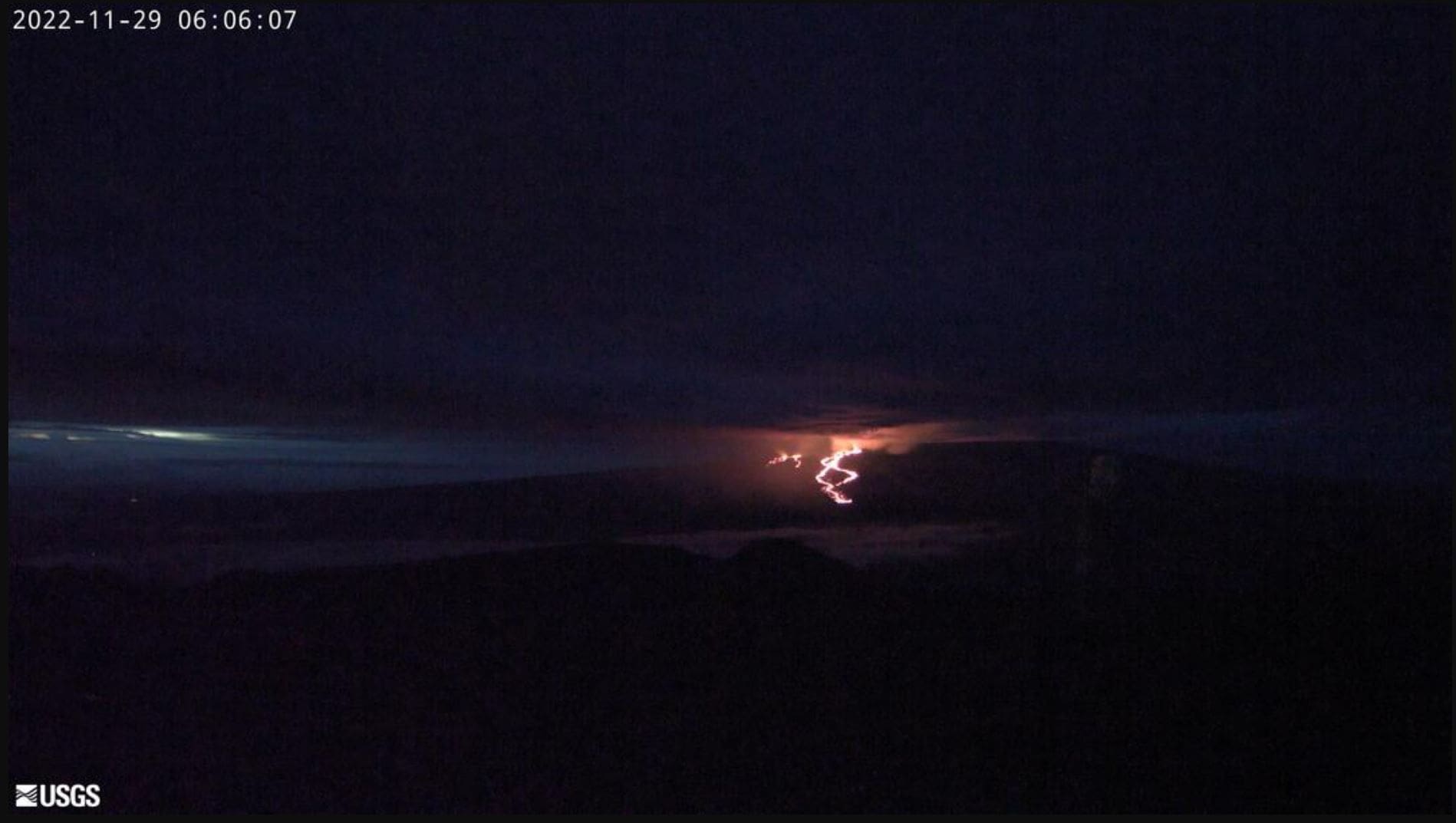
Early morning HVO webcam view of the Mauna Loa Northeast Rift Zone lava flows from Mauna Kea:
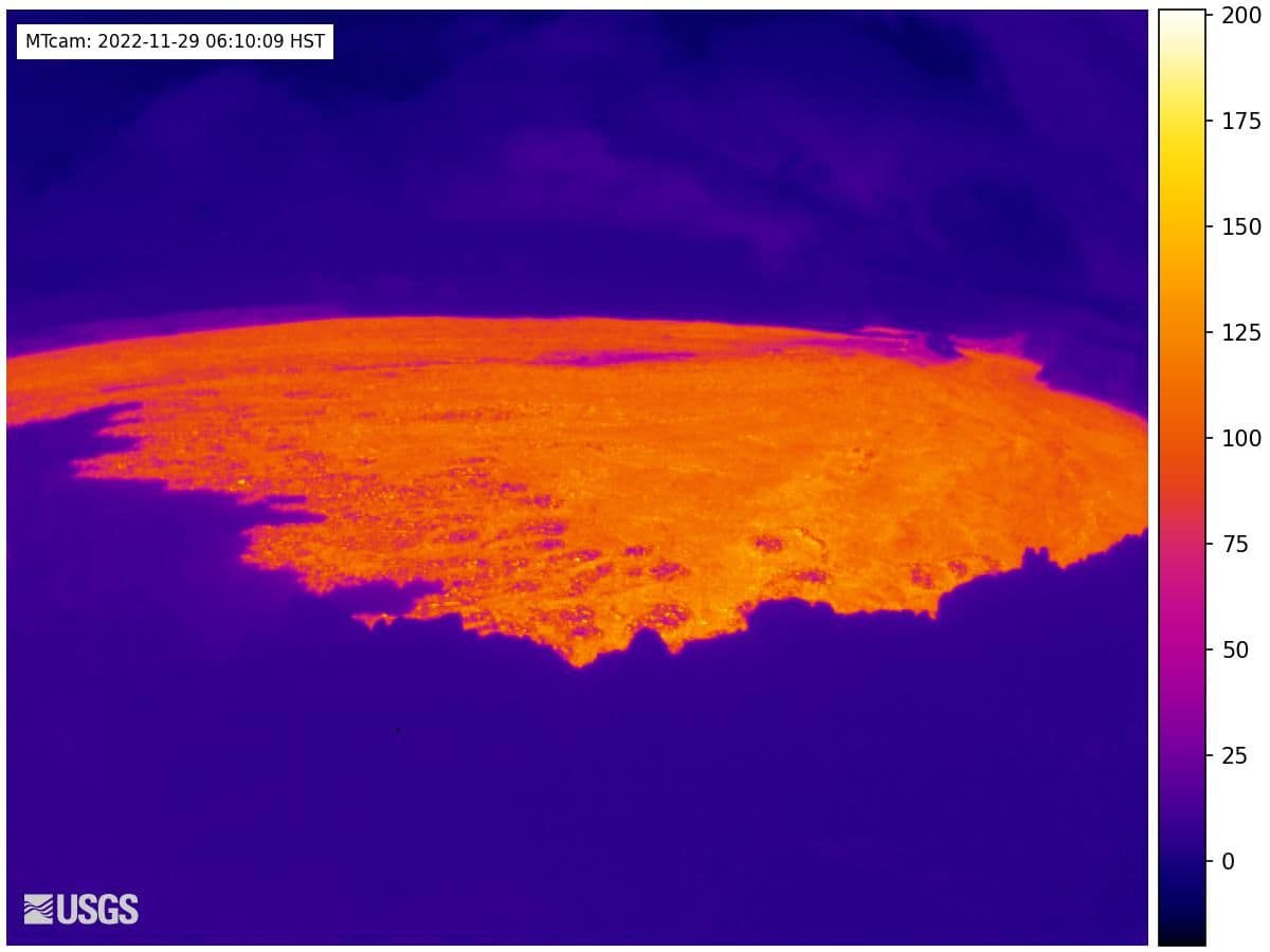
Thermal IR image of the Mauna Loa caldera webcam ([MTcam] Mokuʻāweoweo Caldera Thermal from the Northwest Rim | U.S. Geological Survey (usgs.gov)) showing that yesterday's brief lava flow in the caldera is still hot:
Latest Update:
Just wanted to highlight that the lava flows are advancing on the north/northeast and are now ~6 miles/10 km from Saddle Road.
Latest photos: Photo and Video Chronology – Mauna Loa – November 29, 2022 | U.S. Geological Survey (usgs.gov)
Some of the photos thus far posted from earlier today:
Fissure 4:
Saddle Road shot at 6 AM HST:
Also note that a bunch of the shots posted today were from an overflight yesterday evening and show the extents, at those times, of the lava flows.
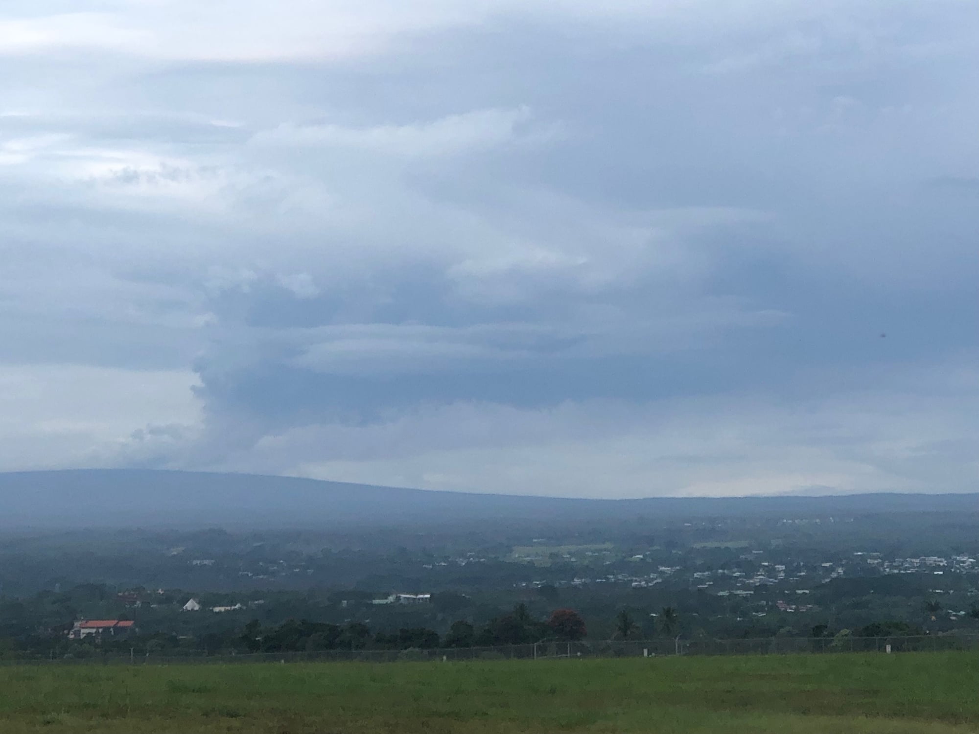
Image of the Mauna Loa eruption plume taken from Hilo this AM posted by HVO:
Likely initial impact might be on lava flows reaching Saddle Road before moving further downslope.
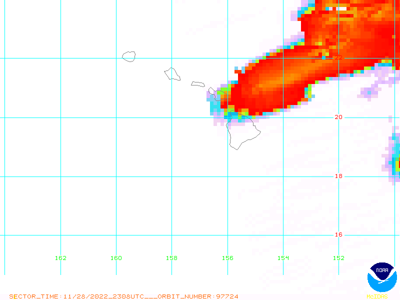
Some SO2 data collection from space
 [/QUOTE]
And VOG predicts from UH (VMAP Vog Forecast Dashboard (hawaii.edu)):
More vog: Vog Information Dashboard | IVHHN
David
Thermal IR image of the Mauna Loa caldera webcam ([MTcam] Mokuʻāweoweo Caldera Thermal from the Northwest Rim | U.S. Geological Survey (usgs.gov)) showing that yesterday's brief lava flow in the caldera is still hot:
Latest Update:
Code:
HAWAIIAN VOLCANO OBSERVATORY DAILY UPDATE U.S. Geological Survey Tuesday, November 29, 2022, 9:12 AM HST (Tuesday, November 29, 2022, 19:12 UTC) MAUNA LOA (VNUM #332020) 19�28'30" N 155�36'29" W, Summit Elevation 13681 ft (4170 m) Current Volcano Alert Level: WARNING Current Aviation Color Code: RED Activity Summary: The Northeast Rift Zone eruption of Mauna Loa continues, with several fissures and lava flows active. Several lava flows are traveling in a northeast direction. The longest and largest lava flow is issuing from fissure 3. This lava flow crossed the Mauna Loa Weather Observatory Road at approximately 8 p.m. yesterday evening, November 29, and the flow front was located approximately 6 miles (10 km) from Saddle Road at 7 a.m. HST this morning. This morning, fountains at fissure 3 are up to 25 m (82 ft) and fountains are fissure 4, which formed at approximately 7:30 p.m. HST last night, were 5-10 m (16-33 ft) tall. There is no active lava within Moku'āweoweo caldera, and there is no lava erupting from the Southwest Rift Zone. All lava flows are on the northeast flank of Mauna Loa. We do not expect any eruptive activity outside the Northeast Rift Zone. No property is at risk currently. There is a visible gas plume from the erupting fissure fountains and lava flows, with the plume primarily being blown to the North.
Latest photos: Photo and Video Chronology – Mauna Loa – November 29, 2022 | U.S. Geological Survey (usgs.gov)
Some of the photos thus far posted from earlier today:
Fissure 4:
Saddle Road shot at 6 AM HST:
Also note that a bunch of the shots posted today were from an overflight yesterday evening and show the extents, at those times, of the lava flows.
Image of the Mauna Loa eruption plume taken from Hilo this AM posted by HVO:
Likely initial impact might be on lava flows reaching Saddle Road before moving further downslope.
Some SO2 data collection from space
[/QUOTE]And VOG predicts from UH (VMAP Vog Forecast Dashboard (hawaii.edu)):
More vog: Vog Information Dashboard | IVHHN
David
Last edited by FlyinHawaiian; Nov 30, 2022 at 6:52 pm Reason: posts made during a day merged
Nov 29, 2022, 3:19 pm
#24
Join Date: Jul 2011
Location: SF Bay Area
Programs: UA MileagePlus (Premier Gold); Hilton HHonors (Gold); Chase Ultimate Rewards; Amex Plat
Posts: 6,680
Nov 29, 2022, 5:29 pm
#25
FlyerTalk Evangelist
Join Date: Dec 2003
Location: USA
Programs: UA Platinum, 1MM
Posts: 13,460
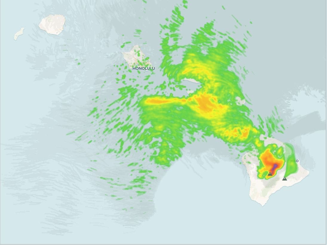
Flights to KOA and OGG are definitely altering their routing to avoid the ash/vog. Adding a bit of extra time as they are flying more northerly than usual and cutting in in the landing stages.
I'm flying to/from NorCal to HNL nonstop and appears no changes to flight routing for those at this time.
Photos look amazing. From what I read this is where the last eruption happened and flowed toward Hilo.
I'm flying to/from NorCal to HNL nonstop and appears no changes to flight routing for those at this time.
Photos look amazing. From what I read this is where the last eruption happened and flowed toward Hilo.
Nov 29, 2022, 6:14 pm
#26
Join Date: May 2012
Location: HNL
Programs: AS MVPG, HA Plat
Posts: 1,268
If you look at the Google Maps satellite layer of the area side by side with the USGS map of the current flow, it's pretty much on the track of the dark flow that that extends down across the Saddle Road around the Mauna Kea Access Road junction. Not good for Saddle Road if it stays on this path.
Nov 29, 2022, 11:03 pm
#27
Join Date: Jan 2013
Location: Hawai'i Nei
Programs: Au: UA, Marriott, Hilton; GE
Posts: 7,145
Nov 30, 2022, 2:45 pm
#28
Join Date: Jul 2011
Location: SF Bay Area
Programs: UA MileagePlus (Premier Gold); Hilton HHonors (Gold); Chase Ultimate Rewards; Amex Plat
Posts: 6,680
After taking out part of the Mauna Loa Observatory road and the power to the observatory yesterday, the flows have now taken out part of the Old Kona Highway. And USGS is now warning that there is a very high probability that Saddle Road will be partly covered by lava: https://www.hawaiinewsnow.com/2022/1...sland-highway/
Nov 30, 2022, 2:48 pm
#29
Join Date: Jan 2013
Location: Hawai'i Nei
Programs: Au: UA, Marriott, Hilton; GE
Posts: 7,145
This morning�s update from USGS
Nov 30, 2022, 2:51 pm
#30
Moderator: Hawaii-based airlines & Hawai'i forums
Original Poster
Join Date: Mar 2003
Location: Ka ʻĀpala Nui, Nuioka
Programs: NEXUS/Global Entry, Delta, United, Hyatt, IHG, Marriott, and Hertz
Posts: 18,042
Here’s a map that’s relatively current as of the time of this post. The main area that has the most activity and feeding the most active flow is Fissure #3 with lesser activity from Fissure #4, which is downslope from #3 and closer to Hilo. Prior flows can be used to loosely predict flow direction as the topography is relatively unchanged. The Fissure #3 flow looks to follow the path of the 1843 flow. The concerning thing I see is the historical flows that originated from Fissure #4’s location (including the most recent 1984 flow). As seen in the map, Hilo has some exposure if there is a prolonged eruption feeding flows.
For now, the Saddle Road/DK Inouye Highway is still uncovered but may be closed to public traffic due to safety issues.
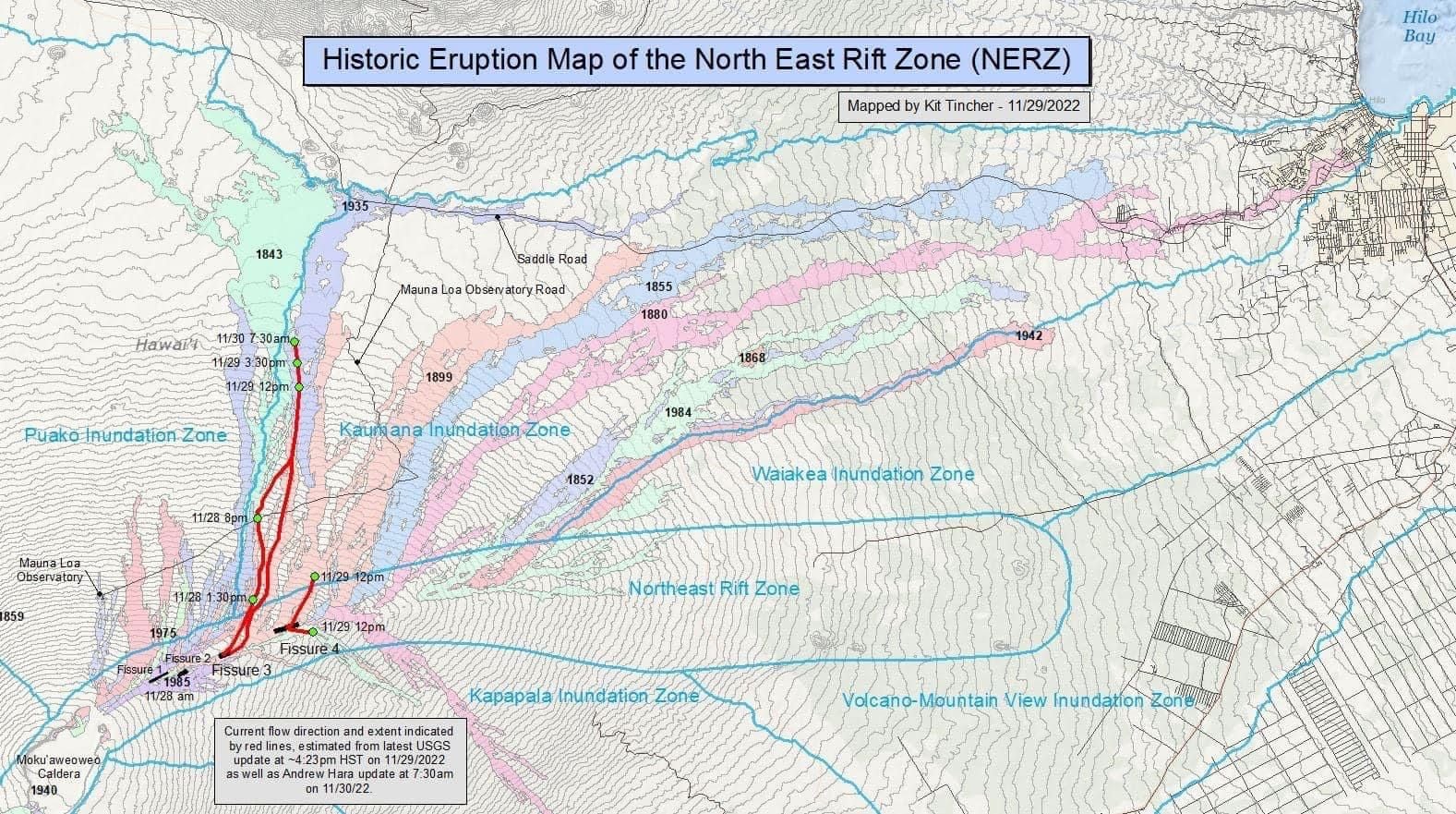
For now, the Saddle Road/DK Inouye Highway is still uncovered but may be closed to public traffic due to safety issues.
Last edited by FlyinHawaiian; Nov 30, 2022 at 3:04 pm