Part 4: The Sand Part
After a few days of being solidly outside of civilization it was a bit of a system shock to hit Swakopmund the following day. An actual, real city, Swakopmund felt both comfy and sketchy all at the same time. We had a relaxing day at the beach and camped near the south end of town at the Tiger Reef Campsite before setting off for Walvis Bay the following morning. Walvis Bay (pronounced, obviously, “VALL-fish”) is the substantially bigger of the only two ports found in Namibia, a break along the Skeleton Coast where ships can safely harbor.
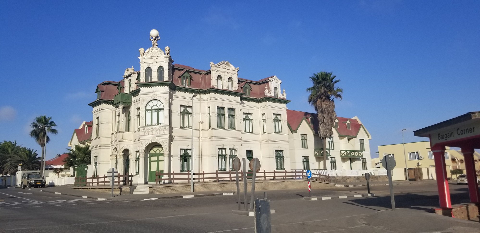 German colonial architecture of Swakopmund
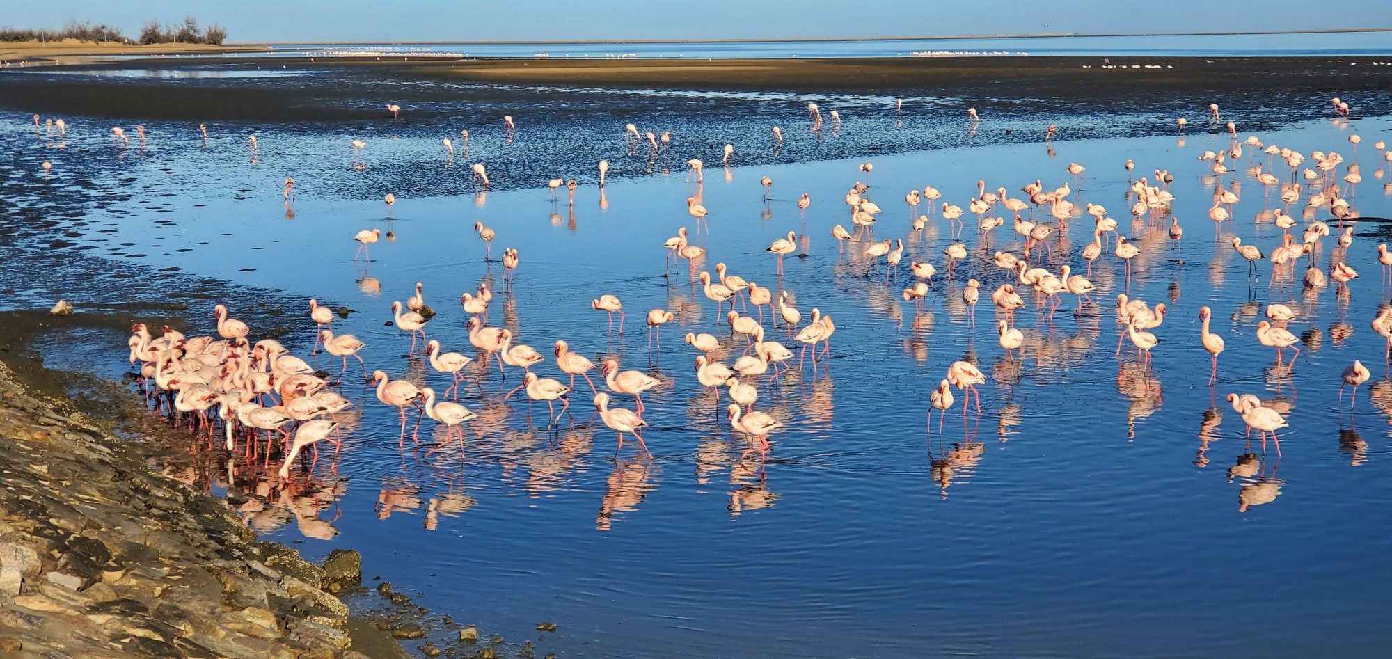 Edge of Walvis Bay, full of flamingos
We had a fun excursion planned that morning as we met our driver, Jako, and piled into his car for a trip to Sandwich Harbour. Sandwich Harbour isn’t really a harbor at all, but a bay a number of miles south of Walvis Bay through the sand dunes. Jako, being a professional, was far less likely to get stuck in loose sand than we were, so we opted to rely on his expertise instead of making the drive ourselves. We made several stops along the way, viewing the flamingos, taking in the pink lakes of drying salt, finding desert lizards buried in the sand, and looking at the tiny gemstones that get deposited along the shore by the diamond mining companies further south. Finally, we made it to the dunes where we were treated to an exceptionally fun drive, along with spectacular view of the harbor, framed by dunes, hundreds of feet high, crashing down into the ocean. Simply put, this was one of the most spectacular views I’ve ever seen my life.
 Pink runoff from the pink salt-producing lakes of Walvis Bay
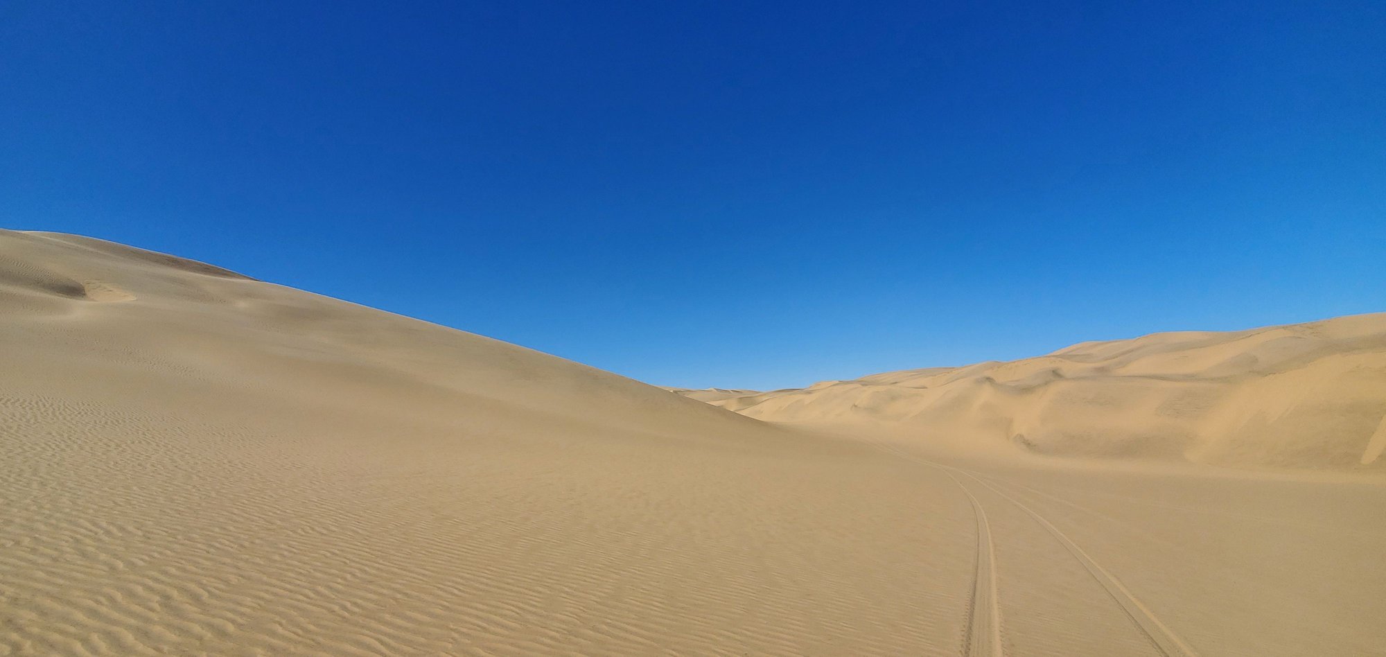 The dunes
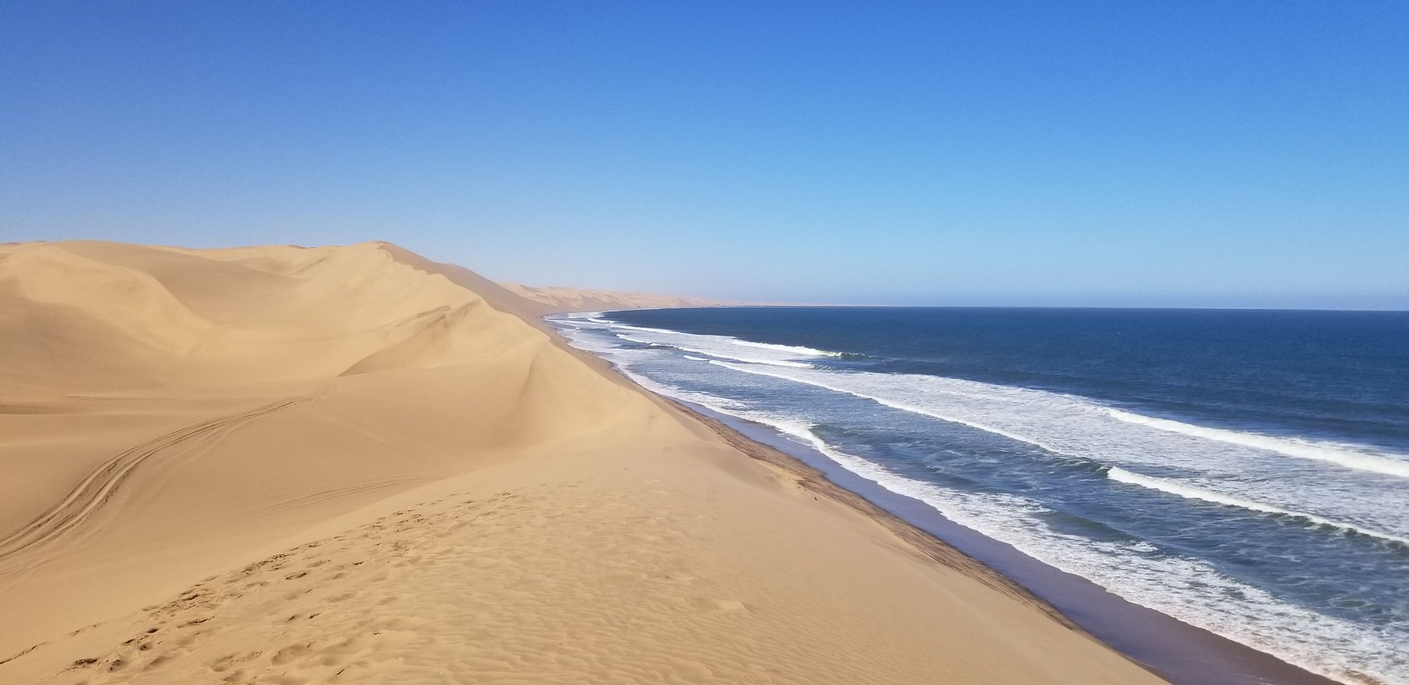 My photos cannot possibly do this justice. Sandwich Harbour is one of the most fantastic views I've seen in my life. Thousand-foot dunes dropping into the ocean.
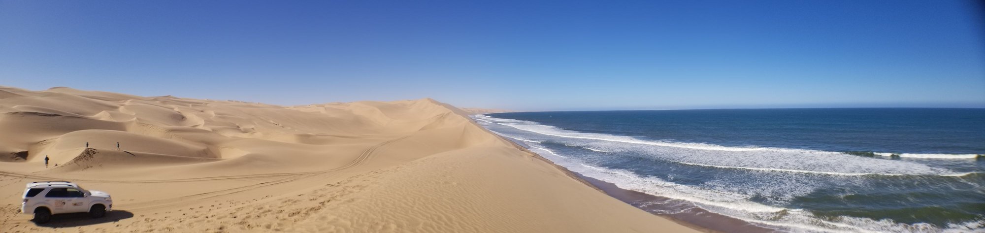 A panorama of Sandwich Harbour
Once back in the car we did some dune cruising, which amounted to Jako using the dunes like a roller coaster. I promise some of the sand faces we drove down were approaching a 45-degree angle. However, with a professional at the steering well it all went swimmingly. We took a brief lunch break, which allowed the boys to “bum slide” down the dunes, which they loved, before heading back to Walvis Bay, hopping in our car, and heading out of town.
Our next destination was Soussusvlei, an area of Namib-Nauklauft National Park known for even more stunning dunes. Technically, Sandwich Harbor is in the same park, so this drive consisted of driving around the perimeter of this massive park for a few hours so we could access the inland side the following day. The drive itself was gorgeous, including driving through a mountain pass and across the Tropic of Capricorn, a popular photo spot.
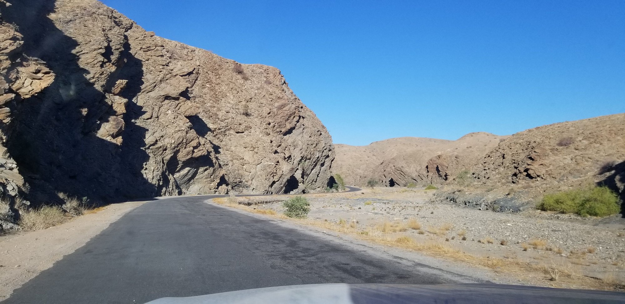 Mountain passes
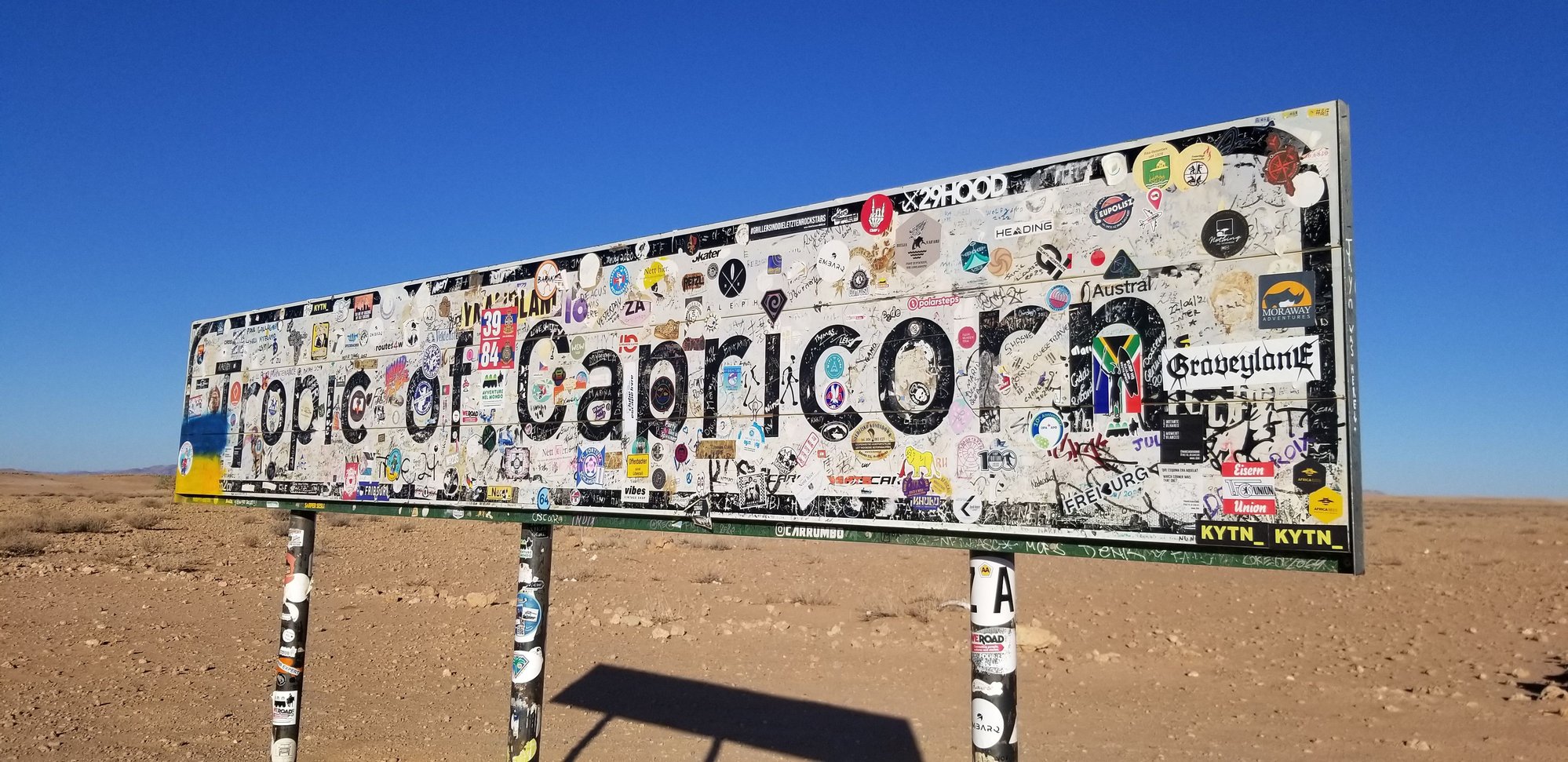 The sticker-covered Tropic of Capricorn sign. We added one of our own (aviation-themed of course!).
The town of Sesriem, at the entrance to the park, is essentially a collection of lodges and campgrounds for those visiting the park. There really isn’t much else there. We stayed at the Sossus Oasis Camp Site and again enjoyed having a personal kitchen area and bathroom right at our campsite.
The following morning, we set out for Soussusvlei, about a 40-minute drive into the national park. This area of Namibia is famous for its stunning reddish-orange dunes, some of which tower over the surrounding landscape. The pavement ends a few miles before the most famous set of dunes, but a set of drivers in safari trucks await you to drive the last little bit to the hiking spots. The ride was absurdly bumpy, though I’m not convinced the driver wasn’t doing that on purpose to make the kids squeal in delight. We stopped partway there to push a car out of the deep, soft sand. Someone had clearly overestimated their ability to drive in those conditions.
Once at the parking area we headed for Deadvlei, probably the most photographed spot in Namibia. The story here is quite interesting. Apparently, about 1,000 years ago the local river shifted course for unknown reasons. This caused the area to desert-ify in a short amount of time. The trees died, but it was too dry for them to decompose, so they just sit there. Obviously, something like that can’t possibly be recreated, so there are rather threatening signs warning tourists not to hurt the trees. Despite the crowds, not huge compared to the Trevi Fountain or something like that, but much larger than we’d seen elsewhere in Namibia, one could wander far enough away to find some solitude. The landscape was breathtaking, with the white ground, red-orange dunes, gray trees, and blue sky all complementing each other perfectly.
We decided to hike up Big Daddy Dune for a look down at Deadvlei. The dune towers 1,000 feet above the valley and was probably more than we should’ve bitten off with the kids. It took us longer than expected, though we weren’t in any rush. The Anarchist even managed to fall asleep while being given a piggy-back ride, so we succeeded (for once) in wearing him out. The views from the top were spectacular, with dunes and valleys in all directions. After taking in the vista, we slid down the dune, making much better time than coming up (obviously…). The advantage of taking a long time to get up was that Deadvlei was nearly, well, dead, by the time we made it down, which gave us the opportunity to snap some photos without anyone around. Take that Instagram influencers! Finally, we made our way back to the safari truck shuttle to head back to our campsite.
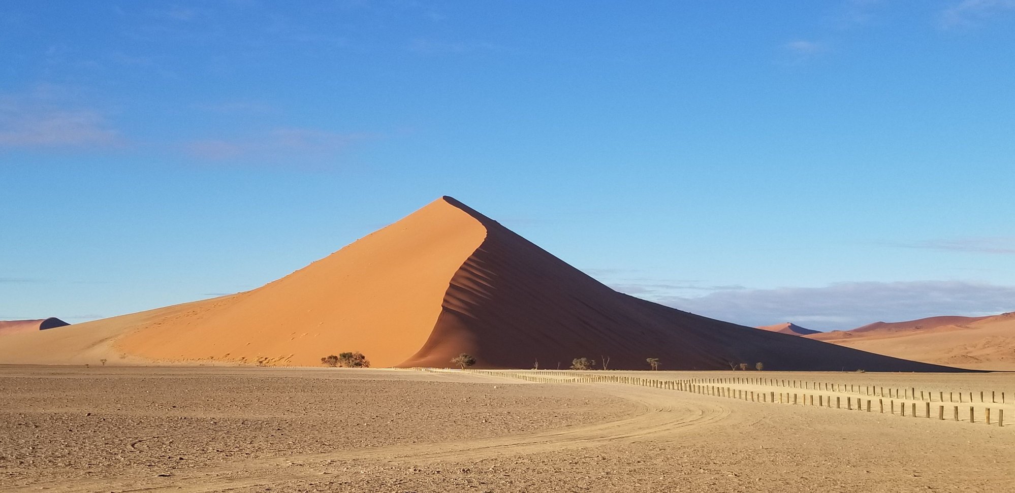 View of Dune 45 on the way in.
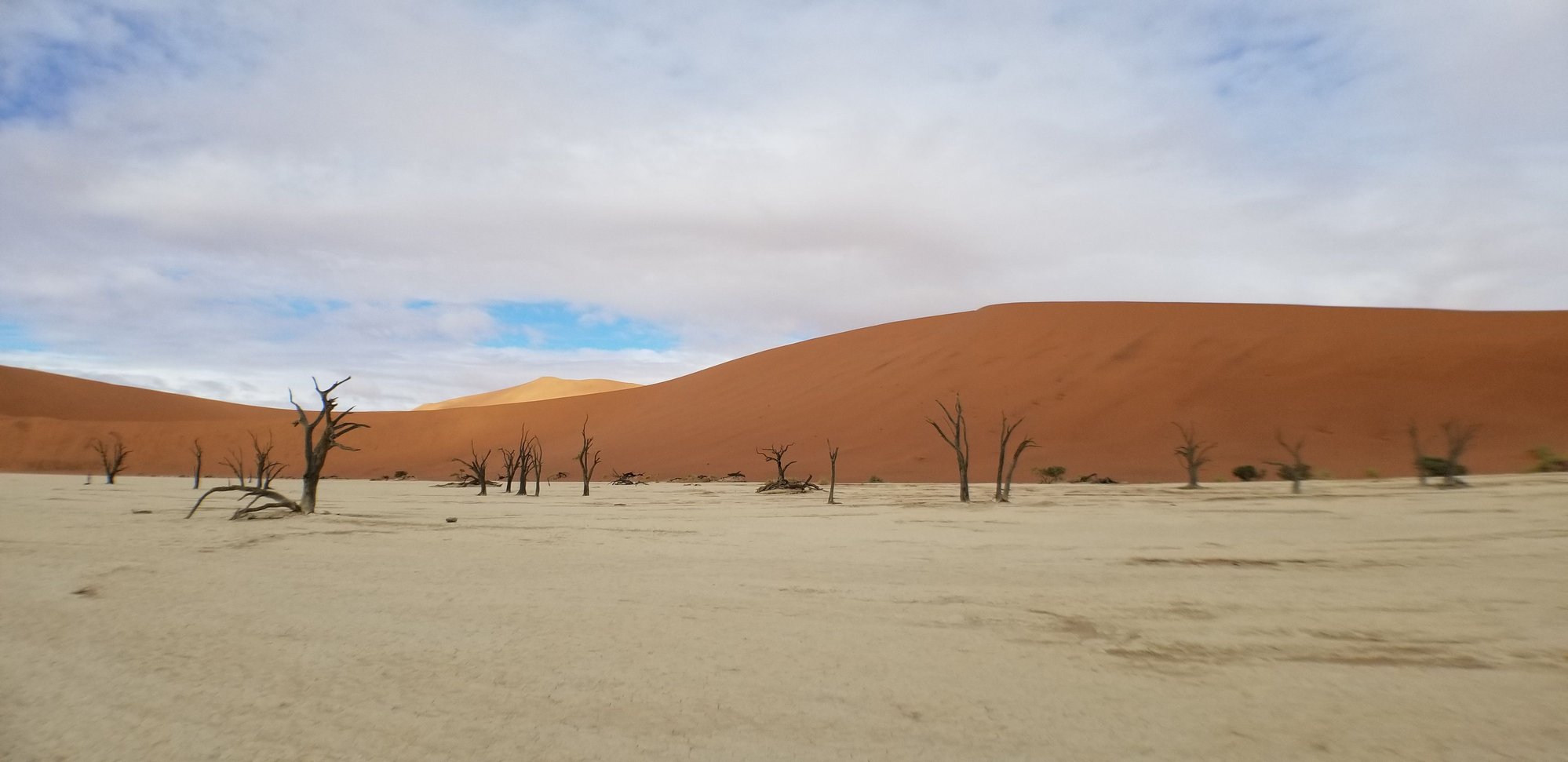 Deadvlei
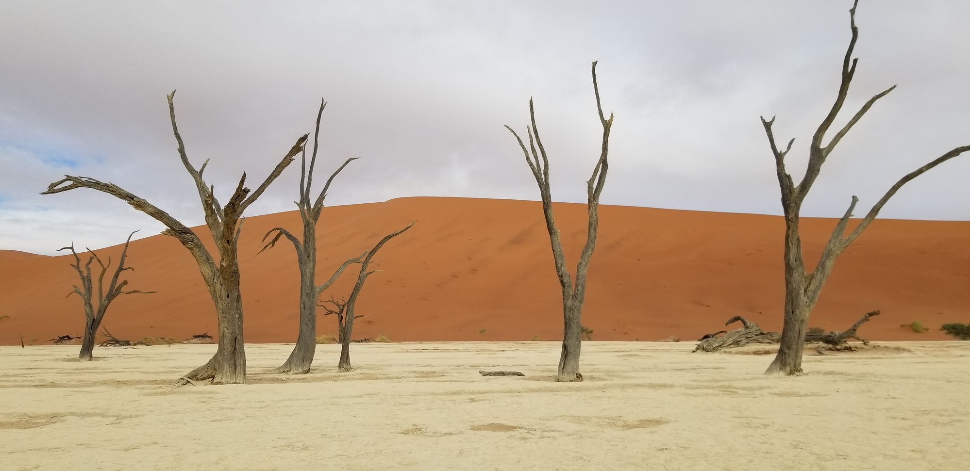 Deadvlei from closer
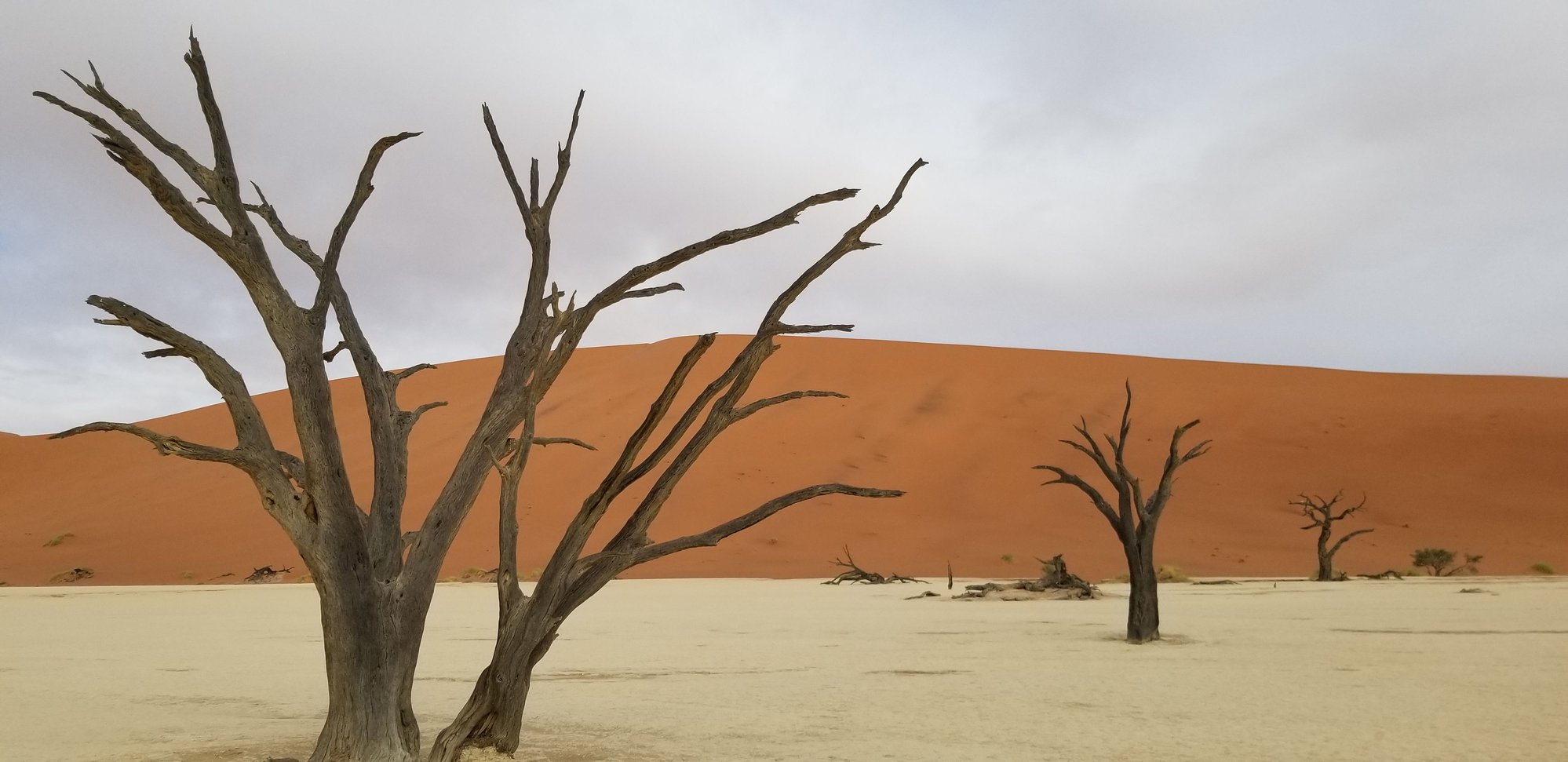 Deadvlei again
 View of Deadvlei from the top of Big Daddy Dune. You can see the dead trees in the distance.
 View in the other direction from the top of Big Daddy. Sand dunes for hundreds of miles.