I built
Great Circle Map.
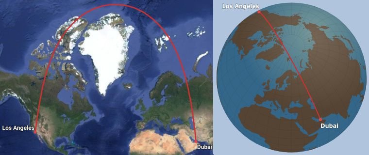
It has two display modes: A Google maps-based projection which is nice since it lets you zoom in as much as you want, and an interactive
3D globe projection which helps explain the weird curves of the route paths

The website is really fast since it never reloads the page. If you type in a route, it will appear instantly.
It addresses some of the problems that have been mentioned in this thread:
* The search lookup function is instantaneous, so inputting routes is very fast even if you don't know the airport codes.
* For people who don't want search, there is a "raw input" mode which works like gcmap.com - just put in the airport codes like "JFK-LHR/AMS".
Cons:
* Mobile version is a bit clunky.
* Not the same breadth of display options as good old gcmap.com (ranges, ETOPS etc).
* A bit more difficult to export as an image - you basically have to take a screen shot.
* Airport database is not as complete as the one on gcmap.com