Originally Posted by
eng3
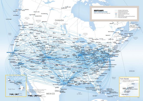
I liked the PDF map because I could instantly see all cities that UA serves. Then I could zoom in and count the lines from a specific city and see how many destinations are served or even follow the lines to see what those destinations are now. I can sort of do that with the interactive map, but I have to know in advance the list of cities that Ua serves
I tried this but the map is cut off. especially on the NE coast where I am specifically looking
Maybe somewhat helpful?
http://www.skywest.com/assets/Upload...outesDEC16.pdf
https://1.bp.blogspot.com/--XCJRJwRp...14.09%2BPM.png
Links to this map:
Last edited by limey1K; Dec 29, 2016 at 4:44 pm