Hello,
Going over JetPlan.com's turbulence forecast map, I am trying to make up what it actually means to the flight.
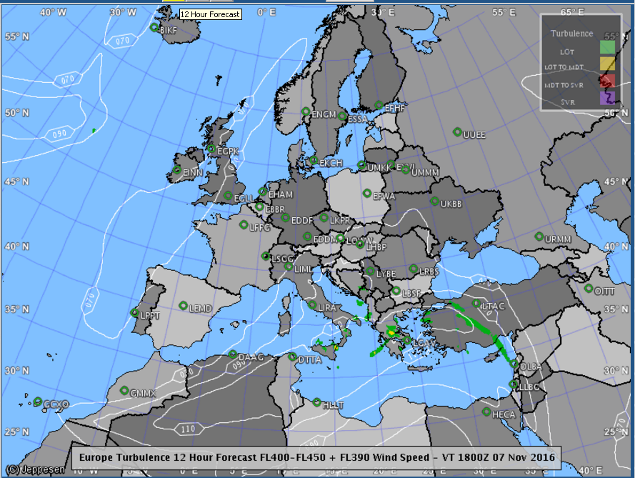
According to the forecast, the first picture looks absolutely smooth all throughout Europe.
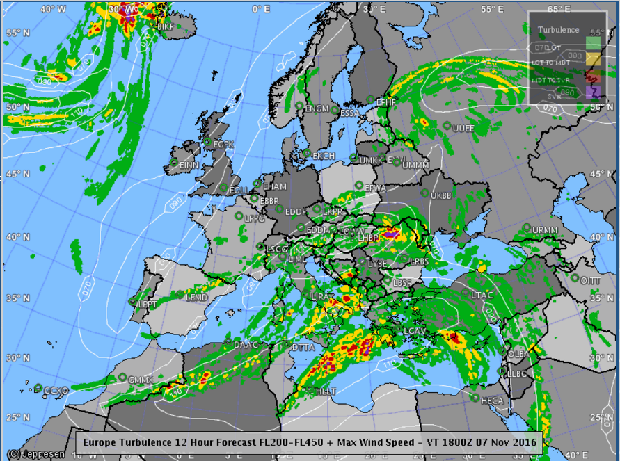
But according to the second picture, and let's say that the forecast is for an altitude of FL300-FL350, on a flight from TLV-FCO, the plane will fly through red, yellow and green. So I'm wondering:
-Does anyone know this map and can tell if that means that the flight will not avoid a moderate turbulence? And a light one?
-Is green (light turbulence) supposed to feel like some bumps only (i.e. water in a cup rippling a bit but no more), or does it feel like more than that?
-Will the pilot bother to bypass a light turbulence or only begin making efforts with a mild one?
Examples:
Thanks very much,
As you can guess this bothers me very much.
Carmel
.