Originally Posted by
kopflyer
It looks like the Openflights routes.dat is a different/incompatible format (comma delimited) from the original ARM format (tab delimited). I would be willing to write a script to convert OF to ARM if OF's are updated more frequently (and I would donate to the OF cause, naturally

)
It's the other way around: OF data is generated from ARM, and it's formatted that way for easy database importing.
On a side note: what are you using to generate those gorgeous world maps with airport locations & routes? GCM is great, but the images are to small - I'd love to be able to generate a large custom route map like what you've done.
Um, are you asking me or
cockpitvisit? OpenFlights uses OpenLayers for mapping, with a whole bunch of custom Javascript code on top to render the routes and airports. My favorite hack, though, is exporting the flight data as KML and rendering it as 3D in Google Earth:
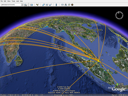
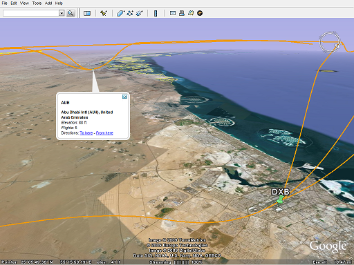 http://openflights.org/blog/2009/02/...-google-earth/