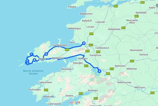
Day 6: (Killarney via the Dingle Peninsula to Tralee)
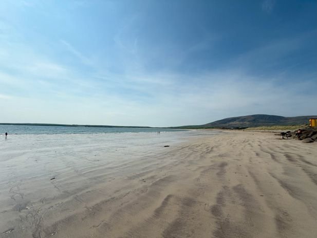
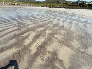
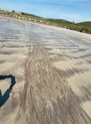
First stop was Ceann Tr� Beach and it is a stunner. The beach is so wide and the water azure blue. But what was most intriguing, other than the luscious sea air, were the tracks left behind by the seaweed as the tide receded. I have included a couple pictures.
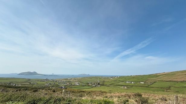
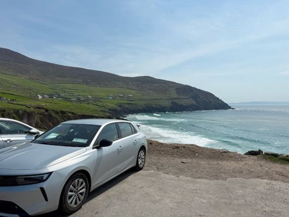
After that I took the verrrry narrow road along the cliffs to the North viewpoint of Radharc na mBlascaoid�. Great cliff views, but I was kind of bored by cliffs by this point.
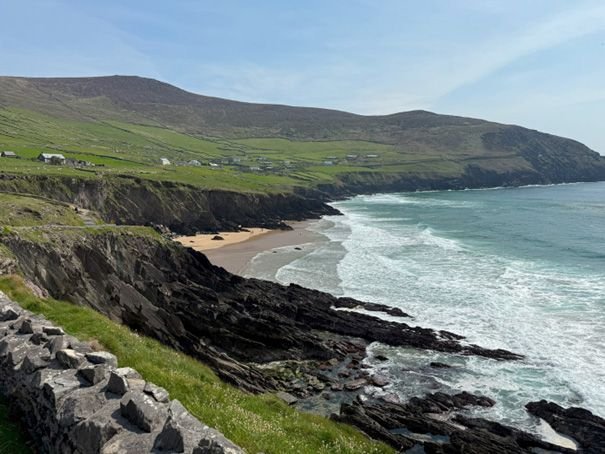
Right after that and just up the road was Coumeenoole Beach. This is perhaps my second favorite vista of the trip. Judge for yourself. I made my way around to the south end of the same beach for a few more pics.
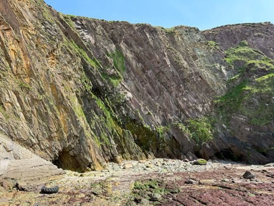
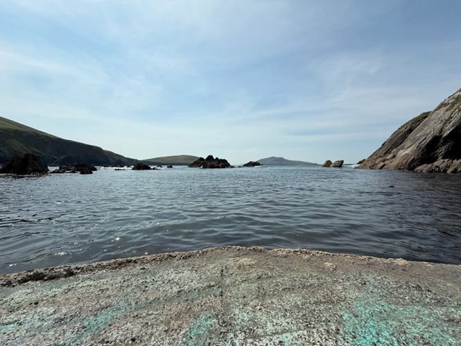
Next up was C� Dh�n Chaoin (Dunquin Pier). This involved a very steep walk down to the water but the views were completely worth it.
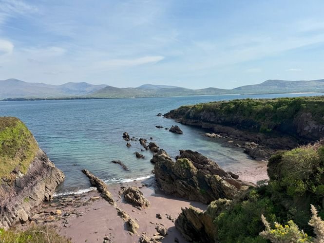
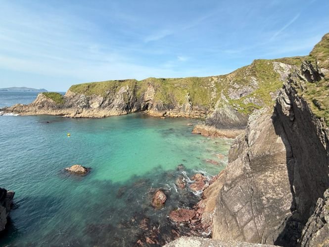
I added an off-piste destination and stopped at Ard na Caithne (Smerwick Harbour) accessed by some incredibly remote barely paved farm roads. Quite beautiful and I think the side trip was well worth it.
The final stop before heading to Tralee was Conor Pass. Amazing well-groomed roads up to the top of the mountain and I was fortunate to have a driver ahead of me who likes these roads as much as I do. We shaved several seconds off the recommended diving time.
Then on to Tralee and a late afternoon pub visit.
For my money, of the three peninsulas, Beara, Kerry, and Dingle, the most beautiful is Dingle but Mizen Head still ranks at the top for coastal cliff views.
Here is a map of my route for the day. Looks like less road time, but this took a good 4 hours given the roads available.
Ceann Tr� Beach. Seriously, if the temps were higher this could be the Caribbean.
Seaweed tracks
Incredible vista on the road to Radharc na mBlascaoid�
Coumeenoole Beach (North End)
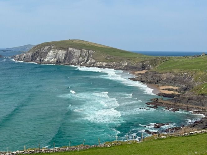
Same beach, wider view. Just incredible!
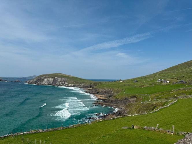
From the north end of the same beach with my wheels in the foreground.
Another shot from the same position
C� Dh�n Chaoin (Dunquin Pier) and the steep snaking path down to the water.

From along the path down, but looking north:
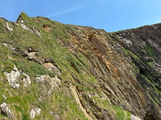
Same pier but looking at the cliff itself as I found it very illustrative of the composition of the coast of Ireland. The land is formed in large part by opposing tectonic plates pushing the ocean floor up against each other over eons resulting in the ocean floor compressed and forming vertically-oriented layers of sand and silt that have long since become rock. This is what enables the easy chiseling of large pieces for the standing stones in Irish and Scottish stone circles (Scotland is made the same way).
If you were a seal this would be your point of view:
The very off-piste side trip I made to Ard na Caithne (Smerwick Harbour). I think this shows it was worth it.