Ruhrgebiet Rother Hike 3: Hagen City Garden - Ennepetal Lake and
Dam
This lengthy and scenic hiking route has a red designation, which I felt was justified during the second half of the route. Beginning at the city garden park in the city of Hagen, the route wound up and up through the woods, heading into deep forested and hilly country towards the south. The lengthy uphill route was compensated by a lengthy downhill into one of the valleys, following by yet another lengthy uphill along a forest track which finally lead me to Waldgaststätte Hinnenwiese. From there the designated route took a scenic way through the woods on a small path which brought me eventually to the spread out farming village of Egge.
 Theater Hagen, a reasonably good opera and Schauspiel house
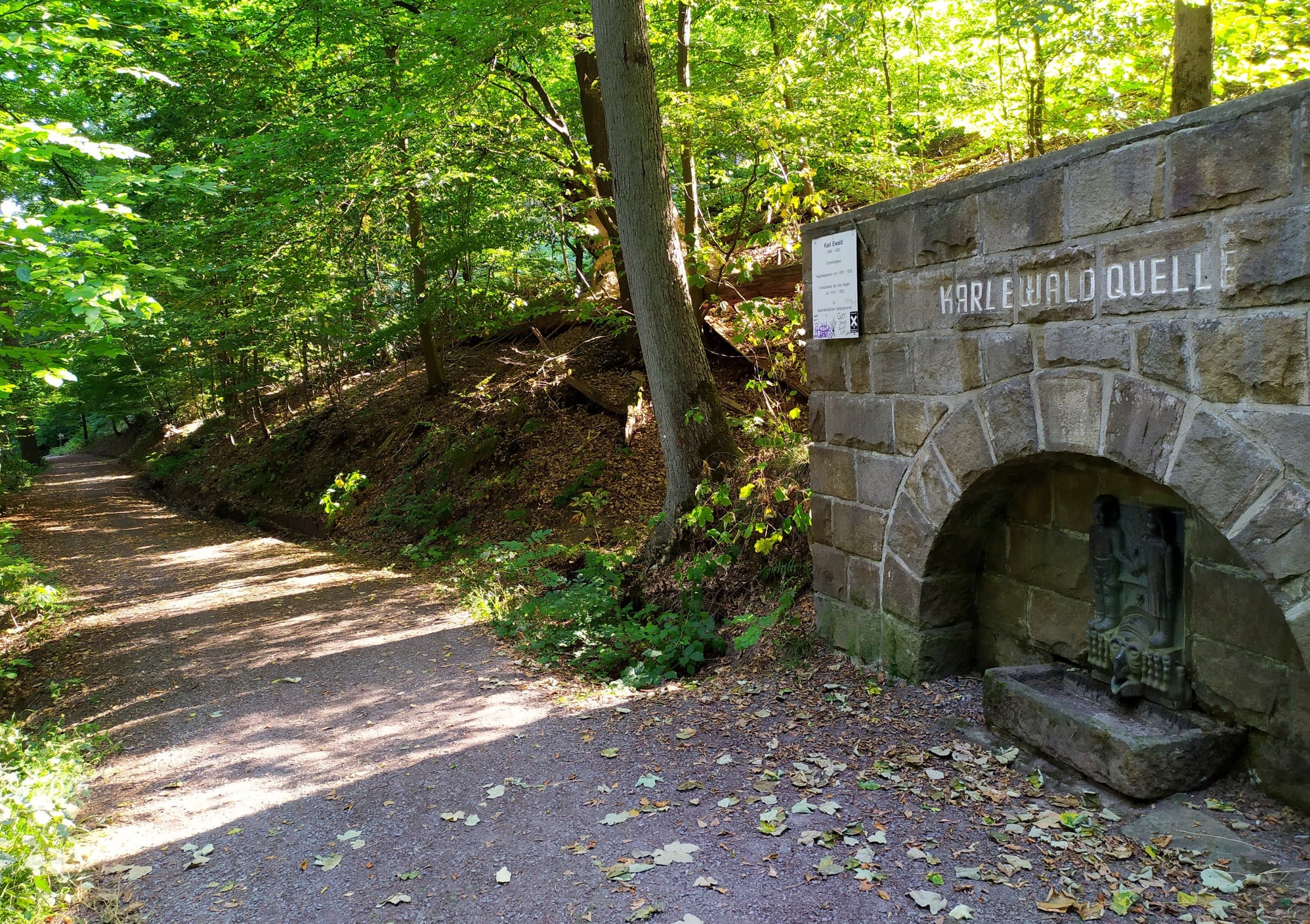 Karl Ewald Quelle, a spring on the trail climbing out of Hagen, which was dry at the time I passed it
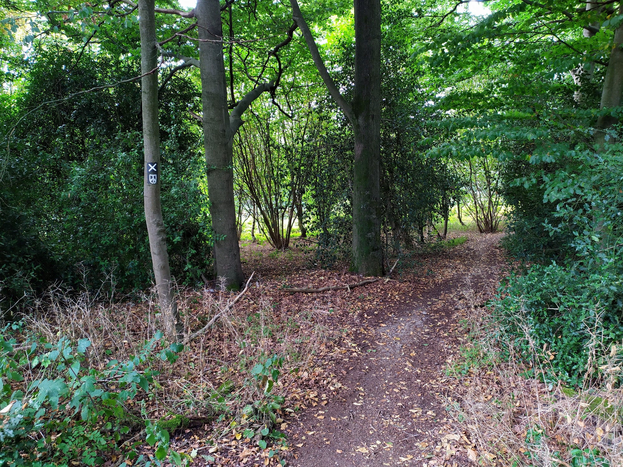
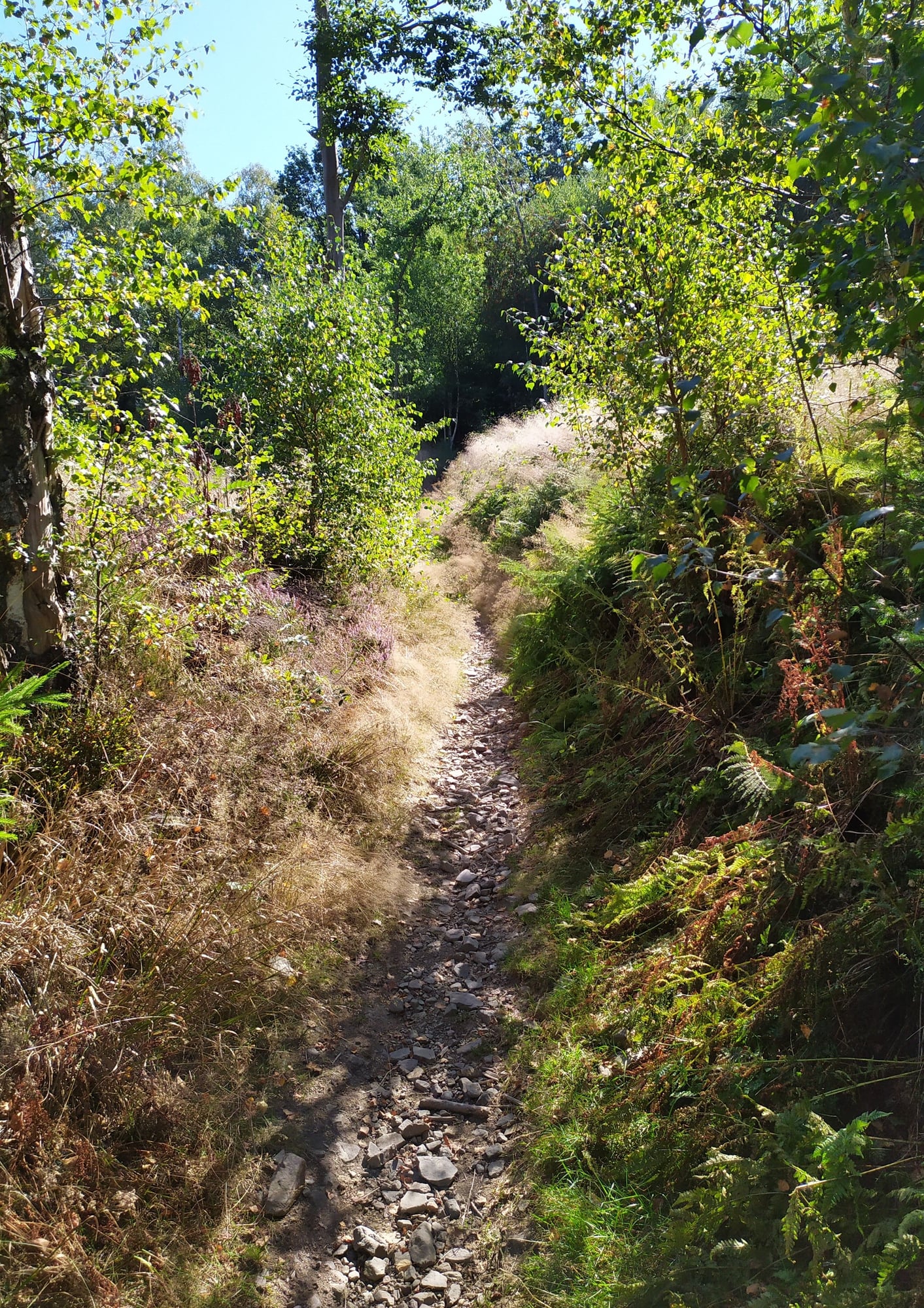 Further along the way became smaller
From here, the way went along country and farm routes, finally heading into open country after passing a small Flugplatz with a grass runway which appeared to be on a hill. At this point the route headed steeply downhill (following a dry torrent stream) to the water's edge of a lake created by a dam in the valley (Hasper Talsperre). You need to continually check the alignment of the route with the map shown on the Alpenverein app. This is very important on the second part of the route, later on, which has a few navigational blank points. The Hasper Talsperre was perhaps the "prettiest" part of the hike and I elected to have my picnic there on a bench. From the lake the route led uphill through fields to the main road through the village of Oberbauer, where I was able to get a bus to Schwelm and from there an S-Bahn train to Dusseldorf (quite a lengthy trip in a very crowded bus, followed by major train delays later on).
 Grass landing strip for light aircraft near the village of Egge; here you can see the original alignment of my trail disappearing into the distance; the trail was diverted when the Flugplatz was designated
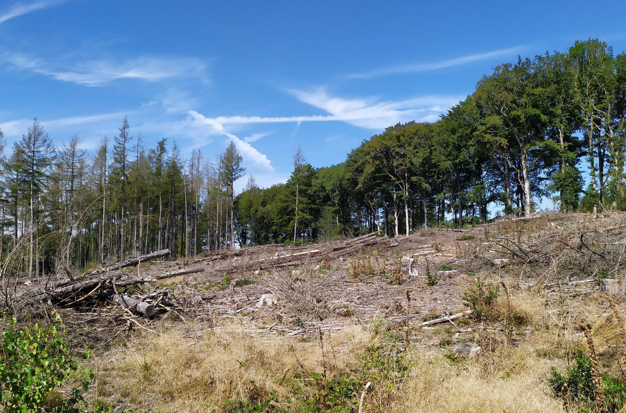 Large tracts of the woods appeared to be damaged or dying
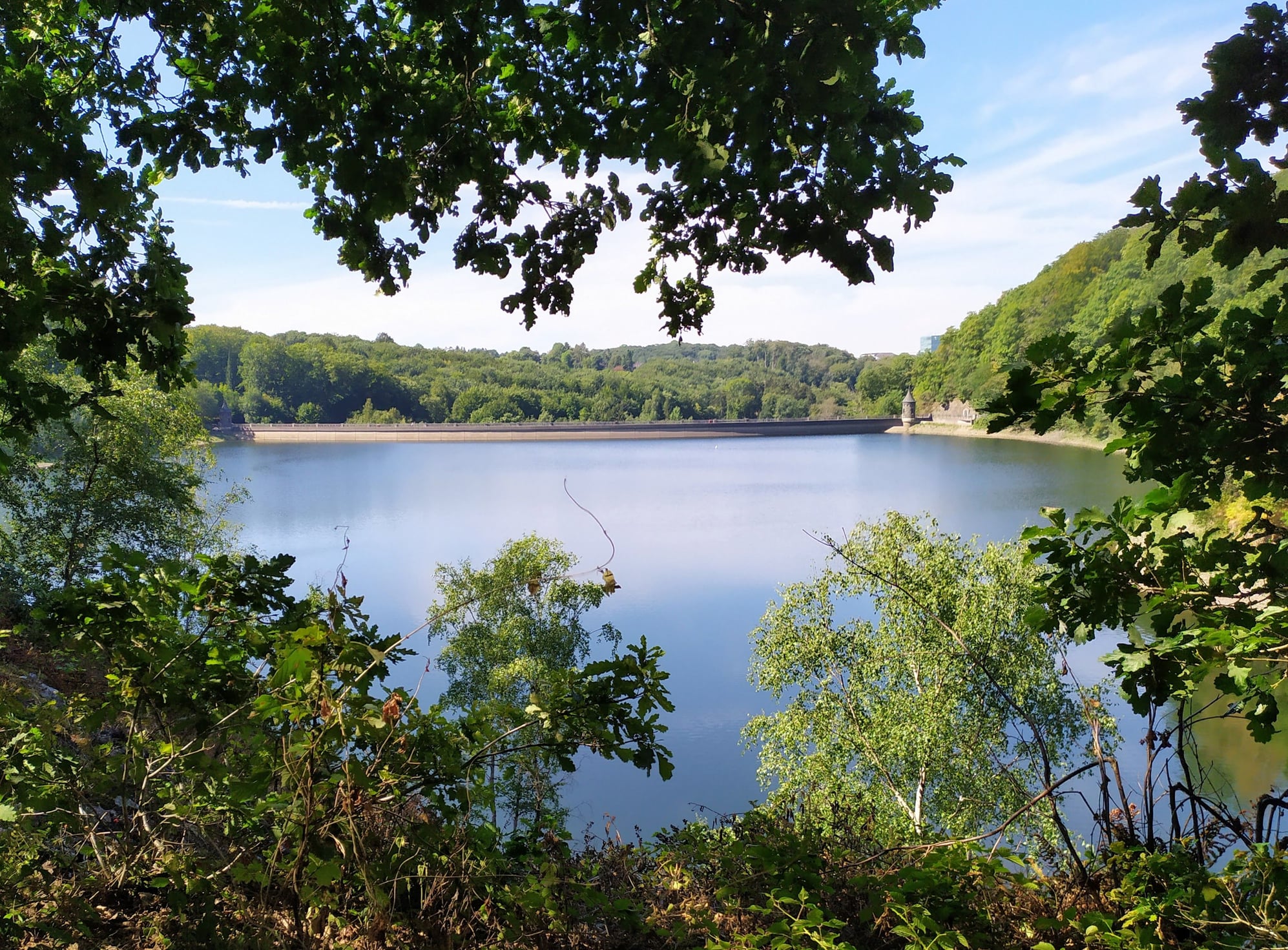 The Hasper Talsperre where I decided to have my picnic
The second part of this walk fully deserved its red rating just by itself, in my opinion, given that there was quite a lot of up and down as well as the final climb up to the Ennepetal dam. There were also a few minor navigation issues which were enough to cause some loss of time. Although in theory you are able to follow the X marks painted on trees and gateposts all the way from Hagen to the Ennepetal dam, sometimes at crucial points these route markers were missing. So a better map than the one in the Rother book is essential, along with the Alpenverein app which is very much up to date. If you are doing this route, you have to stick fairly closely to the alignment as shown on the map in the Rother book - there is one steep descent through the woods where forestry works and tree cutting have eliminated the path, which normally follows the course of a torrent (dry when I was there). This section of the walk had more of a sense of adventure about it and was entirely in deep countryside.
 Heading north from Oberbauer there was an extended section of small path where the way became quite indistinct
 The route lead past this rundown farm building which, oddly, had an amplified radio blaring music across the valley
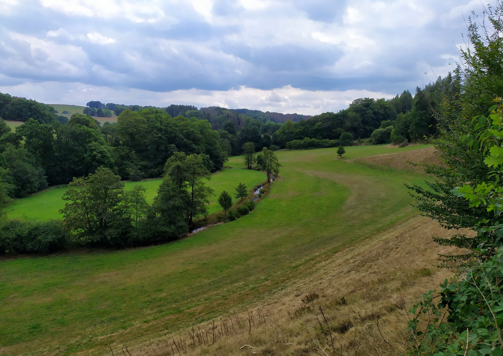 Nice landscape as we approached the Ennepetal dam
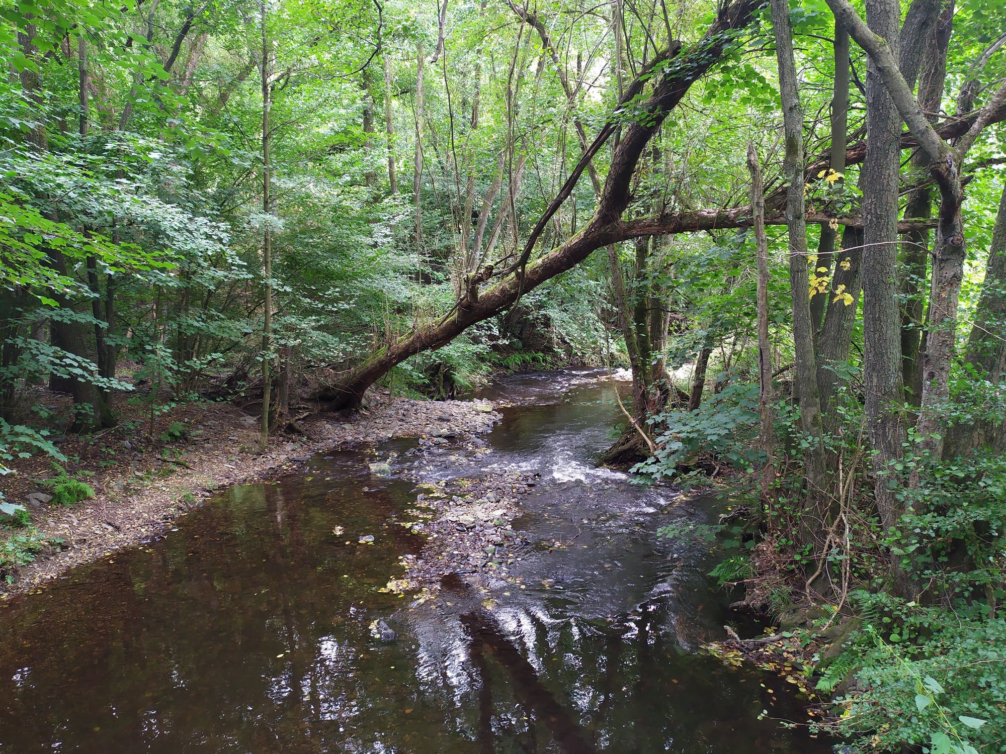 This stream (the Ennepe) is on the down valley side of the dam
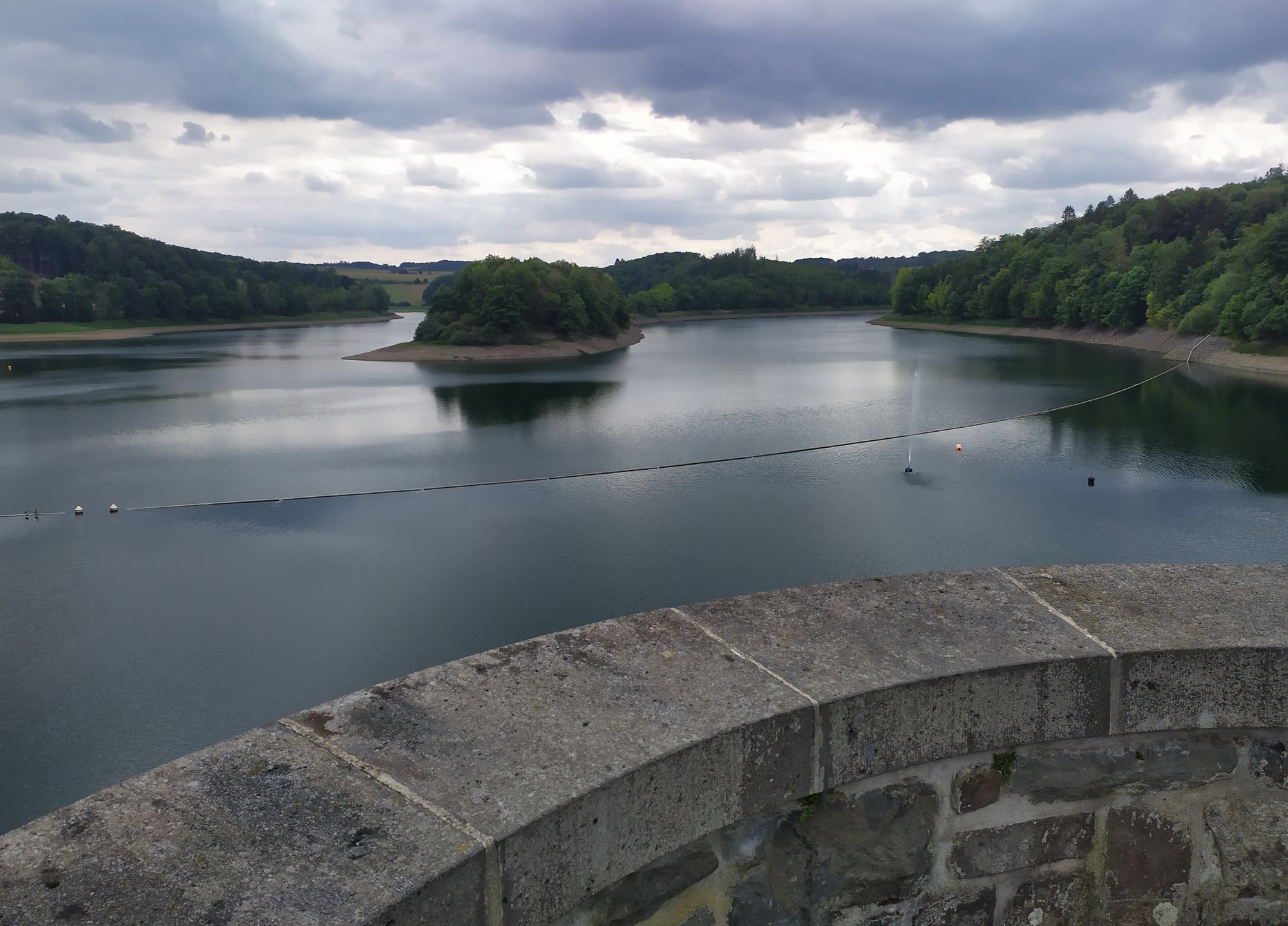
Reaching the Ennepetalsperre, with its impressive views over the big lake (water levels were really low), means we arrived at the end of the walk as described in the Rother book. But to get back to any form of civilization, such as a bus top, I had to walk for over an hour to reach the nearest town, called Breckerfeld. Although initially along a country road with a certain amount of traffic, the way ended up diverting away from the road along a pilgrimage route (Lennep?) which had an incredible sense of peace about it, even when the trail plunged through the darkest part of the forest. At one point the trail almost disappeared (at Kückelhausen), leaving me to improvise as to where it went exactly. It did make me think how Johann Sebastian Bach walked all over Germany in the early
1700s to take up appointments as organist at various churches. It must have taken him a while to tramp all the way up to Lübeck, no trains, no Bundestrassen. I finally reached Breckerfeld in quite a tired state, having gone along country trails and through fields, although I felt curiously energised. I must say that out of all the walks I did in summer
2022, this one stood out as one of the most interesting and most challenging.
 Finally, at the official end of this hike, admiring the view from the Ennepetal dam structure
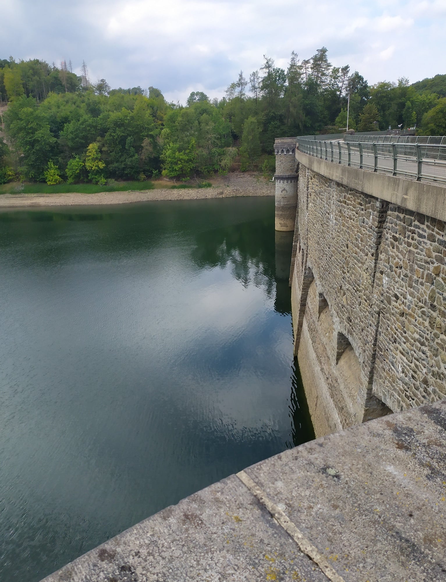 In this shot you can see how low the water level is
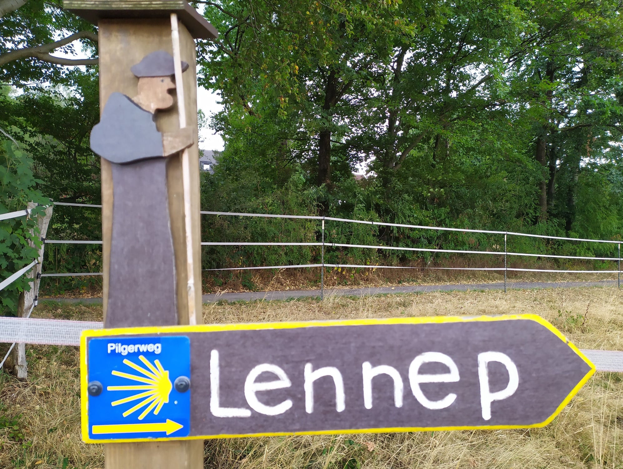 The way from Ennepetalsperre to the town of Breckerfeld lead along a pilgrimage route
 Finally at the town of Breckerfeld which is full of interesting old buildings