I recently started using My Flight Radar 24 (
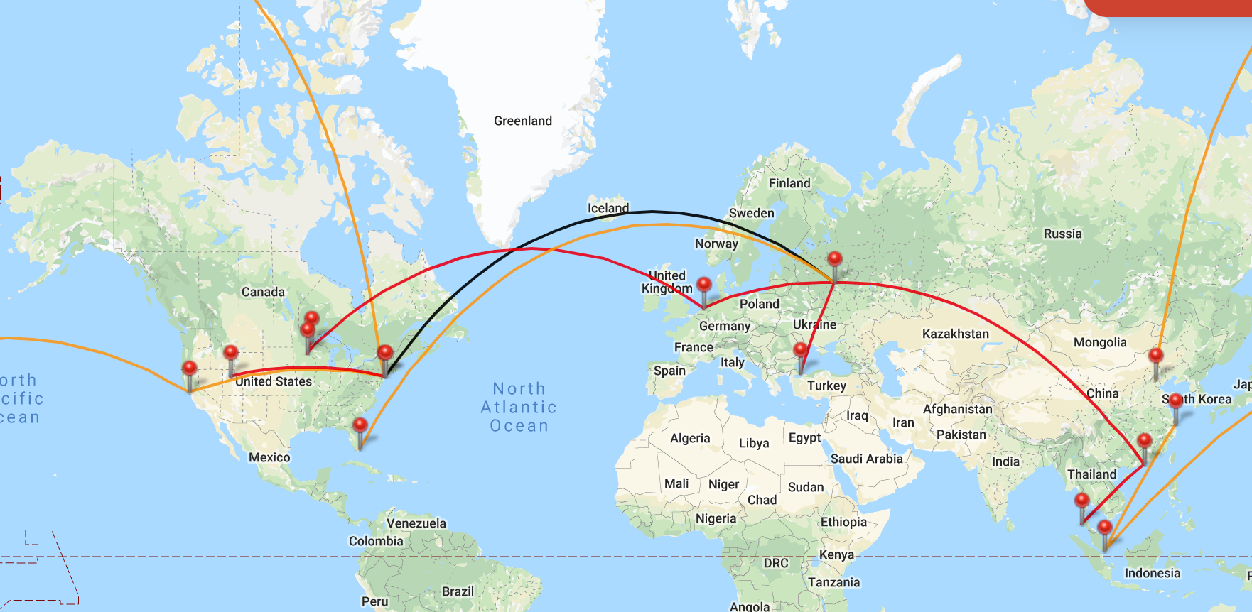
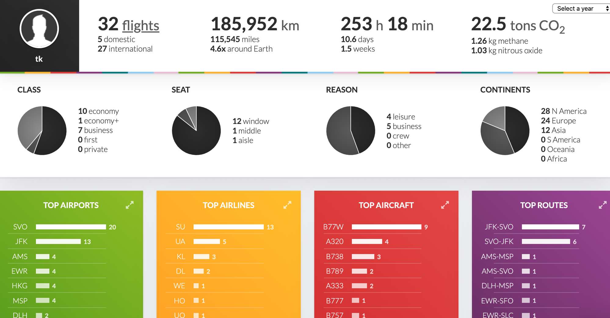
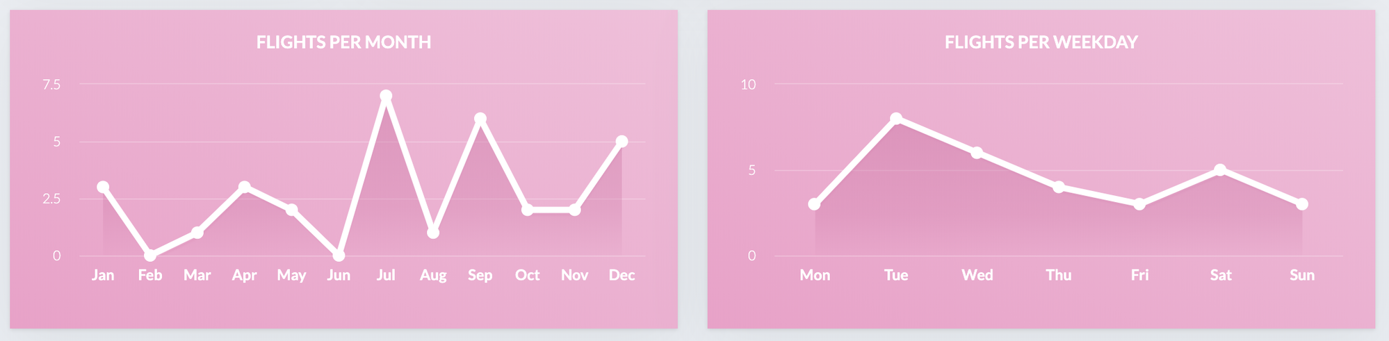
https://my.flightradar24.com/) and it does about 95% of what I want it to do. I had previously kept an Excel file with all the dates, flight numbers and cities. By entering that data into My Flight Radar 24, it automatically generates a cool map and some handy charts like this:
There is a 7-day trial to see if you like it, then it costs around $3 per month for the Gold product.
It does most of what I want (cool charts, csv export, easy entry and decent database of flight data), but I often fly about 20 flights per year between the same pair of cities and I wish it would somehow show on the map that there were 20 flights instead of making it look like just one... Still, the design is much better than some of the other sites shared above.