I wasn't sure where to put this - inclusion in the 'where in the world' thread would have been too easy.
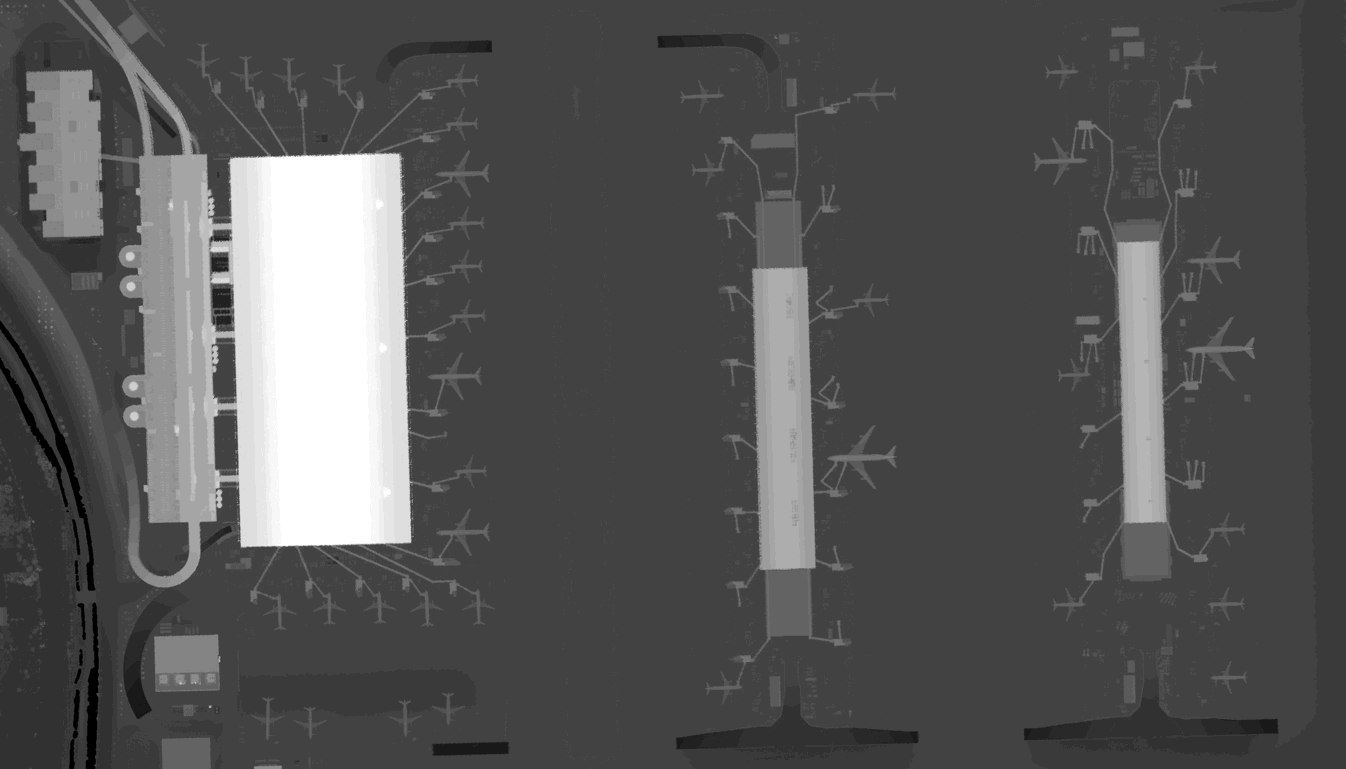
Dabbling around in some pre-Christmas idle-time I generated this: it is lidar (laser detection and ranging) data of Heathrow. Although looking something like a heat map, it is height data - the brighter areas being higher, the darker areas lower. The terminal buildings are clearly seen, as are the parked aircraft with a couple of 747's at T5B and T5C (if you look closely you can see the forward bulge in the fuselage).
(The data has been resampled from 50cm to 1m resolution - the original data being accurate to a few mm vertically).