


The BA Cloud!
 May 24, 2012, 3:19 am
#16
Join Date: Jan 2009
Location: Near Edinburgh
Programs: BA Silver
Posts: 9,034
 May 24, 2012, 3:38 am
#17
Original Poster


Join Date: Nov 2010
Location: Bristol, UK
Programs: HH D, Rad Plat
Posts: 5,352
A provocative first class...
Why do we have weather? Why is it not 25 degrees C and sunny blue skies everywhere? How is this related to BA and my flights?
I'll try to keep things very simple, interesting and fairly short in each of these...hope they are of interest and do not upset too many if I simplify the physics involved!
Effectively it all comes down to temperature.

thermometer by BA_pics, on Flickr
Yes, temperature. If we had a 'closed' system (there was no Sunshine heating us unequally from above and the world was flat and heated equally throughout the air with no change or difference in absorption we would indeed have no weather! (don't worry, not going to happen!)
Because we get the Sun heating the atmosphere and the Earth's surface unequally around the world...this causes a difference in temperature both vertically and horizontally...between the air at the surface and the air at the higher levels in our atmosphere...as well as the temperature of the water in the ocean and the soil on land...and in the process of trying to balance out the temperature over both horizontal and vertical distance we get wind.
We would have no wind if the temperature was uniform in our atmosphere. However, luckily for us, there is a strong difference in temperature both in the vertical and horizontal scales...the stronger the difference in temperature, the stronger the wind from the need to try to balance out this difference (A jet stream is nothing more than an extreme difference in temperature between two air masses.)
Jet Stream description on Wikipedia
Once we have some temperature gradient and therefore some wind...we have weather...as once you move a 'cube' of air from one place to another, vertically or horizontally, it changes accordingly to the conditions...it may either contract or expand due to temperature and the fixed amount of moisture in that 'cube' will reflect the change in temperature of that cube, creating clouds, precipitation or dissipating cloud at the other extreme...
The good news is that without these temperature differences we would have a much harder time trying to get from one place to another...as we would have no wind to flow over an airplane wing and no jet streams to help speed us on our way across larger distances making fuel consumption and times much higher (forgetting the fact that life may not exist in a closed system...however, I will simply ignore that fact for this discussion!)
So the next time it is raining or cloudy in the UK or your BA flight is a bit bumpy...remember that this is actually very important and good at the end of the day as otherwise BA would not be flying you to your destination!
On the next episode of weather....
Air Masses...they are massive but there are not masses of them
I'll try to keep things very simple, interesting and fairly short in each of these...hope they are of interest and do not upset too many if I simplify the physics involved!
Effectively it all comes down to temperature.
thermometer by BA_pics, on Flickr
Yes, temperature. If we had a 'closed' system (there was no Sunshine heating us unequally from above and the world was flat and heated equally throughout the air with no change or difference in absorption we would indeed have no weather! (don't worry, not going to happen!)
Because we get the Sun heating the atmosphere and the Earth's surface unequally around the world...this causes a difference in temperature both vertically and horizontally...between the air at the surface and the air at the higher levels in our atmosphere...as well as the temperature of the water in the ocean and the soil on land...and in the process of trying to balance out the temperature over both horizontal and vertical distance we get wind.
We would have no wind if the temperature was uniform in our atmosphere. However, luckily for us, there is a strong difference in temperature both in the vertical and horizontal scales...the stronger the difference in temperature, the stronger the wind from the need to try to balance out this difference (A jet stream is nothing more than an extreme difference in temperature between two air masses.)
Jet Stream description on Wikipedia
Once we have some temperature gradient and therefore some wind...we have weather...as once you move a 'cube' of air from one place to another, vertically or horizontally, it changes accordingly to the conditions...it may either contract or expand due to temperature and the fixed amount of moisture in that 'cube' will reflect the change in temperature of that cube, creating clouds, precipitation or dissipating cloud at the other extreme...
The good news is that without these temperature differences we would have a much harder time trying to get from one place to another...as we would have no wind to flow over an airplane wing and no jet streams to help speed us on our way across larger distances making fuel consumption and times much higher (forgetting the fact that life may not exist in a closed system...however, I will simply ignore that fact for this discussion!)
So the next time it is raining or cloudy in the UK or your BA flight is a bit bumpy...remember that this is actually very important and good at the end of the day as otherwise BA would not be flying you to your destination!
On the next episode of weather....
Air Masses...they are massive but there are not masses of them
Last edited by BotB; May 24, 2012 at 3:45 am Reason: add link


 May 24, 2012, 8:31 am
#19
Join Date: Sep 2010
Location: London
Programs: BA Gold, VS & Aeroplan Red, Marriott Silver, Hilton Honours, Hertz Gold, GHA Discovery Platinum
Posts: 203
 May 24, 2012, 8:33 am
#20
FlyerTalk Evangelist
Join Date: Nov 2007
Location: The Hague, NL
Programs: GMLFL, Life 2.0 - Mucci Premiere Classe & des Chevaliers Toulousiens
Posts: 22,911
May 24, 2012, 8:39 am
#22
FlyerTalk Evangelist
Join Date: Nov 2007
Location: The Hague, NL
Programs: GMLFL, Life 2.0 - Mucci Premiere Classe & des Chevaliers Toulousiens
Posts: 22,911

 May 24, 2012, 8:43 am
#23
A FlyerTalk Posting Legend
Join Date: Aug 2006
Location: Argentina
Posts: 40,207
May 24, 2012, 9:28 am
#24
Ambassador, British Airways Executive Club
Join Date: Feb 2008
Location: UK
Posts: 10,137
May 24, 2012, 12:48 pm
#26
Ambassador
Join Date: Jan 2011
Location: Frankfurt
Posts: 1,755
 May 24, 2012, 2:50 pm
#27
Moderator: British Airways Executive Club
Join Date: Jan 2009
Programs: Battleaxe Alliance
Posts: 22,127
May 24, 2012, 3:15 pm
#28
Original Poster
Join Date: Nov 2010
Location: Bristol, UK
Programs: HH D, Rad Plat
Posts: 5,352
Sorry, get a bit excited about the power and forces at action from mother nature in these pics and tend to go off on one...hope it is still of interest and makes sense? Let me know if something is not clear and I'll try to do better next time...promise!
Excellent Pictures everyone, thanks for contributing...keep them coming please! ^^^
It is desired that the pictures are indeed taken from BA aircraft (hence the blue engine cowls showing in Prospero's pics ^ ) or a UK location or at least have some tie to BA or UK city, etc...I am certain the MOD's will forgive the odd excursion into foreign parts or transgression...but to keep this thread here we do need to keep this BA relevant please where possible!^


 May 24, 2012, 3:40 pm
#30
Original Poster
Join Date: Nov 2010
Location: Bristol, UK
Programs: HH D, Rad Plat
Posts: 5,352
) a very good point...People ask 'why is it so hard to forecast the weather?'...

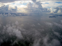
20.05.12 BA0233 East of Moscow from Prospero
This picture illustrates the problem perfectly....why in a fairly small patch of Cumulus cloud is there all of a sudden this fantastic and aggressive growth occurring? What perfect conditions exist in that one place at this moment in time to allow such development of the cloud here but no where else?...The answer is we don't know exactly but are trying to find out...So how do we do this...
We find special cases like this particular situation and then try to get as much data as possible about what the conditions were like...This equates to collecting (where possible) up to 100 variables such as temperature at the surface, at 10m, at 100m, etc..., humidity at the same levels, pressure, wind, cloud cover, solar heating at several bandwidths (short, long, total, direct, indirect), aerosol particle counts, gas constituents, etc...then we look at the geography at this spot and try to then put the specific lifting, heating, cooling convergence, divergence, etc....actions into the computer given this landscape and then run one simulation against all other variations (adjusting the weighing of each parameter against the others) to find what scenario creates this development that nature has made...then we try to repeat this on other similar areas of landscape and heating, season, moisture, etc...to see if they do repeat predictably...if they do we create what is known as a 'local model' that we apply to the super computer when it is running the various scenarios for the weather in the UK...taking into account (where possible and known) all of the 100 variables and all of the local geographic variations and the effects these variations will have on the weather to become modified....You can imagine the amount of 'runs' of the simulations that are needed to figure out which scenarios are most likely and seem to repeat (giving a greater probability)...
So we are effectively trying to understand the very small scale, small scale, mid size scale and large scale effects and how they all interact together with the various 100 or so 'modifiers' such as temperature at a specific height, solar radiation at a specific location at a specific season or day...to see what the best 'gamble' is...due to percentages as we don't yet know all of the interactions and outcomes for each specific scenario...but we are learning them more and more quickly and able to forecast them better with more and more computing power...
To give you an idea...we are now able to run 'local scale' grids for the computer models down to roughly 1.5 Km cubed...Given the diameter of the Earth that is staggering really...of course we don't run the whole Earth model at this fine scale all at once...but we do for the UK for example and that as often as possible to keep up with the current conditions that we have measured and try to ensure we are weighing the correct parameters with the correct scores...
It all boggles the mind really...
So, very isolated, extreme events such as this one TCU cloud in an otherwise very normal CU cloud deck does make for some interesting science ^

However, you are correct...it would indeed be quite 'rude' to fly through that cloud at that particular time as the updraft would be quite decent I think...again the popcorn analogy works well here...just on a bigger scale...
Sorry, gone off on another one!
 Right off to dreamland then...