Originally Posted by
Prospero
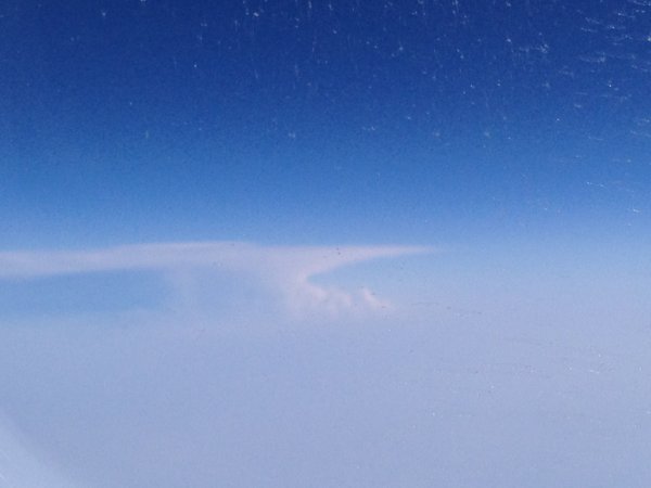
23.05.12 BA0232 German Coast
A fantastic example of the striated 'anvil' formation of a mature Cumulonimbus (CB) cloud which probably is 35,000 feet thick vertically from base to that flat top...The top of the cloud is flat and 'sheared' due to the jet stream coming along on top of this cloud and the change in speed simply 'shear' the cloud cauliflower tops off causing the anvil shape with a bit of time. This cloud is likely 25 miles or more wide at the base and would be absolutely chucking it down with heavy showery rain (+RASH) and possibly lightning as well. The height that a CB can 'grow' to depends on where the cloud is formed and what season it happens in...in Summer and over locations like the US/Canada/Russia you can get tops at 65,000 feet, whereas in Winter and over Europe the tops are much more modest at around 30,000 feet. This is generally a reflection of the height of the Tropopause at that location and season.
Originally Posted by
Prospero
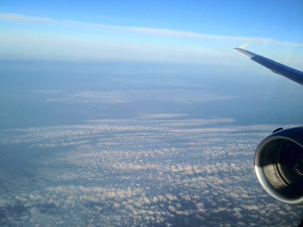
23.05.12 BA1462 Lancashire
The above picture shows two levels of moisture; one at mid levels producing the Altocumulus (AC), here of the floccus variety and a higher Cirrostratus (CS) layer...which is interesting as it shows mid level instability but higher level stability so once you were mid way between the AC and CS clouds you would find the ride should be smooth....time to press the call button for another drink...^
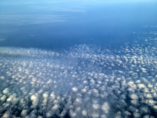
23.05.12 BA1462 Lancashire
A really good picture of AC floccus from above...below this would look very flat and just like cotton balls scattered in 2D on a blue background...but here you can see the 3 dimensional aspect of the cloud which again shows the instability at that height and the convective cycles where the upward vertical motion is where the white cloud bits are and the warmer air which can hold more moisture is subsiding where there is no cloud. (think of mini vertical circles with the direction being upward where there is cloud and downward where there is no cloud...this is why you get a 'patchwork' field of the clouds...the downward flows can be thought of as punching downward holes in the cloud deck...

One for the cloud atlas I would like to display on here, if you are in agreement
Prospero to help ID different clouds, types and heights?
